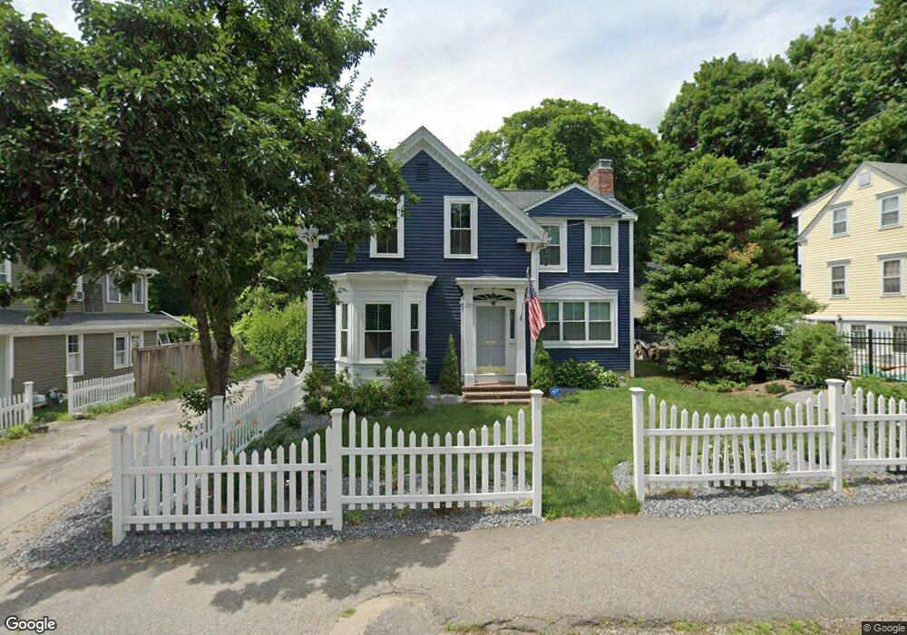
120 Commonwealth Rd Wayland, MA 01778
Estimated Value: $832,481 - $956,000
3
Beds
3
Baths
1,899
Sq Ft
$472/Sq Ft
Est. Value
About This Home
This home is located at 120 Commonwealth Rd, Wayland, MA 01778 and is currently estimated at $897,120, approximately $472 per square foot. 120 Commonwealth Rd is a home located in Middlesex County with nearby schools including Wayland High School, Christa McAuliffe Charter School, and Veritas Christian Academy.
Ownership History
Date
Name
Owned For
Owner Type
Purchase Details
Closed on
Sep 13, 2011
Sold by
Mcallister Elysha C
Bought by
Mcallister Elysha C and Bemis Francis J
Current Estimated Value
Home Financials for this Owner
Home Financials are based on the most recent Mortgage that was taken out on this home.
Original Mortgage
$309,000
Outstanding Balance
$214,047
Interest Rate
4.58%
Mortgage Type
Purchase Money Mortgage
Estimated Equity
$683,073
Purchase Details
Closed on
Aug 4, 2008
Sold by
Stabile Jane and Stabile Lawrence
Bought by
Mcallister Elysha C
Create a Home Valuation Report for This Property
The Home Valuation Report is an in-depth analysis detailing your home's value as well as a comparison with similar homes in the area
Home Values in the Area
Average Home Value in this Area
Purchase History
| Date | Buyer | Sale Price | Title Company |
|---|---|---|---|
| Mcallister Elysha C | -- | -- | |
| Mcallister Elysha C | -- | -- | |
| Mcallister Elysha C | $390,000 | -- | |
| Mcallister Elysha C | -- | -- | |
| Mcallister Elysha C | $390,000 | -- |
Source: Public Records
Mortgage History
| Date | Status | Borrower | Loan Amount |
|---|---|---|---|
| Open | Mcallister Elysha C | $309,000 | |
| Closed | Mcallister Elysha C | $309,000 | |
| Previous Owner | Mcallister Elysha C | $309,000 |
Source: Public Records
Tax History
| Year | Tax Paid | Tax Assessment Tax Assessment Total Assessment is a certain percentage of the fair market value that is determined by local assessors to be the total taxable value of land and additions on the property. | Land | Improvement |
|---|---|---|---|---|
| 2025 | $10,624 | $679,700 | $309,400 | $370,300 |
| 2024 | $10,063 | $648,400 | $294,600 | $353,800 |
| 2023 | $9,557 | $574,000 | $267,900 | $306,100 |
| 2022 | $9,520 | $518,800 | $221,800 | $297,000 |
| 2021 | $15,311 | $501,500 | $206,300 | $295,200 |
| 2020 | $6,428 | $486,900 | $206,300 | $280,600 |
| 2019 | $8,849 | $484,100 | $196,400 | $287,700 |
| 2018 | $0 | $439,500 | $196,400 | $243,100 |
| 2017 | $7,610 | $419,500 | $187,100 | $232,400 |
| 2016 | $7,151 | $412,400 | $183,500 | $228,900 |
| 2015 | $7,246 | $394,000 | $183,500 | $210,500 |
Source: Public Records
Map
Nearby Homes
- 136 Commonwealth Rd
- 5 Griffin Cir
- 340 N Main St
- 13 Shawmut Avenue Extension
- 45 W Plain St Unit 1
- 186 Main St
- 6 Ash St
- 278 N Main St
- 138 W Plain St
- 85 Lake Road Terrace
- 50 Wethersfield Rd
- 123 Dudley Rd
- 5 Bradford Rd
- 4 Richard Rd
- 108 Dudley Rd
- 8 Liberty St
- 1 Richard Rd
- 29 Irving Rd
- 25 Irving Rd
- 5 Haven Ln
- 124 Commonwealth Rd
- 118 Commonwealth Rd
- 5 Stanton St
- 7 Stanton St
- 123 Commonwealth Rd
- 128 Commonwealth Rd
- 11 Stanton St
- 119 Commonwealth Rd
- 127 Commonwealth Rd
- 12 Stanton St
- 110 Commonwealth Rd
- 117 Commonwealth Rd
- 13 Stanton St
- 9 Pemberton Rd
- 15 Pemberton Rd
- 131 Commonwealth Rd
- 131 Commonwealth Rd Unit 1
- 131 Commonwealth Rd Unit 2
- 7 Pemberton Rd
- 11 Cormans Ln
Your Personal Tour Guide
Ask me questions while you tour the home.