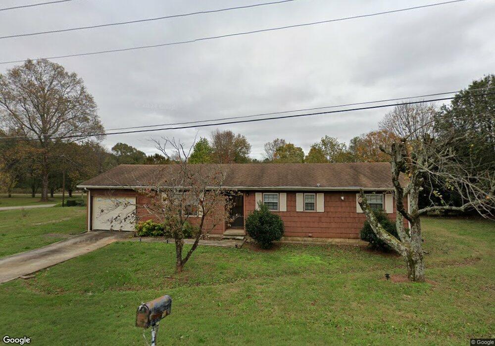
120 Dalewood Dr Winchester, TN 37398
Estimated Value: $158,000 - $219,000
--
Bed
2
Baths
1,120
Sq Ft
$162/Sq Ft
Est. Value
About This Home
This home is located at 120 Dalewood Dr, Winchester, TN 37398 and is currently estimated at $181,080, approximately $161 per square foot. 120 Dalewood Dr is a home located in Franklin County with nearby schools including North Middle School, Franklin County High School, and School of the Good Shepherd.
Ownership History
Date
Name
Owned For
Owner Type
Purchase Details
Closed on
Sep 13, 2024
Sold by
Trigg Vicenna and Blackwell Vicenna Trigg
Bought by
Trigg Karl B
Current Estimated Value
Home Financials for this Owner
Home Financials are based on the most recent Mortgage that was taken out on this home.
Original Mortgage
$76,000
Outstanding Balance
$75,187
Interest Rate
6.73%
Mortgage Type
Credit Line Revolving
Estimated Equity
$105,893
Purchase Details
Closed on
Aug 30, 1984
Bought by
Trigg Vicenna
Purchase Details
Closed on
Jan 1, 1980
Purchase Details
Closed on
Apr 14, 1978
Purchase Details
Closed on
Jan 4, 1900
Create a Home Valuation Report for This Property
The Home Valuation Report is an in-depth analysis detailing your home's value as well as a comparison with similar homes in the area
Home Values in the Area
Average Home Value in this Area
Purchase History
| Date | Buyer | Sale Price | Title Company |
|---|---|---|---|
| Trigg Karl B | $97,000 | Access Title | |
| Trigg Vicenna | -- | -- | |
| -- | $30,700 | -- | |
| -- | -- | -- | |
| -- | -- | -- |
Source: Public Records
Mortgage History
| Date | Status | Borrower | Loan Amount |
|---|---|---|---|
| Open | Trigg Karl B | $76,000 |
Source: Public Records
Tax History Compared to Growth
Tax History
| Year | Tax Paid | Tax Assessment Tax Assessment Total Assessment is a certain percentage of the fair market value that is determined by local assessors to be the total taxable value of land and additions on the property. | Land | Improvement |
|---|---|---|---|---|
| 2024 | $560 | $26,750 | $1,400 | $25,350 |
| 2023 | $560 | $26,750 | $1,400 | $25,350 |
| 2022 | $560 | $26,750 | $1,400 | $25,350 |
| 2021 | $332 | $26,750 | $1,400 | $25,350 |
| 2020 | $471 | $14,325 | $1,100 | $13,225 |
| 2019 | $471 | $14,325 | $1,100 | $13,225 |
| 2018 | $471 | $14,325 | $1,100 | $13,225 |
| 2017 | $471 | $14,325 | $1,100 | $13,225 |
| 2016 | $469 | $14,100 | $1,100 | $13,000 |
| 2015 | $461 | $14,100 | $1,100 | $13,000 |
| 2014 | $461 | $14,105 | $0 | $0 |
Source: Public Records
Map
Nearby Homes
- 114 Allen Dr
- 209 Franklin Park
- 108 Allen Dr
- 120 Dogwood Ln
- 132 Highland Dr
- 136 Bel Aire Dr
- 713 Hunt St
- 709 Hunt St
- 0 Old Cowan Rd Unit RTC2970796
- 105 Lakeview Dr
- 103 Lisa Cir
- 118 Noles St
- 1019 Old Cowan Rd
- 0 Spring Hill Dr
- 105 Edgewater Dr
- 211 S Porter St
- 213 S Porter St
- 215 S Porter St
- 238 Jills Landing
- 505 Kindel Dr
- 122 Hackberry Dr
- 118 Dalewood Dr
- 117 Hackberry Dr
- 115 Hackberry Dr
- 119 Dalewood Dr
- 116 Dalewood Dr
- 117 Dalewood Dr
- 113 Hackberry Dr
- 108 Hackberry Dr
- 308 Russell St
- 114 Dalewood Dr
- 306 Russell St
- 0 Railroad Ave Unit RTC2362741
- 0 Railroad Ave Unit RTC2362740
- 0 Railroad Ave Unit RTC2362727
- 304 Russell St
- 115 Dalewood Dr
- 122 Mountain View Dr
- 106 Hackberry Dr
- 302 Russell St