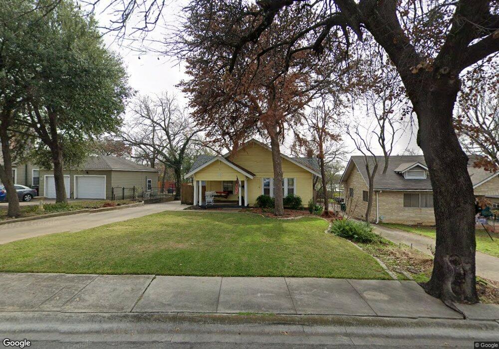
120 E Sherman Dr Denton, TX 76209
Idiot's Hill NeighborhoodEstimated Value: $305,000 - $321,000
2
Beds
1
Bath
1,483
Sq Ft
$211/Sq Ft
Est. Value
About This Home
This home is located at 120 E Sherman Dr, Denton, TX 76209 and is currently estimated at $313,123, approximately $211 per square foot. 120 E Sherman Dr is a home located in Denton County with nearby schools including Evers Park Elementary School, Calhoun Middle School, and Denton High School.
Ownership History
Date
Name
Owned For
Owner Type
Purchase Details
Closed on
Jan 11, 2013
Sold by
Lenaburg Edith I
Bought by
Ingram Pamela June
Current Estimated Value
Home Financials for this Owner
Home Financials are based on the most recent Mortgage that was taken out on this home.
Original Mortgage
$104,400
Outstanding Balance
$72,522
Interest Rate
3.35%
Mortgage Type
New Conventional
Estimated Equity
$240,601
Purchase Details
Closed on
May 14, 2008
Sold by
Harmon Duncan Sara A and Duncan Carl W
Bought by
Lenaburg Edith I
Home Financials for this Owner
Home Financials are based on the most recent Mortgage that was taken out on this home.
Original Mortgage
$94,400
Interest Rate
5.89%
Mortgage Type
Purchase Money Mortgage
Purchase Details
Closed on
Aug 30, 2002
Sold by
Parton Jeffrey and Parton Miranda
Bought by
Harmon Sara A
Home Financials for this Owner
Home Financials are based on the most recent Mortgage that was taken out on this home.
Original Mortgage
$105,661
Interest Rate
6.47%
Mortgage Type
FHA
Purchase Details
Closed on
Dec 30, 1998
Sold by
Pereira Frances A and Whiddon James E
Bought by
Parton Jeffrey and Parton Miranda
Home Financials for this Owner
Home Financials are based on the most recent Mortgage that was taken out on this home.
Original Mortgage
$72,100
Interest Rate
10.2%
Purchase Details
Closed on
Jun 12, 1997
Sold by
Sutcliffe Ronald and Sutcliffe Sharon
Bought by
Pereira Frances A and Whiddon James E
Home Financials for this Owner
Home Financials are based on the most recent Mortgage that was taken out on this home.
Original Mortgage
$80,958
Interest Rate
7.93%
Mortgage Type
FHA
Purchase Details
Closed on
Dec 3, 1993
Sold by
Brand Steven M and Brand Lisa B
Bought by
Sutcliffe Ronald and Sutcliffe Sharon
Home Financials for this Owner
Home Financials are based on the most recent Mortgage that was taken out on this home.
Original Mortgage
$68,300
Interest Rate
6.71%
Create a Home Valuation Report for This Property
The Home Valuation Report is an in-depth analysis detailing your home's value as well as a comparison with similar homes in the area
Home Values in the Area
Average Home Value in this Area
Purchase History
| Date | Buyer | Sale Price | Title Company |
|---|---|---|---|
| Ingram Pamela June | -- | None Available | |
| Lenaburg Edith I | -- | None Available | |
| Harmon Sara A | -- | -- | |
| Parton Jeffrey | -- | -- | |
| Pereira Frances A | -- | First American Title Ins | |
| Sutcliffe Ronald | -- | First American Title Ins |
Source: Public Records
Mortgage History
| Date | Status | Borrower | Loan Amount |
|---|---|---|---|
| Open | Ingram Pamela June | $104,400 | |
| Previous Owner | Lenaburg Edith I | $94,400 | |
| Previous Owner | Harmon Sara A | $105,661 | |
| Previous Owner | Parton Jeffrey | $72,100 | |
| Previous Owner | Pereira Frances A | $80,958 | |
| Previous Owner | Sutcliffe Ronald | $68,300 | |
| Closed | Parton Jeffrey | $13,519 |
Source: Public Records
Tax History
| Year | Tax Paid | Tax Assessment Tax Assessment Total Assessment is a certain percentage of the fair market value that is determined by local assessors to be the total taxable value of land and additions on the property. | Land | Improvement |
|---|---|---|---|---|
| 2025 | $3,609 | $273,787 | $73,500 | $273,108 |
| 2024 | $4,804 | $248,897 | $0 | $0 |
| 2023 | $3,124 | $226,270 | $73,500 | $318,307 |
| 2022 | $4,367 | $205,700 | $73,500 | $172,605 |
| 2021 | $4,157 | $217,418 | $52,500 | $164,918 |
| 2020 | $3,886 | $170,000 | $36,750 | $133,250 |
| 2019 | $3,937 | $165,000 | $36,750 | $128,250 |
| 2018 | $3,793 | $157,000 | $36,750 | $120,250 |
| 2017 | $4,251 | $172,000 | $26,250 | $145,750 |
| 2016 | $4,330 | $175,176 | $26,250 | $153,109 |
| 2015 | $3,357 | $159,251 | $26,250 | $141,486 |
| 2013 | -- | $140,928 | $30,600 | $110,328 |
Source: Public Records
Map
Nearby Homes
- 2010 N Locust St
- 2012 N Locust St
- 211 E Sherman Dr
- 110 Peach St
- 1309 N Austin St
- 2411 Denison St
- 2107 Preston Place
- 2621 N Locust St
- 1401 Bolivar St
- 1111 N Austin St
- 425 Oakhill Dr
- 812 Westway St
- 1030 Denton St
- 2712 N Bell Ave
- 810 Cordell St
- 2821 N Bell Ave
- 809 Crescent St
- 510 Texas St Unit 14
- 1004 Cordell St
- 1011 Crescent St
- 114 E Sherman Dr
- 100 Woodland St
- 132 Woodland St
- 132 Woodland St Unit 2
- 1926 N Locust St
- 1924 N Locust St
- 1922 N Locust St
- 209 E University Dr
- 2000 N Locust St
- 111 E Sherman Dr Unit 115
- 220 Woodland St
- 215 E University Dr
- 220 E Sherman Dr
- 127 E Sherman Dr
- 219 E University Dr
- 232 Woodland St
- 223 E University Dr
- 203 E Sherman Dr
- 205 Woodland St
- 300 Woodland St
Your Personal Tour Guide
Ask me questions while you tour the home.