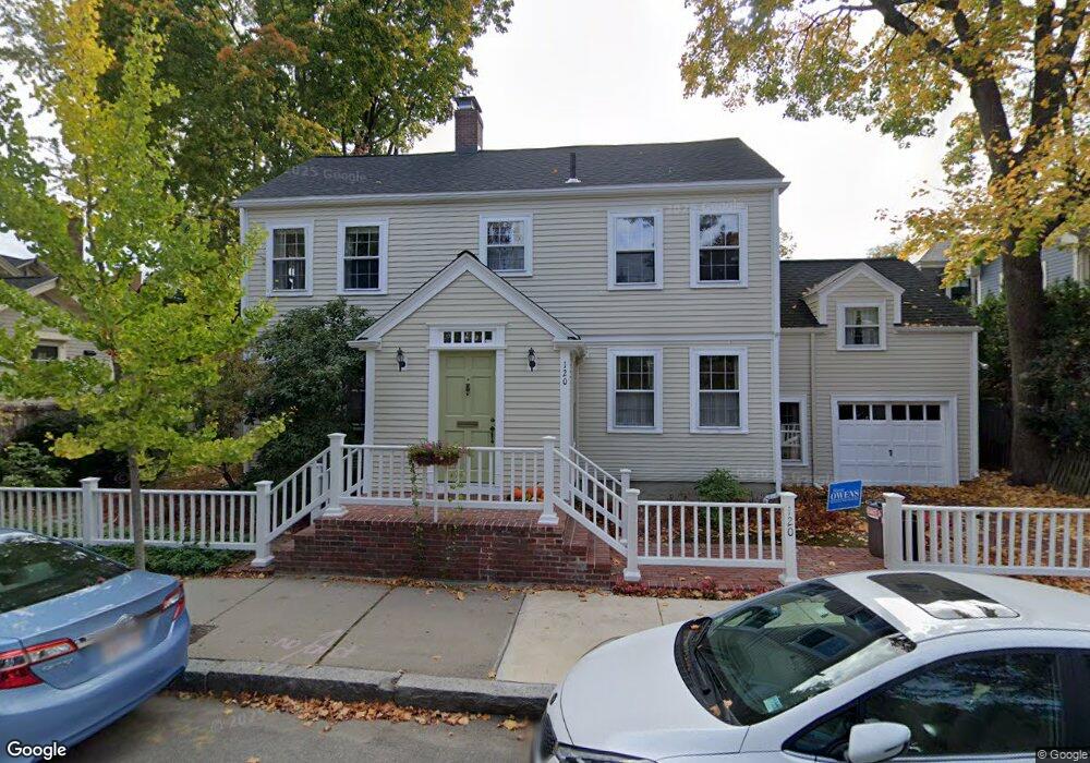
120 Foster St Cambridge, MA 02138
West Cambridge NeighborhoodEstimated Value: $2,813,994 - $3,272,000
5
Beds
4
Baths
2,172
Sq Ft
$1,393/Sq Ft
Est. Value
About This Home
This home is located at 120 Foster St, Cambridge, MA 02138 and is currently estimated at $3,026,249, approximately $1,393 per square foot. 120 Foster St is a home located in Middlesex County with nearby schools including St Peter School, Buckingham Browne & Nichols School, and Shady Hill School.
Ownership History
Date
Name
Owned For
Owner Type
Purchase Details
Closed on
Jul 15, 1996
Sold by
Kosinar Patricia T
Bought by
Vanranst Elizabeth and Zuriff Gerald
Current Estimated Value
Purchase Details
Closed on
Mar 13, 1992
Sold by
Gurewich Ann
Bought by
Kosinar William J and Kosinar Patricia
Home Financials for this Owner
Home Financials are based on the most recent Mortgage that was taken out on this home.
Original Mortgage
$431,250
Interest Rate
8.64%
Mortgage Type
Purchase Money Mortgage
Create a Home Valuation Report for This Property
The Home Valuation Report is an in-depth analysis detailing your home's value as well as a comparison with similar homes in the area
Home Values in the Area
Average Home Value in this Area
Purchase History
| Date | Buyer | Sale Price | Title Company |
|---|---|---|---|
| Vanranst Elizabeth | $705,000 | -- | |
| Kosinar William J | $577,000 | -- |
Source: Public Records
Mortgage History
| Date | Status | Borrower | Loan Amount |
|---|---|---|---|
| Previous Owner | Kosinar William J | $465,000 | |
| Previous Owner | Kosinar William J | $431,250 |
Source: Public Records
Tax History Compared to Growth
Tax History
| Year | Tax Paid | Tax Assessment Tax Assessment Total Assessment is a certain percentage of the fair market value that is determined by local assessors to be the total taxable value of land and additions on the property. | Land | Improvement |
|---|---|---|---|---|
| 2025 | $16,203 | $2,551,700 | $1,543,900 | $1,007,800 |
| 2024 | $14,660 | $2,476,400 | $1,511,600 | $964,800 |
| 2023 | $13,560 | $2,314,000 | $1,479,200 | $834,800 |
| 2022 | $12,935 | $2,184,900 | $1,445,600 | $739,300 |
| 2021 | $12,334 | $2,108,400 | $1,417,600 | $690,800 |
| 2020 | $11,632 | $2,022,900 | $1,368,400 | $654,500 |
| 2019 | $10,722 | $1,805,000 | $1,200,000 | $605,000 |
| 2018 | $11,137 | $1,770,600 | $1,193,000 | $577,600 |
| 2017 | $11,252 | $1,733,700 | $1,193,000 | $540,700 |
| 2016 | $10,835 | $1,550,000 | $1,049,100 | $500,900 |
| 2015 | $11,049 | $1,412,900 | $964,900 | $448,000 |
| 2014 | $11,371 | $1,356,900 | $877,200 | $479,700 |
Source: Public Records
Map
Nearby Homes
- 20 Maynard Place
- 15 Hubbard Park Rd
- 48 Hubbard Park Rd
- 1010 Memorial Dr Unit 6G
- 158 Brattle St
- 153 Brattle St
- 172 Brattle St
- 3 Berkeley Place
- 32 Hawthorn St
- 12 Berkeley St
- 988 Memorial Dr Unit 386
- 234 Huron Ave
- 22 Concord Ave Unit 10
- 986 Memorial Dr Unit 404
- 984 Memorial Dr Unit 984-503
- 983 Memorial Dr Unit 502
- 44 Garden St
- 52 Garden St Unit B2
- 130 Mount Auburn St Unit 108
- 71-73 Reservoir St
- 43 Gibson St
- 9 Kenway St
- 9 Kenway St Unit House
- 9 Kenway St Unit 9
- 41 Gibson St
- 114 Foster St
- 5 Kenway St
- 9 Doane St
- 8 Kenway St
- 6 Kenway St
- 10 Kenway St
- 4 Kenway St
- 14 Hubbard Park Rd
- 20 Hubbard Park Rd
- 140 Foster St
- 140 Foster St Unit 1
- 140 Foster St
- 140 Foster St Unit 4
- 2 Kenway St
- 28 Gibson Terrace Unit 2A