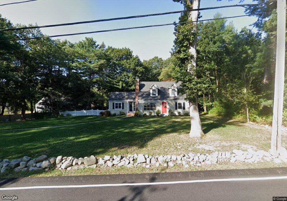
120 Grove St Scituate, MA 02066
Estimated Value: $882,345 - $1,005,000
3
Beds
2
Baths
2,150
Sq Ft
$437/Sq Ft
Est. Value
About This Home
This home is located at 120 Grove St, Scituate, MA 02066 and is currently estimated at $938,836, approximately $436 per square foot. 120 Grove St is a home located in Plymouth County with nearby schools including Cushing Elementary School, Lester J. Gates Middle School, and Scituate High School.
Ownership History
Date
Name
Owned For
Owner Type
Purchase Details
Closed on
Apr 28, 2000
Sold by
Mchugh Christine A
Bought by
Churchill Stephen G and Churchill Jane M
Current Estimated Value
Purchase Details
Closed on
Aug 30, 1993
Sold by
Buckley Richard L and Buckley Mary B
Bought by
Anderson Christine E
Purchase Details
Closed on
May 18, 1988
Sold by
Terzis William P
Bought by
Buckley Richard L
Create a Home Valuation Report for This Property
The Home Valuation Report is an in-depth analysis detailing your home's value as well as a comparison with similar homes in the area
Home Values in the Area
Average Home Value in this Area
Purchase History
| Date | Buyer | Sale Price | Title Company |
|---|---|---|---|
| Churchill Stephen G | $314,000 | -- | |
| Anderson Christine E | $212,500 | -- | |
| Buckley Richard L | $188,000 | -- |
Source: Public Records
Mortgage History
| Date | Status | Borrower | Loan Amount |
|---|---|---|---|
| Open | Buckley Richard L | $35,000 |
Source: Public Records
Tax History Compared to Growth
Tax History
| Year | Tax Paid | Tax Assessment Tax Assessment Total Assessment is a certain percentage of the fair market value that is determined by local assessors to be the total taxable value of land and additions on the property. | Land | Improvement |
|---|---|---|---|---|
| 2025 | $7,292 | $729,900 | $353,800 | $376,100 |
| 2024 | $7,206 | $695,600 | $321,600 | $374,000 |
| 2023 | $6,762 | $630,700 | $292,400 | $338,300 |
| 2022 | $6,762 | $535,800 | $251,300 | $284,500 |
| 2021 | $6,473 | $485,600 | $239,300 | $246,300 |
| 2020 | $6,280 | $465,200 | $230,100 | $235,100 |
| 2019 | $6,198 | $451,100 | $225,600 | $225,500 |
| 2018 | $6,342 | $454,600 | $243,400 | $211,200 |
| 2017 | $6,093 | $432,400 | $221,200 | $211,200 |
Source: Public Records
Map
Nearby Homes
- 575 First Parish Rd
- 131 Maple St
- 116 Old Forge Rd
- 9 Kyle Path
- 16 Cranberry Ln
- 2 Webster Farm Way
- 32 Fairview Ave
- 14 Aberdeen Dr
- 293 Cross St
- 25 Gendarme Place
- 334 Summer St
- 11 Forest Ln
- 9 Forest Ln Unit 9
- 25 Webster Farm Way
- 23 Webster Farm Way
- 449 Clapp Rd
- 455 Clapp Rd
- 453 Clapp Rd
- 451 Clapp Rd
- 453 - 455 Clapp Rd
- 112 Grove St
- 128 Grove St
- 125 Grove St
- 115 Grove St
- 611 First Parish Rd
- 136 Grove St
- 607 First Parish Rd
- 605 First Parish Rd
- 119 Grove St
- 627 First Parish Rd
- 612 First Parish Rd
- 577R First Parish Rd
- 601 First Parish Rd
- 604 First Parish Rd
- 141 Grove St
- 643 First Parish Rd
- 639 First Parish Rd
- 647 First Parish Rd
- 635 First Parish Rd
- 589 First Parish Rd