Estimated Value: $350,000 - $515,000
2
Beds
2
Baths
1,200
Sq Ft
$337/Sq Ft
Est. Value
About This Home
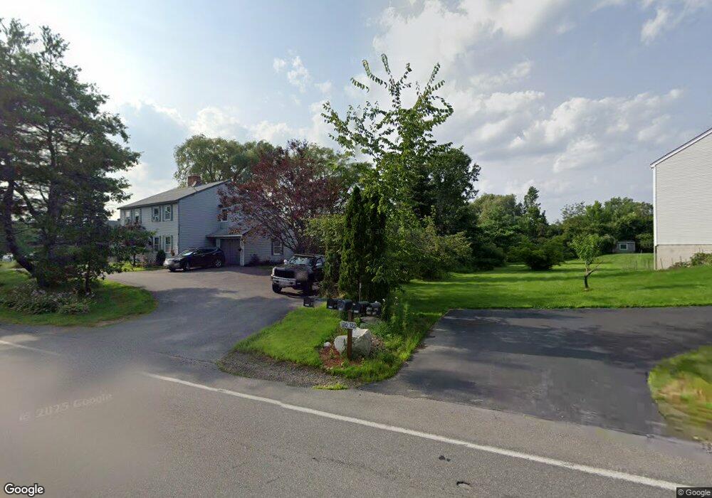
This home is located at 120 Hampstead Rd Unit R, Derry, NH 03038 and is currently estimated at $404,949, approximately $337 per square foot. 120 Hampstead Rd Unit R is a home located in Rockingham County with nearby schools including Derry Village School, West Running Brook Middle School, and Pinkerton Academy.
Ownership History
Date
Name
Owned For
Owner Type
Purchase Details
Closed on
Oct 26, 2015
Sold by
Mateja Maria H
Bought by
Murray Carol A
Current Estimated Value
Home Financials for this Owner
Home Financials are based on the most recent Mortgage that was taken out on this home.
Original Mortgage
$142,272
Outstanding Balance
$112,320
Interest Rate
3.9%
Estimated Equity
$292,629
Create a Home Valuation Report for This Property
The Home Valuation Report is an in-depth analysis detailing your home's value as well as a comparison with similar homes in the area
Home Values in the Area
Average Home Value in this Area
Purchase History
| Date | Buyer | Sale Price | Title Company |
|---|---|---|---|
| Murray Carol A | $146,733 | -- |
Source: Public Records
Mortgage History
| Date | Status | Borrower | Loan Amount |
|---|---|---|---|
| Open | Murray Carol A | $142,272 |
Source: Public Records
Tax History Compared to Growth
Tax History
| Year | Tax Paid | Tax Assessment Tax Assessment Total Assessment is a certain percentage of the fair market value that is determined by local assessors to be the total taxable value of land and additions on the property. | Land | Improvement |
|---|---|---|---|---|
| 2024 | $7,155 | $382,800 | $0 | $382,800 |
| 2023 | $6,161 | $297,900 | $0 | $297,900 |
| 2022 | $5,672 | $297,900 | $0 | $297,900 |
| 2021 | $4,967 | $200,600 | $0 | $200,600 |
| 2020 | $4,883 | $200,600 | $0 | $200,600 |
| 2019 | $5,295 | $202,700 | $97,000 | $105,700 |
| 2018 | $5,276 | $202,700 | $97,000 | $105,700 |
| 2017 | $5,276 | $182,800 | $92,200 | $90,600 |
| 2016 | $4,957 | $183,200 | $92,200 | $91,000 |
| 2015 | $4,075 | $139,400 | $46,100 | $93,300 |
| 2014 | $4,101 | $139,400 | $46,100 | $93,300 |
| 2013 | $4,305 | $136,700 | $42,200 | $94,500 |
Source: Public Records
Map
Nearby Homes
- 4 Colony Brook Ln
- 12 Halls Village Rd
- 7 Desforge Ln Unit R
- 12 Orchard Dr
- 2 Remington Ct
- 4C Pine Isle Dr Unit B
- 51 Chester Rd
- 87 Island Pond Rd
- 14 True Ave
- 7 Dexter St
- 2 Silvestri Cir Unit 13
- 2 Silvestri Cir Unit 6
- 7 Chester Rd Unit 211
- 7 Chester Rd Unit 212
- 2 Pembroke Dr Unit 21
- 100 Rockingham Rd Unit 9
- 144 Rockingham Rd
- 5 Nesmith St
- 1 Barkland Dr
- 167 Chester Rd
- 120 Hampstead Rd Unit L
- 120 Hampstead Rd Unit LEFT
- 120 Hampstead Rd Unit 120
- 122 Hampstead Rd Unit R
- 122 Hampstead Rd Unit L
- 122 Hampstead Rd Unit 122
- 122 Hampstead Rd
- 1 Senter Cove Rd Unit R
- 1 Senter Cove Rd Unit L
- 1 Senter Cove Rd Unit 1
- 1 Senter Cove Rd Unit 1L
- 2 Senter Cove Rd Unit L
- 2 Senter Cove Rd Unit R
- 131 Hampstead Rd
- 2L Senter Cove Rd
- 133 Hampstead Rd
- 112 Hampstead Rd Unit R
- 112 Hampstead Rd Unit L
- 112 Hampstead Rd Unit 112R
- 112 Hampstead Rd