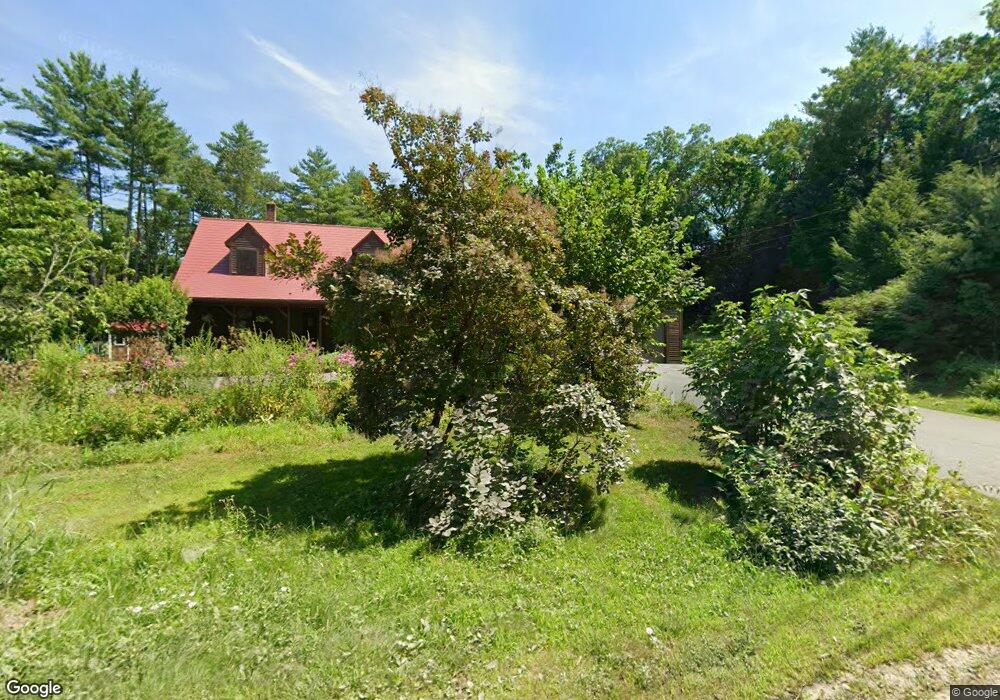
120 Jones Cemetery Rd Orange, MA 01364
Estimated Value: $448,000 - $517,000
3
Beds
2
Baths
2,318
Sq Ft
$211/Sq Ft
Est. Value
About This Home
This home is located at 120 Jones Cemetery Rd, Orange, MA 01364 and is currently estimated at $488,150, approximately $210 per square foot. 120 Jones Cemetery Rd is a home located in Franklin County with nearby schools including Fisher Hill and Ralph C Mahar Regional School.
Ownership History
Date
Name
Owned For
Owner Type
Purchase Details
Closed on
Jul 31, 2002
Sold by
Derosa Robert S and Derosa Laurie J
Bought by
Johnson Richard E and Johnson Shannon M
Current Estimated Value
Home Financials for this Owner
Home Financials are based on the most recent Mortgage that was taken out on this home.
Original Mortgage
$150,300
Interest Rate
6.64%
Mortgage Type
Purchase Money Mortgage
Purchase Details
Closed on
Oct 9, 2001
Sold by
Jasins Alfed C and Sayles William W
Bought by
Derosa Robert S and Derosa Laurie J
Create a Home Valuation Report for This Property
The Home Valuation Report is an in-depth analysis detailing your home's value as well as a comparison with similar homes in the area
Home Values in the Area
Average Home Value in this Area
Purchase History
| Date | Buyer | Sale Price | Title Company |
|---|---|---|---|
| Johnson Richard E | $187,900 | -- | |
| Derosa Robert S | $25,000 | -- |
Source: Public Records
Mortgage History
| Date | Status | Borrower | Loan Amount |
|---|---|---|---|
| Open | Derosa Robert S | $261,250 | |
| Closed | Derosa Robert S | $168,000 | |
| Closed | Derosa Robert S | $150,300 |
Source: Public Records
Tax History Compared to Growth
Tax History
| Year | Tax Paid | Tax Assessment Tax Assessment Total Assessment is a certain percentage of the fair market value that is determined by local assessors to be the total taxable value of land and additions on the property. | Land | Improvement |
|---|---|---|---|---|
| 2025 | $77 | $468,200 | $39,500 | $428,700 |
| 2024 | $6,653 | $381,500 | $39,500 | $342,000 |
| 2023 | $5,695 | $317,100 | $39,500 | $277,600 |
| 2022 | $5,851 | $306,000 | $39,500 | $266,500 |
| 2021 | $43 | $223,300 | $56,100 | $167,200 |
| 2020 | $4,497 | $221,200 | $55,700 | $165,500 |
| 2019 | $4,380 | $194,500 | $48,500 | $146,000 |
| 2018 | $4,166 | $189,900 | $45,500 | $144,400 |
| 2017 | $4,032 | $189,900 | $45,500 | $144,400 |
| 2016 | $3,908 | $180,100 | $45,500 | $134,600 |
| 2015 | $3,728 | $179,500 | $45,500 | $134,000 |
| 2014 | $3,601 | $182,400 | $45,500 | $136,900 |
Source: Public Records
Map
Nearby Homes
- 260 East Rd
- 153 Dana Rd
- 900 N Main St
- 15 Tully Rd
- 31 Pinedale Rd
- 660 Pinedale Ave
- 330 N Orange Rd
- 38 Twichell St
- 52 Creamery Hill Rd
- 340 Brickyard Rd
- 23 Mount Pleasant St
- 140 Mechanic St
- 0 Oxbow Unit 73446570
- 102 Mechanic St
- 68 D St
- 52 Mechanic St
- 25 Marjorie St
- 20 Marjorie St
- 0 Brickyard Rd
- LOT Walnut Hill