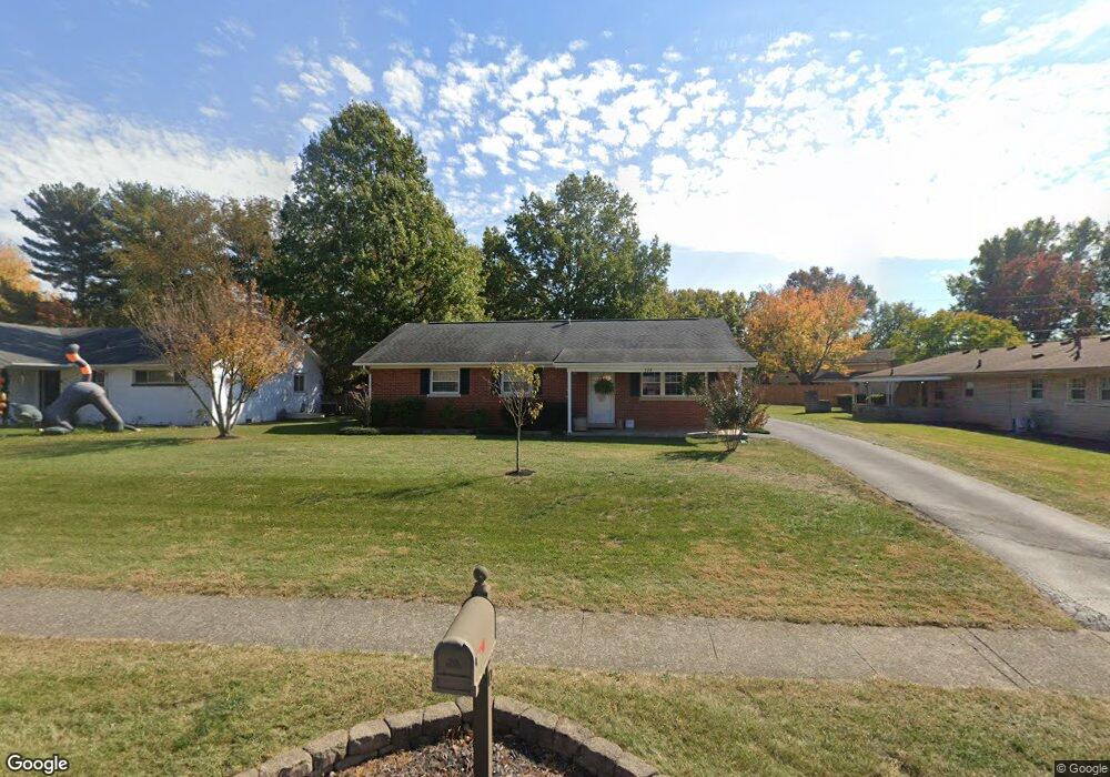
120 Markham Dr Georgetown, KY 40324
Mount Vernon NeighborhoodEstimated Value: $194,818 - $229,000
3
Beds
2
Baths
1,176
Sq Ft
$180/Sq Ft
Est. Value
About This Home
This home is located at 120 Markham Dr, Georgetown, KY 40324 and is currently estimated at $211,705, approximately $180 per square foot. 120 Markham Dr is a home located in Scott County with nearby schools including Southern Elementary School, Georgetown Middle School, and Scott County High School.
Ownership History
Date
Name
Owned For
Owner Type
Purchase Details
Closed on
Oct 3, 2014
Sold by
Spears Kathy J
Bought by
Carper Russell
Current Estimated Value
Purchase Details
Closed on
Jan 28, 2009
Sold by
Federal National Mortgage Association
Bought by
Spears Kathy J
Home Financials for this Owner
Home Financials are based on the most recent Mortgage that was taken out on this home.
Original Mortgage
$2,600
Interest Rate
5.08%
Mortgage Type
Unknown
Purchase Details
Closed on
Nov 13, 2008
Sold by
Rose David M
Bought by
Federal National Mortgage Association
Create a Home Valuation Report for This Property
The Home Valuation Report is an in-depth analysis detailing your home's value as well as a comparison with similar homes in the area
Home Values in the Area
Average Home Value in this Area
Purchase History
| Date | Buyer | Sale Price | Title Company |
|---|---|---|---|
| Carper Russell | $80,490 | Attorney | |
| Spears Kathy J | -- | None Available | |
| Federal National Mortgage Association | $85,000 | Napa Land Title |
Source: Public Records
Mortgage History
| Date | Status | Borrower | Loan Amount |
|---|---|---|---|
| Previous Owner | Spears Kathy J | $2,600 | |
| Previous Owner | Spears Kathy J | $86,409 |
Source: Public Records
Tax History
| Year | Tax Paid | Tax Assessment Tax Assessment Total Assessment is a certain percentage of the fair market value that is determined by local assessors to be the total taxable value of land and additions on the property. | Land | Improvement |
|---|---|---|---|---|
| 2025 | $884 | $148,400 | $0 | $0 |
| 2024 | $865 | $142,500 | $0 | $0 |
| 2023 | $797 | $134,300 | $32,000 | $102,300 |
| 2022 | $743 | $127,900 | $25,000 | $102,900 |
| 2021 | $685 | $113,200 | $25,000 | $88,200 |
| 2020 | $614 | $110,800 | $25,000 | $85,800 |
| 2019 | $563 | $103,800 | $0 | $0 |
| 2018 | $528 | $98,500 | $0 | $0 |
| 2017 | $485 | $93,208 | $0 | $0 |
| 2016 | $703 | $87,300 | $0 | $0 |
| 2015 | $698 | $87,300 | $0 | $0 |
| 2014 | -- | $88,504 | $0 | $0 |
| 2011 | $55 | $88,504 | $0 | $0 |
Source: Public Records
Map
Nearby Homes
- 139 E Showalter Dr
- 104 Bronte Place
- 1117 Pawnee Trail
- 107 Oconner Ct
- 305 Yorktown Ct
- 206 Hiawatha Trail
- 1026 Parkside Dr
- 1336 Dorchester Dr
- 199 Hawthorne Dr
- 633 Military St
- 115 Victor Place
- 106 Ransom Trace
- 113 Walden Cove Unit 3I
- 512 Pocahontas Trail
- 422 Military St
- 103 Crescent Way
- 101 Crescent Way
- 107 Crescent Way
- 109 Crescent Way
- 129 Compass Trail
- 124 Markham Dr
- 105 Greenbriar Dr
- 107 Markham Dr
- 110 Greenbriar Dr
- 112 Markham Dr
- 113 Markham Dr
- 121 Markham Dr
- 128 Markham Dr
- 125 Markham Dr
- 200 Markham Dr
- 105 Markham Dr
- 137 Towson Way Unit A & B
- 129 Markham Dr
- 113 E Showalter Dr
- 115 E Showalter Dr
- 108 Markham Dr
- 111 E Showalter Dr
- 117 E Showalter Dr
- 109 E Showalter Dr
- 814 S Broadway St
Your Personal Tour Guide
Ask me questions while you tour the home.