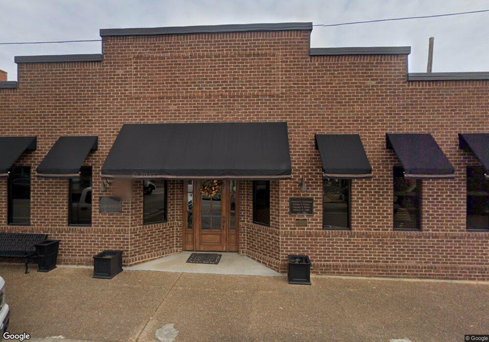
120 N Jefferson St Winchester, TN 37398
Estimated Value: $714,349
--
Bed
2
Baths
7,763
Sq Ft
$92/Sq Ft
Est. Value
About This Home
This home is located at 120 N Jefferson St, Winchester, TN 37398 and is currently estimated at $714,349, approximately $92 per square foot. 120 N Jefferson St is a home located in Franklin County with nearby schools including North Middle School, Franklin County High School, and Winchester Christian Academy.
Ownership History
Date
Name
Owned For
Owner Type
Purchase Details
Closed on
Sep 24, 2024
Sold by
Priest Timothy S and Priest Shanon B
Bought by
Perusse Farms Gp
Current Estimated Value
Purchase Details
Closed on
Sep 18, 2020
Sold by
Tharp David S
Bought by
David S Tharp Revocable Trust
Purchase Details
Closed on
Sep 10, 2020
Sold by
Tharp Karen E
Bought by
Tharp David S
Purchase Details
Closed on
Apr 29, 2008
Sold by
Roy Davis
Bought by
Priest Timothy S
Purchase Details
Closed on
Dec 7, 1985
Bought by
Davis Roy and Davis Charleen K
Purchase Details
Closed on
Jul 3, 1981
Purchase Details
Closed on
Jun 18, 1965
Purchase Details
Closed on
Jan 4, 1900
Create a Home Valuation Report for This Property
The Home Valuation Report is an in-depth analysis detailing your home's value as well as a comparison with similar homes in the area
Home Values in the Area
Average Home Value in this Area
Purchase History
| Date | Buyer | Sale Price | Title Company |
|---|---|---|---|
| Perusse Farms Gp | $680,000 | Southern Tennessee Title | |
| David S Tharp Revocable Trust | -- | Chambliss Banner & Stophel Pc | |
| Tharp David S | -- | None Available | |
| Priest Timothy S | $165,000 | -- | |
| Davis Roy | $55,000 | -- | |
| -- | -- | -- | |
| -- | -- | -- | |
| -- | -- | -- |
Source: Public Records
Tax History Compared to Growth
Tax History
| Year | Tax Paid | Tax Assessment Tax Assessment Total Assessment is a certain percentage of the fair market value that is determined by local assessors to be the total taxable value of land and additions on the property. | Land | Improvement |
|---|---|---|---|---|
| 2024 | $4,021 | $156,400 | $15,120 | $141,280 |
| 2023 | $4,021 | $156,400 | $15,120 | $141,280 |
| 2022 | $3,943 | $156,400 | $15,120 | $141,280 |
| 2021 | $3,210 | $156,400 | $15,120 | $141,280 |
| 2020 | $4,430 | $125,320 | $11,200 | $114,120 |
| 2019 | $4,430 | $125,320 | $11,200 | $114,120 |
| 2018 | $4,173 | $125,320 | $11,200 | $114,120 |
| 2017 | $4,173 | $125,320 | $11,200 | $114,120 |
| 2016 | $4,399 | $132,120 | $9,400 | $122,720 |
| 2015 | $4,318 | $132,120 | $9,400 | $122,720 |
| 2014 | $4,168 | $127,510 | $0 | $0 |
Source: Public Records
Map
Nearby Homes
- 0 River Watch Way Unit RTC3032964
- 0 River Watch Way Unit RTC3032408
- 0 River Watch Way Unit RTC3032406
- 209 N Jefferson St
- 203 Campfire Ct
- 201&203 3rd Ave NE
- 203 3rd Ave NE
- 303 N Porter St
- 0 N Porter St
- 211 S Porter St
- 213 S Porter St
- 215 S Porter St
- 510 N Porter St
- 105 N Shephard St
- 301 N Shephard St
- 109 N Shephard St
- 103 Lisa Cir
- 803 S Shephard St
- 706 N Vine St
- 503 Elm St
- 105 1st Ave NE
- 117 1st Ave NE
- 101 2nd Ave NW
- 104 1st Ave NW
- 104 1st Ave NW Unit 204
- 104 1st Ave NW Unit 202
- 104 1st Ave NW Unit 200
- 237 237 River Watch Way
- 0 Raspberry Dr Unit 1926867
- 222 River Watch Way
- 0 River Watch Way Unit RTC2941026
- 0 River Watch Way Unit RTC2941025
- 0 River Watch Way Unit RTC2941023
- 0 River Watch Way Unit RTC2812097
- 0 River Watch Way Unit RTC2812090
- 0 River Watch Way Unit RTC2812067
- 0 River Watch Way Unit RTC2803897
- 0 River Watch Way Unit RTC2803896
- 0 River Watch Way Unit RTC2803895
- 0 River Watch Way Unit RTC2803894