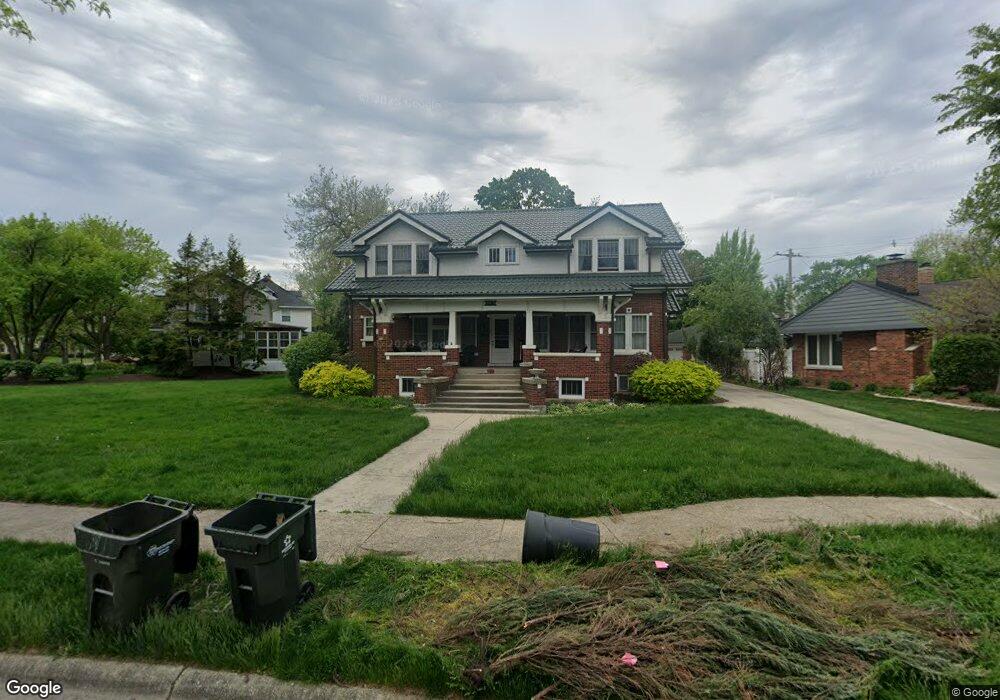
120 S Herbert Rd Riverside, IL 60546
Estimated Value: $685,000 - $1,046,331
5
Beds
5
Baths
3,613
Sq Ft
$252/Sq Ft
Est. Value
About This Home
This home is located at 120 S Herbert Rd, Riverside, IL 60546 and is currently estimated at $910,583, approximately $252 per square foot. 120 S Herbert Rd is a home located in Cook County with nearby schools including Central Elementary School, L J Hauser Jr High School, and Riverside Brookfield High School.
Ownership History
Date
Name
Owned For
Owner Type
Purchase Details
Closed on
Nov 16, 2021
Sold by
Walsh Timothy P and Walsh Y
Bought by
Walsh Timothy P and Timothy P Walsh Trust
Current Estimated Value
Purchase Details
Closed on
Aug 3, 2017
Sold by
Walsh Mary K
Bought by
Walsh Timothy P
Purchase Details
Closed on
Feb 6, 2004
Sold by
Kotov Sabina
Bought by
Walsh Timothy P and Walsh Mary K
Home Financials for this Owner
Home Financials are based on the most recent Mortgage that was taken out on this home.
Original Mortgage
$333,700
Interest Rate
3.25%
Mortgage Type
Adjustable Rate Mortgage/ARM
Create a Home Valuation Report for This Property
The Home Valuation Report is an in-depth analysis detailing your home's value as well as a comparison with similar homes in the area
Home Values in the Area
Average Home Value in this Area
Purchase History
| Date | Buyer | Sale Price | Title Company |
|---|---|---|---|
| Walsh Timothy P | -- | -- | |
| Walsh Timothy P | -- | Attorney | |
| Walsh Timothy P | $455,000 | First American Title Insuran |
Source: Public Records
Mortgage History
| Date | Status | Borrower | Loan Amount |
|---|---|---|---|
| Previous Owner | Walsh Timothy P | $333,700 |
Source: Public Records
Tax History
| Year | Tax Paid | Tax Assessment Tax Assessment Total Assessment is a certain percentage of the fair market value that is determined by local assessors to be the total taxable value of land and additions on the property. | Land | Improvement |
|---|---|---|---|---|
| 2025 | $23,252 | $76,000 | $11,629 | $64,371 |
| 2024 | $23,252 | $76,000 | $11,629 | $64,371 |
| 2023 | $21,100 | $76,000 | $11,629 | $64,371 |
| 2022 | $21,100 | $58,507 | $10,175 | $48,332 |
| 2021 | $20,307 | $58,507 | $10,175 | $48,332 |
| 2020 | $19,724 | $58,507 | $10,175 | $48,332 |
| 2019 | $17,136 | $52,117 | $9,303 | $42,814 |
| 2018 | $16,631 | $52,117 | $9,303 | $42,814 |
| 2017 | $16,111 | $52,117 | $9,303 | $42,814 |
| 2016 | $19,488 | $57,836 | $8,140 | $49,696 |
| 2015 | $18,999 | $57,836 | $8,140 | $49,696 |
| 2014 | $18,692 | $57,836 | $8,140 | $49,696 |
| 2013 | $16,644 | $55,979 | $8,140 | $47,839 |
Source: Public Records
Map
Nearby Homes
- 280 Blackhawk Rd
- 248 Gage Rd
- 176 Riverside Rd
- 303 Lionel Rd
- 289 Lawton Rd
- 7336 39th St
- 7330 39th St
- 7335 Oakwood Ave Unit P-10
- 7335 Oakwood Ave Unit P-12
- 7335 Oakwood Ave Unit P-8
- 7335 Oakwood Ave Unit P-11
- 7335 Oakwood Ave Unit P-14
- 7316 40th St Unit 2E
- 7316 40th St Unit P-9
- 7316 40th St Unit P-10
- 7316 40th St Unit P-13
- 10 E Burlington St Unit 2C
- 10 E Burlington St Unit 2B
- 7048 35th St
- 3829 Wisconsin Ave
Your Personal Tour Guide
Ask me questions while you tour the home.