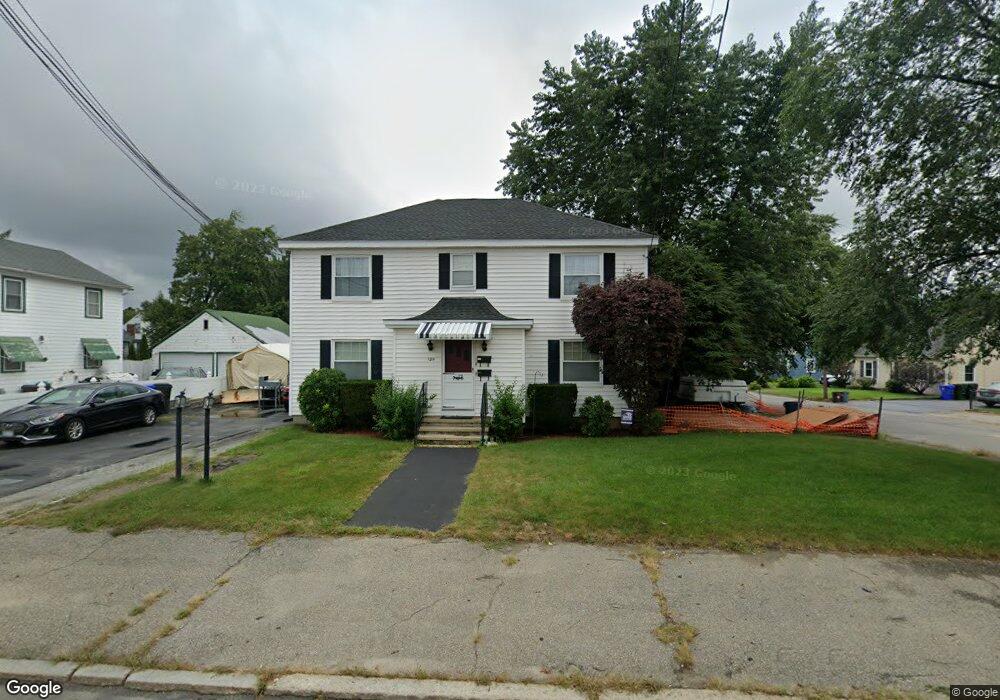
120 S Maple St Manchester, NH 03103
Southside NeighborhoodEstimated Value: $477,087 - $536,000
4
Beds
2
Baths
1,944
Sq Ft
$262/Sq Ft
Est. Value
About This Home
This home is located at 120 S Maple St, Manchester, NH 03103 and is currently estimated at $509,522, approximately $262 per square foot. 120 S Maple St is a home located in Hillsborough County with nearby schools including Jewett Street Elementary School, Southside Middle School, and Manchester Memorial High School.
Ownership History
Date
Name
Owned For
Owner Type
Purchase Details
Closed on
Nov 2, 1998
Sold by
Langevin Madeline D
Bought by
Brown Steve N
Current Estimated Value
Home Financials for this Owner
Home Financials are based on the most recent Mortgage that was taken out on this home.
Original Mortgage
$113,900
Outstanding Balance
$25,058
Interest Rate
6.68%
Estimated Equity
$484,464
Create a Home Valuation Report for This Property
The Home Valuation Report is an in-depth analysis detailing your home's value as well as a comparison with similar homes in the area
Home Values in the Area
Average Home Value in this Area
Purchase History
| Date | Buyer | Sale Price | Title Company |
|---|---|---|---|
| Brown Steve N | $115,000 | -- |
Source: Public Records
Mortgage History
| Date | Status | Borrower | Loan Amount |
|---|---|---|---|
| Open | Brown Steve N | $60,000 | |
| Open | Brown Steve N | $113,900 |
Source: Public Records
Tax History Compared to Growth
Tax History
| Year | Tax Paid | Tax Assessment Tax Assessment Total Assessment is a certain percentage of the fair market value that is determined by local assessors to be the total taxable value of land and additions on the property. | Land | Improvement |
|---|---|---|---|---|
| 2024 | $6,598 | $337,000 | $103,200 | $233,800 |
| 2023 | $6,356 | $337,000 | $103,200 | $233,800 |
| 2022 | $6,147 | $337,000 | $103,200 | $233,800 |
| 2021 | $5,958 | $337,000 | $103,200 | $233,800 |
| 2020 | $5,090 | $206,400 | $71,200 | $135,200 |
| 2019 | $5,020 | $206,400 | $71,200 | $135,200 |
| 2018 | $4,888 | $206,400 | $71,200 | $135,200 |
| 2017 | $4,813 | $206,400 | $71,200 | $135,200 |
| 2016 | $4,776 | $206,400 | $71,200 | $135,200 |
| 2015 | $4,388 | $187,200 | $65,900 | $121,300 |
| 2014 | $4,399 | $187,200 | $65,900 | $121,300 |
| 2013 | $4,244 | $187,200 | $65,900 | $121,300 |
Source: Public Records
Map
Nearby Homes
- 152 Oakdale Ave
- 87 S Wilson St
- 63 Parkview St
- 507 Clay St
- 615 Clay St
- 202 Mitchell St
- 47 Rosedale Ave
- 87 Harrington Ave
- 161 Flint St
- 131 Calef Rd
- 160 S Elm St
- 33 W Elmhurst Ave Unit B
- 323 Seames Dr
- 618 Prescott St
- 106 W Hillcrest Ave
- 167 Jobin Dr
- 118 W Hillcrest Ave
- 60 W Elmwood Ave
- 700 S Beech St
- 165 Taylor St