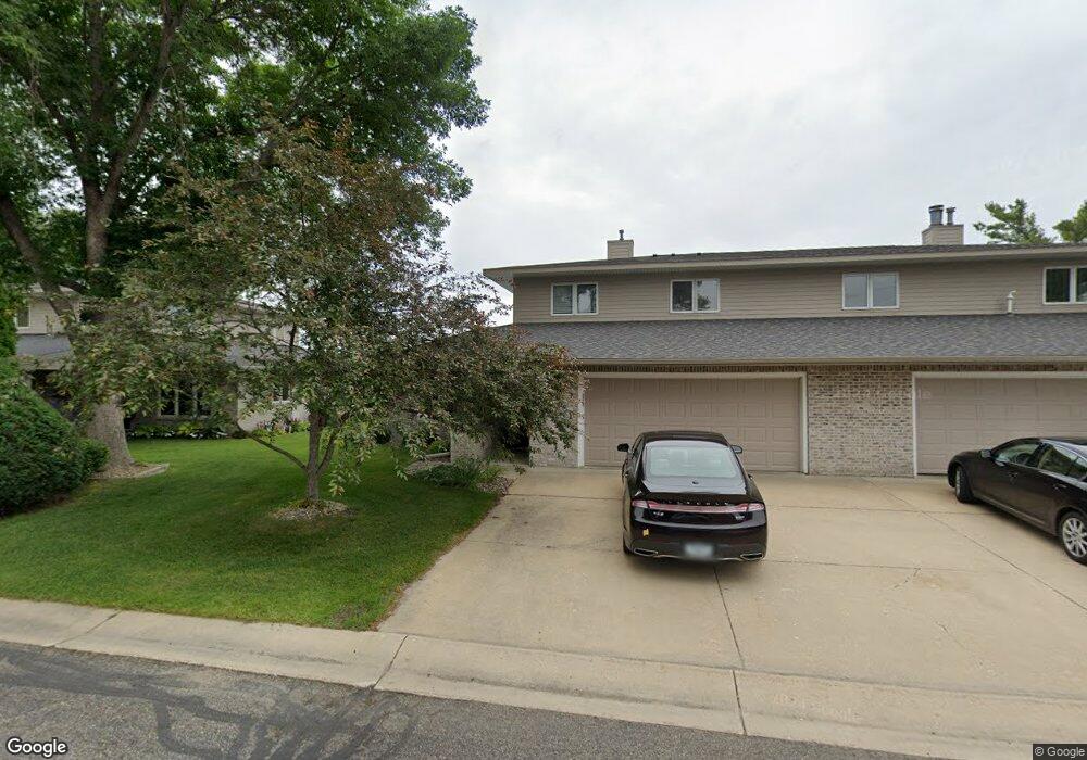
120 Salem Point Dr SW Rochester, MN 55902
Estimated Value: $524,000 - $714,000
3
Beds
3
Baths
2,401
Sq Ft
$264/Sq Ft
Est. Value
About This Home
This home is located at 120 Salem Point Dr SW, Rochester, MN 55902 and is currently estimated at $632,892, approximately $263 per square foot. 120 Salem Point Dr SW is a home located in Olmsted County with nearby schools including Bamber Valley Elementary School, John Adams Middle School, and Mayo Senior High School.
Ownership History
Date
Name
Owned For
Owner Type
Purchase Details
Closed on
Jul 10, 2020
Sold by
Friedman Roger and Roger Friedman Trust
Bought by
Georger Gloria G and Moore Maynard
Current Estimated Value
Home Financials for this Owner
Home Financials are based on the most recent Mortgage that was taken out on this home.
Original Mortgage
$250,000
Outstanding Balance
$221,683
Interest Rate
3.1%
Mortgage Type
New Conventional
Estimated Equity
$411,209
Purchase Details
Closed on
Nov 2, 2018
Sold by
Friedman Roger
Bought by
Friedman Roger and Roger Friedman Trust
Purchase Details
Closed on
Sep 15, 2016
Sold by
Wilson John D and Wilson David Merle
Bought by
Friedman Roger
Home Financials for this Owner
Home Financials are based on the most recent Mortgage that was taken out on this home.
Original Mortgage
$389,500
Interest Rate
3.45%
Mortgage Type
New Conventional
Create a Home Valuation Report for This Property
The Home Valuation Report is an in-depth analysis detailing your home's value as well as a comparison with similar homes in the area
Home Values in the Area
Average Home Value in this Area
Purchase History
| Date | Buyer | Sale Price | Title Company |
|---|---|---|---|
| Georger Gloria G | $565,000 | Title Services Inc | |
| Friedman Roger | -- | Title Services Inc | |
| Friedman Roger | $410,000 | Title Services Inc |
Source: Public Records
Mortgage History
| Date | Status | Borrower | Loan Amount |
|---|---|---|---|
| Open | Georger Gloria G | $250,000 | |
| Previous Owner | Friedman Roger | $389,500 |
Source: Public Records
Tax History Compared to Growth
Tax History
| Year | Tax Paid | Tax Assessment Tax Assessment Total Assessment is a certain percentage of the fair market value that is determined by local assessors to be the total taxable value of land and additions on the property. | Land | Improvement |
|---|---|---|---|---|
| 2024 | $7,420 | $523,600 | $145,000 | $378,600 |
| 2023 | $6,622 | $521,300 | $145,000 | $376,300 |
| 2022 | $6,370 | $485,900 | $145,000 | $340,900 |
| 2021 | $6,012 | $463,000 | $145,000 | $318,000 |
| 2020 | $5,980 | $436,400 | $145,000 | $291,400 |
| 2019 | $5,828 | $416,400 | $125,000 | $291,400 |
| 2018 | $5,464 | $408,200 | $125,000 | $283,200 |
| 2017 | $4,360 | $382,300 | $110,000 | $272,300 |
| 2016 | $4,174 | $297,400 | $41,600 | $255,800 |
| 2015 | $2,023 | $278,200 | $41,200 | $237,000 |
| 2014 | $1,943 | $281,300 | $41,300 | $240,000 |
| 2012 | -- | $297,600 | $41,559 | $256,041 |
Source: Public Records
Map
Nearby Homes
- 2449 Salem Heights Ln SW
- 1568 Salem Ct SW
- 2308 Baihly Hills Dr SW
- 1758 Mayowood Rd SW
- 1750 Mayowood Rd SW
- 1782 Mayowood Ct SW
- 1213 Grey Fox Ave SW
- 1941 Waterford Place SW
- 1726 Mayowood Rd SW
- 3177 Glenwood Rd SW
- 3125 Glenwood Rd SW
- 2961 Glenwood Rd SW
- 1798 Mayowood Rd SW
- 1787 Mayowood Rd SW
- 1739 Mayowood Ct SW
- 1710 Mayowood Ct SW
- 1203 Baihly View Ln SW
- 1702 Mayowood Ct SW
- 1822 Mayowood Rd SW
- 1835 Mayowood Rd SW
- 130 Salem Point Dr SW
- 110 Salem Point Dr SW
- 100 Salem Point Dr SW
- 125 Salem Point Dr SW
- 115 Salem Point Dr SW
- 150 Salem Point Dr SW
- 135 Salem Point Dr SW
- 105 Salem Point Dr SW
- 160 Salem Point Dr SW
- 145 Salem Point Dr SW
- 170 Salem Point Dr SW
- 155 Salem Point Dr SW
- 180 Salem Point Dr SW
- 235 Salem Point Dr SW
- 190 Salem Point Dr SW
- 245 Salem Point Dr SW
- 210 Salem Point Dr SW
- 200 Salem Point Dr SW
- 220 Salem Point Dr SW
- 255 Salem Point Dr SW