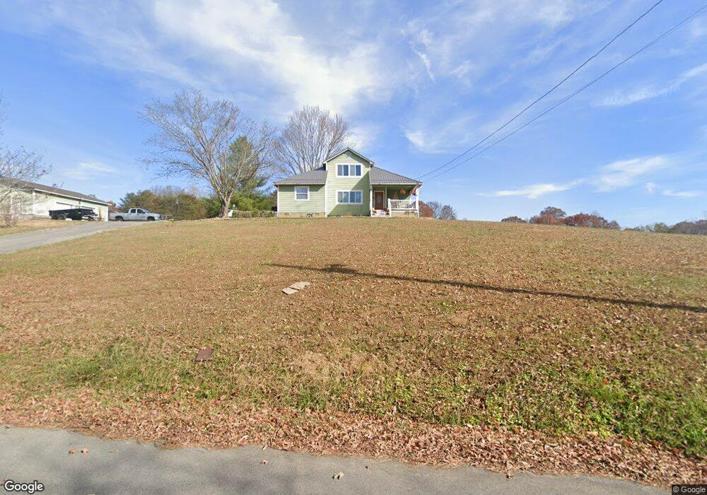
120 Sally Ford Rd Jonesborough, TN 37659
Estimated Value: $332,000 - $454,000
--
Bed
2
Baths
2,022
Sq Ft
$189/Sq Ft
Est. Value
About This Home
This home is located at 120 Sally Ford Rd, Jonesborough, TN 37659 and is currently estimated at $382,793, approximately $189 per square foot. 120 Sally Ford Rd is a home located in Washington County with nearby schools including Ridgeview Elementary School and Daniel Boone High School.
Ownership History
Date
Name
Owned For
Owner Type
Purchase Details
Closed on
Mar 8, 2021
Sold by
Sims Jeffery and Sims Garnetta
Bought by
Sims Matthew Eugene and Garland Whitney Lasha
Current Estimated Value
Home Financials for this Owner
Home Financials are based on the most recent Mortgage that was taken out on this home.
Original Mortgage
$224,200
Outstanding Balance
$200,979
Interest Rate
2.7%
Mortgage Type
New Conventional
Estimated Equity
$181,814
Purchase Details
Closed on
Apr 13, 1989
Bought by
Sims Jeffery and Sims Garnetta
Create a Home Valuation Report for This Property
The Home Valuation Report is an in-depth analysis detailing your home's value as well as a comparison with similar homes in the area
Home Values in the Area
Average Home Value in this Area
Purchase History
| Date | Buyer | Sale Price | Title Company |
|---|---|---|---|
| Sims Matthew Eugene | $236,000 | Ecu Title & Escrow | |
| Sims Jeffery | $16,200 | -- |
Source: Public Records
Mortgage History
| Date | Status | Borrower | Loan Amount |
|---|---|---|---|
| Open | Sims Matthew Eugene | $224,200 |
Source: Public Records
Tax History Compared to Growth
Tax History
| Year | Tax Paid | Tax Assessment Tax Assessment Total Assessment is a certain percentage of the fair market value that is determined by local assessors to be the total taxable value of land and additions on the property. | Land | Improvement |
|---|---|---|---|---|
| 2024 | $1,333 | $77,975 | $10,400 | $67,575 |
| 2022 | $1,003 | $46,650 | $9,150 | $37,500 |
| 2021 | $1,003 | $46,650 | $9,150 | $37,500 |
| 2020 | $1,003 | $46,650 | $9,150 | $37,500 |
| 2019 | $1,105 | $46,650 | $9,150 | $37,500 |
| 2018 | $1,105 | $46,450 | $9,150 | $37,300 |
| 2017 | $1,105 | $46,450 | $9,150 | $37,300 |
| 2016 | $1,105 | $46,450 | $9,150 | $37,300 |
| 2015 | $920 | $46,450 | $9,150 | $37,300 |
| 2014 | $920 | $46,450 | $9,150 | $37,300 |
Source: Public Records
Map
Nearby Homes
- 310 Mitchell Ct
- 0 A Deakins Rd
- 215 Timberlyne Parc
- 356 Cameron Ct
- 374 Cameron Ct
- 147 Pembrooke Cir
- 162 Bob Ford Rd
- 115 Maple Ridge Dr
- 198 Bob Ford Rd
- 2013 Presley Crossing
- 166 Booher Rd
- 1229 Cabot Cove
- 1270 Cabot Cove
- 1436 Cabot Cove
- 1432 Cabot Cove
- 1444 Cabot Cove
- 1428 Cabot Cove
- 1420 Cabot Cove
- 1416 Cabot Cove
- 111 Bermuda Dr
- 144 Sally Ford Rd
- 125 Sally Ford Rd
- 113 Sally Ford Rd
- 110 Sally Ford Rd
- 111 Sally Ford Rd
- 114 Sally Ford Rd
- 102 Aa Deakins Rd
- 286 Aa Deakins Rd
- 143 Sally Ford Rd
- 156 Sally Ford Rd
- 320 Aa Deakins Rd
- 310 Aa Deakins Rd
- 154 Sally Ford Rd
- 162 Sally Ford Rd
- 272 Aa Deakins Rd
- 159 Sally Ford Rd
- 166 Sally Ford Rd
- 161 Sally Ford Rd
- 168 Sally Ford Rd
- 260 Aa Deakins Rd