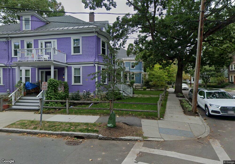
120 Stedman St Unit 122 Brookline, MA 02446
Coolidge Corner NeighborhoodEstimated Value: $2,862,000 - $3,755,000
9
Beds
6
Baths
4,582
Sq Ft
$722/Sq Ft
Est. Value
About This Home
This home is located at 120 Stedman St Unit 122, Brookline, MA 02446 and is currently estimated at $3,308,500, approximately $722 per square foot. 120 Stedman St Unit 122 is a home located in Norfolk County with nearby schools including Match Charter Public School and New England Hebrew Academy.
Ownership History
Date
Name
Owned For
Owner Type
Purchase Details
Closed on
Jun 27, 2014
Sold by
Wong Mary C
Bought by
Mcw Rt and Wong Mary C
Current Estimated Value
Purchase Details
Closed on
Dec 10, 1984
Bought by
Wong Mary C
Create a Home Valuation Report for This Property
The Home Valuation Report is an in-depth analysis detailing your home's value as well as a comparison with similar homes in the area
Home Values in the Area
Average Home Value in this Area
Purchase History
| Date | Buyer | Sale Price | Title Company |
|---|---|---|---|
| Mcw Rt | -- | -- | |
| Wong Mary C | -- | -- |
Source: Public Records
Mortgage History
| Date | Status | Borrower | Loan Amount |
|---|---|---|---|
| Previous Owner | Wong Mary C | $100,000 |
Source: Public Records
Tax History Compared to Growth
Tax History
| Year | Tax Paid | Tax Assessment Tax Assessment Total Assessment is a certain percentage of the fair market value that is determined by local assessors to be the total taxable value of land and additions on the property. | Land | Improvement |
|---|---|---|---|---|
| 2025 | $24,321 | $2,464,100 | $1,270,300 | $1,193,800 |
| 2024 | $24,197 | $2,476,700 | $1,221,300 | $1,255,400 |
| 2023 | $23,865 | $2,393,700 | $1,122,600 | $1,271,100 |
| 2022 | $23,230 | $2,279,700 | $1,069,100 | $1,210,600 |
| 2021 | $21,482 | $2,192,000 | $1,028,000 | $1,164,000 |
| 2020 | $20,070 | $2,123,800 | $934,500 | $1,189,300 |
| 2019 | $18,953 | $2,022,700 | $890,000 | $1,132,700 |
| 2018 | $17,353 | $1,834,400 | $741,600 | $1,092,800 |
| 2017 | $16,781 | $1,698,500 | $699,600 | $998,900 |
| 2016 | $16,090 | $1,544,100 | $653,900 | $890,200 |
| 2015 | $14,992 | $1,403,700 | $611,100 | $792,600 |
| 2014 | $14,551 | $1,277,500 | $509,200 | $768,300 |
Source: Public Records
Map
Nearby Homes
- 85 Naples Rd Unit 2
- 11 Abbottsford Rd
- 233 Freeman St Unit 1
- 116 Thorndike St
- 116 Thorndike St Unit 2
- 116 Thorndike St Unit 1
- 45 Dwight St
- 58 Dwight St Unit 6
- 99 Crowninshield Rd Unit 99
- 52 Babcock St Unit 6
- 125 Crowninshield Rd Unit 125
- 6 Elba St
- 373 Harvard St Unit 1
- 51 John St Unit 201
- 10 Bradford Terrace Unit 5
- 125 Pleasant St Unit 201
- 63 Green St Unit 3
- 63 Green St Unit 2
- 107 Centre St Unit A
- 79 Pleasant St Unit 4
- 112 Beals St
- 3 Gibbs St
- 119 Stedman St
- 28 Manchester Rd
- 28 Manchester Rd
- 28 Manchester Rd Unit 2
- 28 Manchester Rd Unit 1
- 9 Gibbs St Unit 3
- 9 Gibbs St Unit 2
- 9 Gibbs St Unit 1
- 9 Gibbs St
- 123 Stedman St Unit 123 123
- 117 Stedman St
- 32 Manchester Rd
- 121 Stedman St Unit 123
- 121 Stedman St Unit 123
- 121 Stedman St Unit 121 121
- 11 Gibbs St
- 11 Gibbs St Unit 3
- 115 Stedman St