Estimated Value: $304,561 - $364,000
3
Beds
2
Baths
1,586
Sq Ft
$206/Sq Ft
Est. Value
About This Home
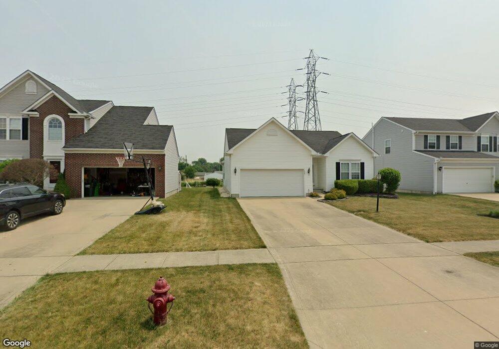
This home is located at 120 Stonefield Dr, Berea, OH 44017 and is currently estimated at $327,140, approximately $206 per square foot. 120 Stonefield Dr is a home located in Cuyahoga County with nearby schools including Falls-Lenox Primary Elementary School, Olmsted Falls Intermediate Building, and Olmsted Falls Middle School.
Ownership History
Date
Name
Owned For
Owner Type
Purchase Details
Closed on
Dec 20, 2006
Sold by
Nvr Inc
Bought by
Borowski Conrad L and Borowski Betty J
Current Estimated Value
Home Financials for this Owner
Home Financials are based on the most recent Mortgage that was taken out on this home.
Original Mortgage
$135,500
Outstanding Balance
$80,698
Interest Rate
6.24%
Mortgage Type
Purchase Money Mortgage
Estimated Equity
$246,442
Create a Home Valuation Report for This Property
The Home Valuation Report is an in-depth analysis detailing your home's value as well as a comparison with similar homes in the area
Home Values in the Area
Average Home Value in this Area
Purchase History
| Date | Buyer | Sale Price | Title Company |
|---|---|---|---|
| Borowski Conrad L | $215,090 | Nvr Title Agency |
Source: Public Records
Mortgage History
| Date | Status | Borrower | Loan Amount |
|---|---|---|---|
| Open | Borowski Conrad L | $135,500 |
Source: Public Records
Tax History Compared to Growth
Tax History
| Year | Tax Paid | Tax Assessment Tax Assessment Total Assessment is a certain percentage of the fair market value that is determined by local assessors to be the total taxable value of land and additions on the property. | Land | Improvement |
|---|---|---|---|---|
| 2024 | $4,970 | $95,270 | $23,940 | $71,330 |
| 2023 | $4,991 | $81,240 | $21,600 | $59,640 |
| 2022 | $4,988 | $81,240 | $21,600 | $59,640 |
| 2021 | $4,951 | $81,240 | $21,600 | $59,640 |
| 2020 | $5,007 | $73,850 | $19,640 | $54,220 |
| 2019 | $4,874 | $211,000 | $56,100 | $154,900 |
| 2018 | $4,839 | $73,850 | $19,640 | $54,220 |
| 2017 | $4,299 | $62,310 | $17,120 | $45,190 |
| 2016 | $4,267 | $62,310 | $17,120 | $45,190 |
| 2015 | $3,940 | $62,310 | $17,120 | $45,190 |
| 2014 | $3,940 | $61,080 | $16,770 | $44,310 |
Source: Public Records
Map
Nearby Homes
- 361 Chestnut Dr
- 109 Marble Ct
- 351 Lombardy Dr
- 100 River Rock Way
- 228 Stone Ridge Way
- 136 River Rock Way Unit D
- 75 Sunset Dr
- 260 Stone Ridge Way
- 7587 Lewis Rd
- 243 Edgewood Dr
- 8757 Roberts Ct Unit 25C
- 8241 Lewis Rd
- 396 Crossbrook Dr
- 0 River Rd Unit 5169658
- 35 W 5th Ave
- 154 Lee Rd
- 281-12-007 River Rd
- 281-12-024 River Rd
- 28 Crocker St
- 483 Front St
- 118 Stonefield Dr
- 122 Stonefield Dr
- 124 Stonefield Dr
- 116 Stonefield Dr
- 119 Stonefield Dr
- 117 Stonefield Dr
- 126 Stonefield Dr
- 121 Stonefield Dr
- 109 Shale Ct
- 123 Stonefield Dr
- 125 Stonefield Dr
- 411 Chestnut Dr
- 107 Shale Ct
- 421 Chestnut Dr
- 128 Stonefield Dr
- 405 Buckeye Dr
- 417 Chestnut Dr
- 425 Chestnut Dr
- 115 Stonefield Dr
- 127 Stonefield Dr