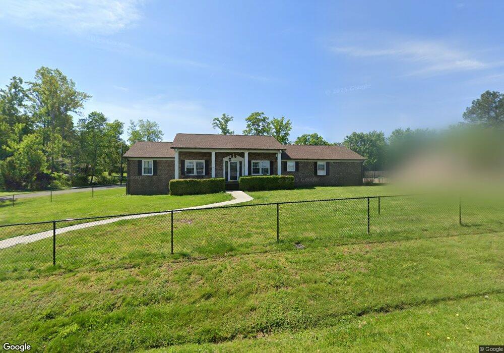
120 Tara Dr Cookeville, TN 38501
Estimated Value: $331,713 - $375,000
3
Beds
2
Baths
2,480
Sq Ft
$143/Sq Ft
Est. Value
About This Home
This home is located at 120 Tara Dr, Cookeville, TN 38501 and is currently estimated at $353,428, approximately $142 per square foot. 120 Tara Dr is a home located in Putnam County with nearby schools including Cane Creek Elementary School, Upperman Middle School, and Upperman High School.
Ownership History
Date
Name
Owned For
Owner Type
Purchase Details
Closed on
Sep 14, 2006
Sold by
Nabors James C
Bought by
Conley William L and Conley Jenny
Current Estimated Value
Home Financials for this Owner
Home Financials are based on the most recent Mortgage that was taken out on this home.
Original Mortgage
$139,900
Outstanding Balance
$83,142
Interest Rate
6.48%
Estimated Equity
$270,286
Purchase Details
Closed on
Sep 2, 1992
Bought by
Nabors James C and Nabors Diane
Purchase Details
Closed on
Feb 26, 1992
Bought by
Susong Nick R and Susong Fay
Purchase Details
Closed on
Aug 23, 1988
Bought by
Crews John R and Crews Eleanor
Purchase Details
Closed on
Dec 22, 1987
Bought by
Ethyl Corp
Purchase Details
Closed on
Oct 3, 1980
Bought by
Lee Hayes B and Lee Kathy
Create a Home Valuation Report for This Property
The Home Valuation Report is an in-depth analysis detailing your home's value as well as a comparison with similar homes in the area
Home Values in the Area
Average Home Value in this Area
Purchase History
| Date | Buyer | Sale Price | Title Company |
|---|---|---|---|
| Conley William L | $140,000 | -- | |
| Nabors James C | $84,000 | -- | |
| Susong Nick R | $70,000 | -- | |
| Crews John R | $64,900 | -- | |
| Ethyl Corp | -- | -- | |
| Lee Hayes B | -- | -- |
Source: Public Records
Mortgage History
| Date | Status | Borrower | Loan Amount |
|---|---|---|---|
| Open | Lee Hayes B | $139,900 |
Source: Public Records
Tax History Compared to Growth
Tax History
| Year | Tax Paid | Tax Assessment Tax Assessment Total Assessment is a certain percentage of the fair market value that is determined by local assessors to be the total taxable value of land and additions on the property. | Land | Improvement |
|---|---|---|---|---|
| 2024 | $1,496 | $56,225 | $5,750 | $50,475 |
| 2023 | $1,496 | $56,225 | $5,750 | $50,475 |
| 2022 | $1,390 | $56,225 | $5,750 | $50,475 |
| 2021 | $1,390 | $56,225 | $5,750 | $50,475 |
| 2020 | $811 | $56,225 | $5,750 | $50,475 |
| 2019 | $1,013 | $38,850 | $5,750 | $33,100 |
| 2018 | $945 | $34,625 | $5,750 | $28,875 |
| 2017 | $945 | $34,625 | $5,750 | $28,875 |
| 2016 | $945 | $34,625 | $5,750 | $28,875 |
| 2015 | $971 | $34,625 | $5,750 | $28,875 |
| 2014 | $906 | $32,289 | $0 | $0 |
Source: Public Records
Map
Nearby Homes
- 270 Locust Grove Rd
- 279 Willow Brook Dr
- 2911 Grand Ridge Dr
- 2136 W Broad St
- 500 N McBroom Chapel Rd
- 2.52 St
- 0 Corner of W Broad St & Tn Ave Unit RTC2794105
- 1957 W Broad St
- Lot 3 Miller
- 4131 Charlton Square
- 4060 Charlton Square
- 2.52 ac W Broad St
- 918 Faye Dr
- 1711 Creekside Dr
- 1775 Creekside Dr
- 553 County Farm Rd
- 4113 Buffalo Valley Rd
- 1520 Hawkins Crawford Rd
- 1408 Oak Grove Dr