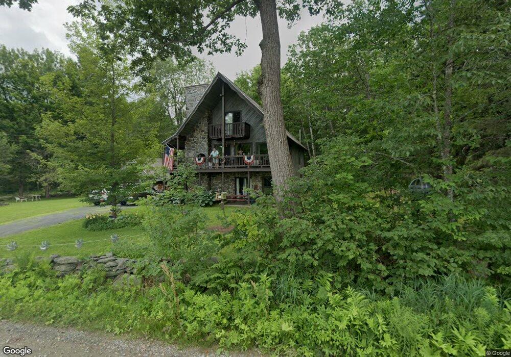
120 Taylor Brook Colrain, MA 01340
Heath NeighborhoodEstimated Value: $364,000 - $431,000
4
Beds
3
Baths
2,116
Sq Ft
$182/Sq Ft
Est. Value
About This Home
This home is located at 120 Taylor Brook, Colrain, MA 01340 and is currently estimated at $384,652, approximately $181 per square foot. 120 Taylor Brook is a home located in Franklin County with nearby schools including Mohawk Trail Regional High School.
Ownership History
Date
Name
Owned For
Owner Type
Purchase Details
Closed on
Nov 29, 2022
Sold by
Brandenburg Elizabeth M
Bought by
Graves Daniel F and Brandenburg Jeffrey S
Current Estimated Value
Purchase Details
Closed on
Jul 17, 2003
Sold by
Veilleux Daniel and Veilleux Donal
Bought by
Maddern-Dehoy Elizabeth G
Home Financials for this Owner
Home Financials are based on the most recent Mortgage that was taken out on this home.
Original Mortgage
$100,000
Interest Rate
5.34%
Mortgage Type
Purchase Money Mortgage
Create a Home Valuation Report for This Property
The Home Valuation Report is an in-depth analysis detailing your home's value as well as a comparison with similar homes in the area
Home Values in the Area
Average Home Value in this Area
Purchase History
We collect this data history from publicly available records. To have your information removed, we recommend requesting removal directly through your county’s website.
| Date | Buyer | Sale Price | Title Company |
|---|---|---|---|
| Graves Daniel F | -- | None Available | |
| Brandenburg Elizabeth M | -- | None Available | |
| Brandenburg Elizabeth M | -- | None Available | |
| Graves Daniel F | -- | None Available | |
| Graves Daniel F | -- | None Available | |
| Maddern-Dehoy Elizabeth G | $160,000 | -- | |
| Maddern-Dehoy Elizabeth G | $160,000 | -- |
Source: Public Records
Mortgage History
We collect this data history from publicly available records. To have your information removed, we recommend requesting removal directly through your county’s website.
| Date | Status | Borrower | Loan Amount |
|---|---|---|---|
| Previous Owner | Maddern-Dehoy Elizabeth G | $28,800 | |
| Previous Owner | Maddern-Dehoy Elizabeth G | $100,000 |
Source: Public Records
Tax History
| Year | Tax Paid | Tax Assessment Tax Assessment Total Assessment is a certain percentage of the fair market value that is determined by local assessors to be the total taxable value of land and additions on the property. | Land | Improvement |
|---|---|---|---|---|
| 2025 | $5,626 | $299,100 | $30,200 | $268,900 |
| 2024 | $5,612 | $274,700 | $30,200 | $244,500 |
| 2023 | $4,876 | $213,100 | $30,200 | $182,900 |
| 2022 | $4,498 | $209,100 | $30,200 | $178,900 |
| 2021 | $4,468 | $198,400 | $30,200 | $168,200 |
| 2020 | $4,437 | $199,400 | $30,200 | $169,200 |
| 2019 | $4,339 | $200,900 | $29,900 | $171,000 |
| 2018 | $4,382 | $200,900 | $29,900 | $171,000 |
| 2017 | $3,917 | $186,600 | $21,600 | $165,000 |
| 2016 | $3,848 | $187,600 | $21,600 | $166,000 |
| 2015 | $3,764 | $188,600 | $21,600 | $167,000 |
Source: Public Records
Map
Nearby Homes
- 3 Flagg Hill Rd
- 35 Cheyenne St
- 8 Deer Run Path
- 2 Modoc Dr
- 14 South Rd
- 144 Branch Hill Rd
- 0 W Oxbow Rd Unit 248444
- 0 Sadoga Rd Unit 249488
- 0 Sadoga Rd Unit 73507720
- 594 Massachusetts 8a
- 24 W Oxbow Rd
- 31 W Oxbow Rd
- 2155 Massachusetts 2
- Lot 121 Davis Mine Rd
- 2151 Route 2
- 143 Charlemont Rd
- 13 Griswoldville St
- 251 Phillips Hill Rd
- 168 Main St
- 442 Mcmillan Rd
- 116 Taylor Brook Rd
- 116 Taylor Brook
- 17 W Brook Dr
- 1 Clearwater Dr
- 1 Mohawk Beach Dr
- 0 Taylor Brook Rd Unit 30170027
- 0 Taylor Brook Rd Unit 30103369
- 0 Taylor Brook Rd Unit 30067418
- 0 Taylor Brook Rd Unit 72602790
- 0 Taylor Brook Rd Unit 72413255
- 36 W Brook Dr
- 16 Clearwater Dr
- 12 & 16 Clearwater Dr
- 128 Taylor Brook Rd
- 21 Lakeview Dr
- 22 Lakeview Dr
- 10/11 Tepee Ln
- 10 Mohawk Beach Dr
- 2 Navaho Ln
- 20 Tepee Ln
Your Personal Tour Guide
Ask me questions while you tour the home.