120 Topstone Rd Redding, CT 06896
Estimated Value: $1,110,414 - $1,235,000
4
Beds
3
Baths
3,254
Sq Ft
$366/Sq Ft
Est. Value
About This Home
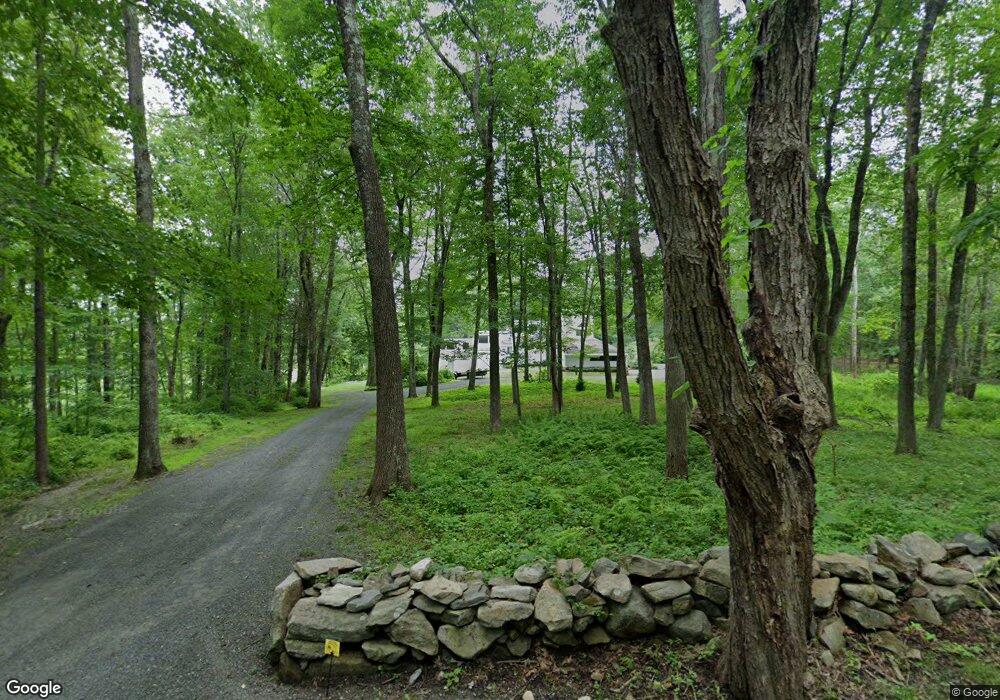
This home is located at 120 Topstone Rd, Redding, CT 06896 and is currently estimated at $1,192,104, approximately $366 per square foot. 120 Topstone Rd is a home located in Fairfield County with nearby schools including Redding Elementary School, John Read Middle School, and Joel Barlow High School.
Ownership History
Date
Name
Owned For
Owner Type
Purchase Details
Closed on
Nov 16, 2010
Sold by
Friedland Lawrence N and Friedland Alice L
Bought by
Durie John David and Durie Earifteh S
Current Estimated Value
Home Financials for this Owner
Home Financials are based on the most recent Mortgage that was taken out on this home.
Original Mortgage
$345,000
Outstanding Balance
$228,552
Interest Rate
4.35%
Estimated Equity
$963,552
Create a Home Valuation Report for This Property
The Home Valuation Report is an in-depth analysis detailing your home's value as well as a comparison with similar homes in the area
Home Values in the Area
Average Home Value in this Area
Purchase History
| Date | Buyer | Sale Price | Title Company |
|---|---|---|---|
| Durie John David | $645,000 | -- |
Source: Public Records
Mortgage History
| Date | Status | Borrower | Loan Amount |
|---|---|---|---|
| Open | Durie John David | $345,000 | |
| Previous Owner | Durie John David | $300,000 |
Source: Public Records
Tax History
| Year | Tax Paid | Tax Assessment Tax Assessment Total Assessment is a certain percentage of the fair market value that is determined by local assessors to be the total taxable value of land and additions on the property. | Land | Improvement |
|---|---|---|---|---|
| 2025 | $16,427 | $556,100 | $204,700 | $351,400 |
| 2024 | $15,971 | $556,100 | $204,700 | $351,400 |
| 2023 | $15,398 | $556,100 | $204,700 | $351,400 |
| 2022 | $14,560 | $436,700 | $199,900 | $236,800 |
| 2021 | $14,354 | $437,100 | $199,900 | $237,200 |
| 2020 | $14,354 | $437,100 | $199,900 | $237,200 |
| 2019 | $14,354 | $437,100 | $199,900 | $237,200 |
| 2018 | $13,865 | $437,100 | $199,900 | $237,200 |
| 2017 | $15,642 | $528,100 | $282,300 | $245,800 |
| 2016 | $15,447 | $528,300 | $282,300 | $246,000 |
| 2015 | $15,273 | $528,300 | $282,300 | $246,000 |
| 2014 | $15,273 | $528,300 | $282,300 | $246,000 |
Source: Public Records
Map
Nearby Homes
- 229 Umpawaug Rd
- 2 Brick School Dr
- 74 Seventy Acre Rd
- 36 Fox Run Rd
- 24 Costa Ln
- 12 Werf Dr
- 176 Picketts Ridge Rd
- 8 Cornerstone Ct
- 45 Great Pasture Rd
- 71 Picketts Ridge Rd
- 299 Redding Rd
- 15 Laurel Hill Rd
- 9 Chuck Wagon Ln
- 9 New Light Dr
- 2 Longwood Dr
- 21 Wicks Manor Dr
- 22 Ledgewood Rd
- 86 Starrs Plain Rd
- 41 Deer Hill Rd
- 14 Fillmore Ln
- 114 Topstone Rd
- 110 Topstone Rd
- 130 Topstone Rd
- 101 Topstone Rd
- 106 Topstone Rd
- 107 Topstone Rd
- 99 Topstone Rd
- 1 Jeremiah Sanford Rd
- 132 Topstone Rd
- 96 Topstone Rd
- 3 Jeremiah Sanford Rd
- 144 Topstone Rd
- 140 Topstone Rd
- 142 Topstone Rd
- 37 White Birch Rd
- 41 White Birch Rd
- 209 Umpawaug Rd
- 5 Jeremiah Sanford Rd
- 31 White Birch Rd
- 5 Charlie Hill Rd
Your Personal Tour Guide
Ask me questions while you tour the home.