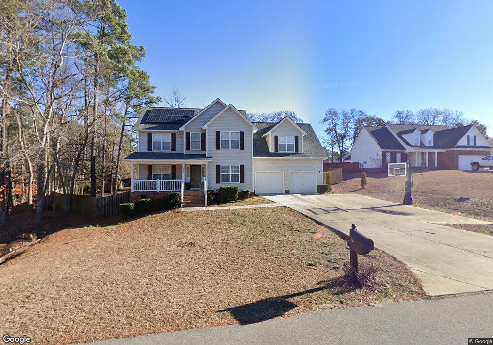
120 Union Cir Lillington, NC 27546
Estimated Value: $313,000 - $319,943
3
Beds
3
Baths
2,394
Sq Ft
$133/Sq Ft
Est. Value
About This Home
This home is located at 120 Union Cir, Lillington, NC 27546 and is currently estimated at $317,736, approximately $132 per square foot. 120 Union Cir is a home located in Harnett County with nearby schools including Anderson Creek Primary School, South Harnett Elementary School, and Western Harnett Middle School.
Ownership History
Date
Name
Owned For
Owner Type
Purchase Details
Closed on
May 11, 2022
Sold by
Gilliam Joycelyn R
Bought by
Gilliam Clarence M
Current Estimated Value
Purchase Details
Closed on
May 15, 2006
Sold by
Caviness Land Devlopment Inc
Bought by
Gilliam Clarence M and Gilliam Joycelyn R
Home Financials for this Owner
Home Financials are based on the most recent Mortgage that was taken out on this home.
Original Mortgage
$198,750
Interest Rate
6.39%
Mortgage Type
VA
Create a Home Valuation Report for This Property
The Home Valuation Report is an in-depth analysis detailing your home's value as well as a comparison with similar homes in the area
Home Values in the Area
Average Home Value in this Area
Purchase History
| Date | Buyer | Sale Price | Title Company |
|---|---|---|---|
| Gilliam Clarence M | -- | Kathryn Johnston Tart Pllc | |
| Gilliam Clarence M | $190,500 | None Available |
Source: Public Records
Mortgage History
| Date | Status | Borrower | Loan Amount |
|---|---|---|---|
| Previous Owner | Gilliam Clarence M | $198,750 |
Source: Public Records
Tax History Compared to Growth
Tax History
| Year | Tax Paid | Tax Assessment Tax Assessment Total Assessment is a certain percentage of the fair market value that is determined by local assessors to be the total taxable value of land and additions on the property. | Land | Improvement |
|---|---|---|---|---|
| 2025 | $1,785 | $242,491 | $0 | $0 |
| 2024 | $1,785 | $242,491 | $0 | $0 |
| 2023 | $1,785 | $242,491 | $0 | $0 |
| 2022 | $1,603 | $242,491 | $0 | $0 |
| 2021 | $1,603 | $176,520 | $0 | $0 |
| 2020 | $1,603 | $176,520 | $0 | $0 |
| 2019 | $1,588 | $176,520 | $0 | $0 |
| 2018 | $1,588 | $176,520 | $0 | $0 |
| 2017 | $1,588 | $176,520 | $0 | $0 |
| 2016 | $1,711 | $190,760 | $0 | $0 |
| 2015 | $1,711 | $190,760 | $0 | $0 |
| 2014 | $1,711 | $190,760 | $0 | $0 |
Source: Public Records
Map
Nearby Homes
- 412 Dunbar Dr
- 1234 Micahs Way N
- 77 Teak Wood Ct
- 73 Harborwood St
- 57 Spring Water Ct
- 32 Overview Ct
- Wayfare Plan at Creekside Oaks North
- Embark Plan at Creekside Oaks North
- Prelude Plan at Creekside Oaks North
- Freelance Plan at Creekside Oaks North
- 296 Greenbay St
- Engage Plan at Creekside Oaks North
- 16 Spring Pond Ln
- 85 Heatherspring Way
- 284 Harborwood St
- 91 Harborwood St
- 293 Harborwood St
- 46 Poplar Dr