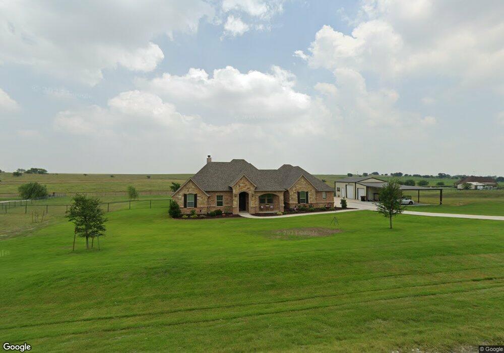
120 Vista Ridge N Decatur, TX 76234
Estimated Value: $518,000 - $591,000
--
Bed
--
Bath
2,408
Sq Ft
$231/Sq Ft
Est. Value
About This Home
This home is located at 120 Vista Ridge N, Decatur, TX 76234 and is currently estimated at $556,682, approximately $231 per square foot. 120 Vista Ridge N is a home with nearby schools including Decatur High School.
Ownership History
Date
Name
Owned For
Owner Type
Purchase Details
Closed on
Nov 29, 2016
Sold by
Bailee Developers Lp
Bought by
Cooperrider Elizbeth A and Harsha Eric B
Current Estimated Value
Home Financials for this Owner
Home Financials are based on the most recent Mortgage that was taken out on this home.
Original Mortgage
$279,200
Outstanding Balance
$224,853
Interest Rate
3.52%
Mortgage Type
New Conventional
Estimated Equity
$331,829
Purchase Details
Closed on
Jul 15, 2016
Sold by
Chisos Mountains Development Llc
Bought by
Harsha Eric B and Cooperrider Elizabeth A
Create a Home Valuation Report for This Property
The Home Valuation Report is an in-depth analysis detailing your home's value as well as a comparison with similar homes in the area
Home Values in the Area
Average Home Value in this Area
Purchase History
| Date | Buyer | Sale Price | Title Company |
|---|---|---|---|
| Cooperrider Elizbeth A | -- | Guardian Title Co | |
| Harsha Eric B | -- | -- |
Source: Public Records
Mortgage History
| Date | Status | Borrower | Loan Amount |
|---|---|---|---|
| Open | Cooperrider Elizbeth A | $279,200 |
Source: Public Records
Tax History Compared to Growth
Tax History
| Year | Tax Paid | Tax Assessment Tax Assessment Total Assessment is a certain percentage of the fair market value that is determined by local assessors to be the total taxable value of land and additions on the property. | Land | Improvement |
|---|---|---|---|---|
| 2025 | $5,685 | $574,891 | $90,906 | $483,985 |
| 2024 | $5,685 | $566,619 | $0 | $0 |
| 2023 | $6,223 | $515,108 | $0 | $0 |
| 2022 | $7,186 | $468,280 | $0 | $0 |
| 2021 | $6,824 | $425,710 | $56,460 | $369,250 |
| 2020 | $6,815 | $422,440 | $78,050 | $344,390 |
| 2019 | $7,166 | $417,110 | $78,050 | $339,060 |
| 2018 | $6,729 | $405,340 | $73,460 | $331,880 |
| 2017 | $5,590 | $314,940 | $46,680 | $268,260 |
| 2016 | $366 | $296,040 | $41,470 | $254,570 |
Source: Public Records
Map
Nearby Homes
- 141 Vista Ridge N
- 149 Heritage Pkwy E
- 124 Heritage Pkwy W
- TBD County Road 4010
- Aster V2 SE Plan at Hillview Addition
- Salado Plan at Hillview Addition
- Verbena V2 SE Plan at Hillview Addition
- Caddo Plan at Hillview Addition
- Colorado III Plan at Hillview Addition
- Cibolo Plan at Hillview Addition
- Bluebonnet SE Plan at Hillview Addition
- 118 Hillview Trail
- 1395 Private Road 4011
- 115 Hillview Trail
- 111 Hillview Trail
- 130 Longbranch Dr
- 120 Hillcrest Ln
- 1970 Fm 2264
- The Salado Plan at Hillcrest Meadows North
- 126 Range Ln
- 115 Vista Ridge N
- 134 Vista Ridge N
- 127 Vista Ridge N
- 128 Vista Ridge N
- 176 Heritage Pkwy E
- 133 Vista Ridge N
- 185 Heritage Pkwy W
- 177 Heritage Pkwy W
- 170 Heritage Pkwy E
- 171 Heritage Pkwy W
- 142 Vista Ridge N
- 142 Vista Ridge N
- 149 Vista Ridge N
- 164 Heritage Pkwy E
- 166 Heritage Pkwy W
- 155 Vista Ridge N
- 154 Vista Ridge N
- 160 Heritage Pkwy W
- 159 Heritage Pkwy W
- 174 Vista Ridge N