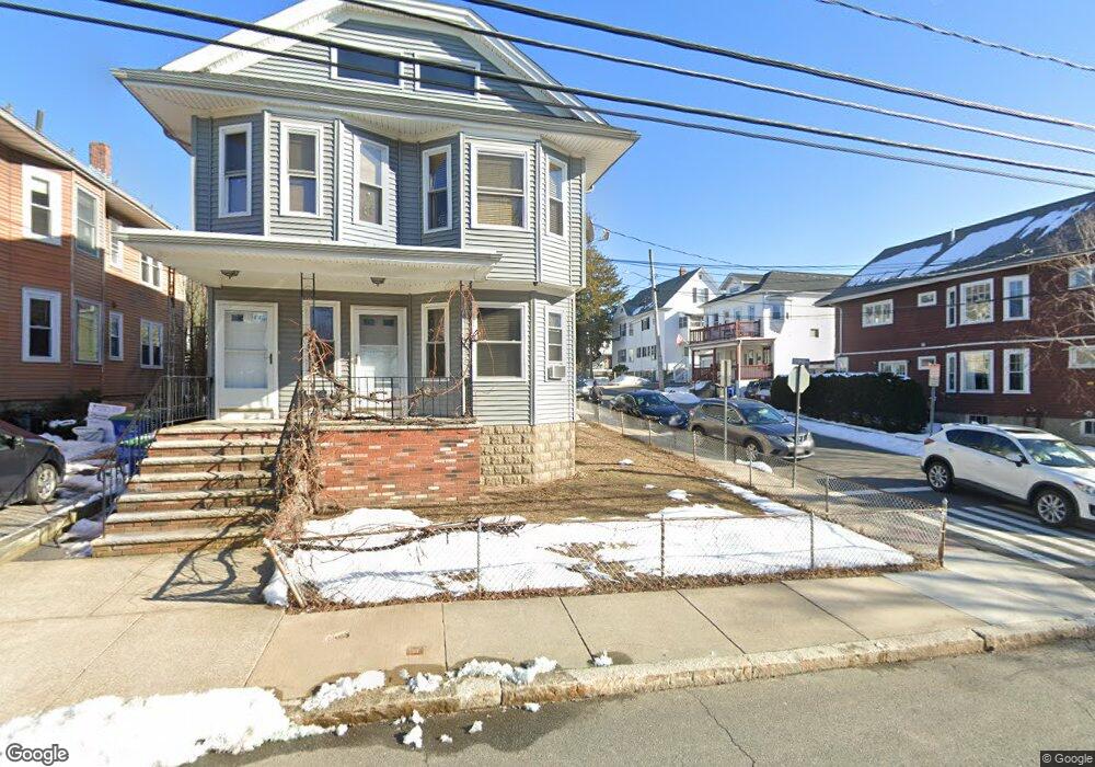
120 W Adams St Somerville, MA 02144
West Somerville NeighborhoodEstimated Value: $1,022,000 - $1,326,000
7
Beds
2
Baths
2,362
Sq Ft
$509/Sq Ft
Est. Value
About This Home
This home is located at 120 W Adams St, Somerville, MA 02144 and is currently estimated at $1,201,265, approximately $508 per square foot. 120 W Adams St is a home located in Middlesex County with nearby schools including Somerville High School, International School of Boston, and St. Clement Elementary School.
Ownership History
Date
Name
Owned For
Owner Type
Purchase Details
Closed on
Apr 30, 2020
Sold by
Marano Rt
Bought by
118 & 120 West Adams St Nt
Current Estimated Value
Purchase Details
Closed on
Sep 7, 2004
Sold by
Marano Elizabeth A and Marano Pasquale
Bought by
Marano Joey Louis and Marano Louis Nicholas
Create a Home Valuation Report for This Property
The Home Valuation Report is an in-depth analysis detailing your home's value as well as a comparison with similar homes in the area
Home Values in the Area
Average Home Value in this Area
Purchase History
| Date | Buyer | Sale Price | Title Company |
|---|---|---|---|
| 118 & 120 West Adams St Nt | -- | None Available | |
| Marano Joey Louis | -- | -- |
Source: Public Records
Tax History Compared to Growth
Tax History
| Year | Tax Paid | Tax Assessment Tax Assessment Total Assessment is a certain percentage of the fair market value that is determined by local assessors to be the total taxable value of land and additions on the property. | Land | Improvement |
|---|---|---|---|---|
| 2025 | $10,670 | $978,000 | $540,100 | $437,900 |
| 2024 | $10,046 | $954,900 | $540,100 | $414,800 |
| 2023 | $10,027 | $969,700 | $540,100 | $429,600 |
| 2022 | $9,238 | $907,500 | $514,400 | $393,100 |
| 2021 | $8,987 | $881,900 | $510,600 | $371,300 |
| 2020 | $8,828 | $874,900 | $510,900 | $364,000 |
| 2019 | $8,268 | $768,400 | $465,100 | $303,300 |
| 2018 | $7,983 | $705,800 | $422,800 | $283,000 |
| 2017 | $7,675 | $657,700 | $398,900 | $258,800 |
| 2016 | $7,889 | $629,600 | $356,300 | $273,300 |
| 2015 | $7,533 | $597,400 | $329,000 | $268,400 |
Source: Public Records
Map
Nearby Homes
- 33 Conwell Ave
- 16 High St Unit 2
- 21 High St
- 9 Woods Ave
- 31 Fairfax St
- 235 Powder House Blvd
- 327 Alewife Brook Pkwy Unit A
- 44 Woods Ave Unit 44
- 16 Hamilton Rd
- 202 Powder House Blvd Unit 2
- 69 Sterling St
- 6 Hamilton Rd Unit 6
- 34 Belknap St
- 11 Watson St Unit 1
- 11 Watson St Unit 2
- 395 Alewife Brook Pkwy Unit 2C
- 395 Alewife Brook Pkwy Unit PH E
- 76 Orchard St
- 55 Packard Ave Unit 1
- 12 Arizona Terrace Unit 2
- 114 W Adams St
- 116 W Adams St
- 130 W Adams St
- 110 W Adams St
- 128 W Adams St
- 128 W Adams St Unit 1
- 128 W Adams St Unit 1
- 65 Chetwynd Rd
- 112 W Adams St Unit 112
- 64 Chetwynd Rd
- 64 Chetwynd Rd
- 64 Chetwynd Rd Unit 1
- 64 Chetwynd Rd Unit 2
- 117 Hillsdale Rd
- 117 Hillsdale Rd Unit 1
- 117 Hillsdale Rd Unit 2
- 121 W Adams St Unit 2
- 121 W Adams St Unit 1
- 134 W Adams St
- 119 W Adams St