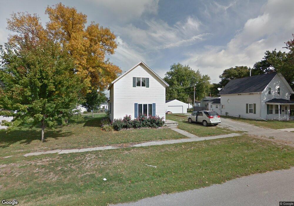
120 W Broadway St Colfax, IA 50054
Estimated Value: $165,000 - $195,877
3
Beds
1
Bath
1,320
Sq Ft
$139/Sq Ft
Est. Value
About This Home
This home is located at 120 W Broadway St, Colfax, IA 50054 and is currently estimated at $183,219, approximately $138 per square foot. 120 W Broadway St is a home located in Jasper County with nearby schools including Colfax-Mingo Elementary School and Colfax-Mingo High School.
Ownership History
Date
Name
Owned For
Owner Type
Purchase Details
Closed on
Sep 28, 2011
Sold by
Jnt Properties Llc
Bought by
Nicholson Jeff and Nicholson Tonya
Current Estimated Value
Home Financials for this Owner
Home Financials are based on the most recent Mortgage that was taken out on this home.
Original Mortgage
$50,000
Outstanding Balance
$34,168
Interest Rate
4.14%
Mortgage Type
FHA
Estimated Equity
$149,051
Purchase Details
Closed on
Jun 15, 2011
Sold by
Slifer Renee Charlene and Slifer Terry Lee
Bought by
Wells Fargo Bank Na
Create a Home Valuation Report for This Property
The Home Valuation Report is an in-depth analysis detailing your home's value as well as a comparison with similar homes in the area
Home Values in the Area
Average Home Value in this Area
Purchase History
| Date | Buyer | Sale Price | Title Company |
|---|---|---|---|
| Nicholson Jeff | -- | United Land Title Co | |
| Wells Fargo Bank Na | $29,614 | None Available |
Source: Public Records
Mortgage History
| Date | Status | Borrower | Loan Amount |
|---|---|---|---|
| Open | Nicholson Jeff | $50,000 |
Source: Public Records
Tax History Compared to Growth
Tax History
| Year | Tax Paid | Tax Assessment Tax Assessment Total Assessment is a certain percentage of the fair market value that is determined by local assessors to be the total taxable value of land and additions on the property. | Land | Improvement |
|---|---|---|---|---|
| 2025 | $2,678 | $157,540 | $11,690 | $145,850 |
| 2024 | $2,678 | $140,640 | $11,690 | $128,950 |
| 2023 | $2,696 | $140,640 | $11,690 | $128,950 |
| 2022 | $2,302 | $113,210 | $11,690 | $101,520 |
| 2021 | $1,806 | $102,520 | $11,690 | $90,830 |
| 2020 | $1,806 | $75,720 | $8,180 | $67,540 |
| 2019 | $1,700 | $67,450 | $0 | $0 |
| 2018 | $1,700 | $67,450 | $0 | $0 |
| 2017 | $1,678 | $67,450 | $0 | $0 |
| 2016 | $1,678 | $67,450 | $0 | $0 |
| 2015 | $1,668 | $67,440 | $0 | $0 |
| 2014 | $1,588 | $67,440 | $0 | $0 |
Source: Public Records
Map
Nearby Homes
- 119 W Washington St
- 223 W Broadway St
- 108 N West St
- 215 W Spring St
- 108 S Walnut St
- 501 W Broadway St
- 34 E Broadway St
- 222 E Broadway St
- 200 Jefferson St
- 226 S Iowa St
- 0000 Lincoln St
- 300 E Front St
- 20 S Oak Park Ave
- 520 S Oak Park Ave
- 400 S Goodrich St
- 655 E Division St
- 624 S Goodrich St
- 1161 S Goodrich St
- 11213 Orchard Ave
- HWY 117 at Intersection of Fleet Ave
- 110 W Broadway St
- 128 W Broadway St
- 115 W Washington St
- 123 S Locust St
- 115 S Locust St
- 109 S Locust St
- 121 W Washington St
- 121 W Broadway St
- 125 W Broadway St
- 101 S Locust St
- 129 W Broadway St
- 111 W Broadway St
- 200 W Broadway St
- 203 S West St
- 103 W Broadway St
- 201 W Washington St
- 206 W Broadway St
- 205 W Washington St
- 23 S Locust St
- 118 W Washington St