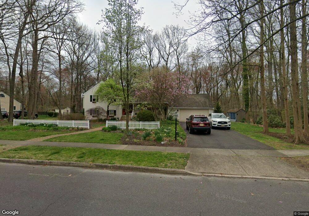
120 W Walnut Ave Moorestown, NJ 08057
Estimated Value: $1,023,346 - $1,213,000
--
Bed
--
Bath
3,112
Sq Ft
$363/Sq Ft
Est. Value
About This Home
This home is located at 120 W Walnut Ave, Moorestown, NJ 08057 and is currently estimated at $1,128,449, approximately $362 per square foot. 120 W Walnut Ave is a home located in Burlington County with nearby schools including George C. Baker Elementary School, Moorestown Upper Elementary School, and William Allen Middle School.
Ownership History
Date
Name
Owned For
Owner Type
Purchase Details
Closed on
Jun 2, 2001
Sold by
Goodman Philip and Goodman Deena
Bought by
Birdsall Robert H and Birdsall Gretchen M
Current Estimated Value
Home Financials for this Owner
Home Financials are based on the most recent Mortgage that was taken out on this home.
Original Mortgage
$60,000
Interest Rate
6.7%
Purchase Details
Closed on
Jul 1, 1997
Sold by
Lafrankie James V and Lafrankie Nancy L
Bought by
Goodman Philip and Goodman Deena
Create a Home Valuation Report for This Property
The Home Valuation Report is an in-depth analysis detailing your home's value as well as a comparison with similar homes in the area
Home Values in the Area
Average Home Value in this Area
Purchase History
| Date | Buyer | Sale Price | Title Company |
|---|---|---|---|
| Birdsall Robert H | $410,000 | Infinity Title Agency Inc | |
| Goodman Philip | $300,000 | Weichert Title Agency |
Source: Public Records
Mortgage History
| Date | Status | Borrower | Loan Amount |
|---|---|---|---|
| Previous Owner | Birdsall Robert H | $60,000 |
Source: Public Records
Tax History Compared to Growth
Tax History
| Year | Tax Paid | Tax Assessment Tax Assessment Total Assessment is a certain percentage of the fair market value that is determined by local assessors to be the total taxable value of land and additions on the property. | Land | Improvement |
|---|---|---|---|---|
| 2025 | $16,040 | $565,400 | $285,100 | $280,300 |
| 2024 | $15,554 | $565,400 | $285,100 | $280,300 |
| 2023 | $15,554 | $565,400 | $285,100 | $280,300 |
| 2022 | $15,396 | $565,400 | $285,100 | $280,300 |
| 2021 | $15,192 | $565,400 | $285,100 | $280,300 |
| 2020 | $15,096 | $565,400 | $285,100 | $280,300 |
| 2019 | $14,830 | $565,400 | $285,100 | $280,300 |
| 2018 | $14,429 | $565,400 | $285,100 | $280,300 |
| 2017 | $14,553 | $565,400 | $285,100 | $280,300 |
| 2016 | $14,503 | $565,400 | $285,100 | $280,300 |
| 2015 | $14,327 | $565,400 | $285,100 | $280,300 |
| 2014 | $13,604 | $565,400 | $285,100 | $280,300 |
Source: Public Records
Map
Nearby Homes
- 543 Bethel Ave
- 493 N Church St
- 308 Farmdale Rd
- 316 Farmdale Rd
- 423 Park Blvd
- 313 Fairview Ave
- 316 W 3rd St
- 15 E 2nd St
- 50 E 3rd St
- 66 E 3rd St
- 531 Covington Terrace
- 82 E 3rd St
- 80 E 3rd St
- 129 S Church St
- 4 W Close
- 133 Plum St Unit 6
- 25 Oriole Way
- 205 E Central Ave
- 310 S Washington Ave
- 600 Stratford Dr
- 116 W Walnut Ave
- 121 W Walnut Ave
- 117 W Walnut Ave
- 112 W Walnut Ave
- 700 Iron Post Rd
- 705 Iron Post Rd
- 144 Holmes Terrace
- 113 W Walnut Ave
- 151 Holmes Terrace
- 150 Holmes Terrace
- 145 Holmes Terrace
- 108 W Walnut Ave
- 704 Iron Post Rd
- 6 Walnut Ct
- 129 W Spruce Ave
- 709 Iron Post Rd
- 539 Bethel Ave
- 127 W Spruce Ave
- 145 Coleman Terrace
- 535 Bethel Ave