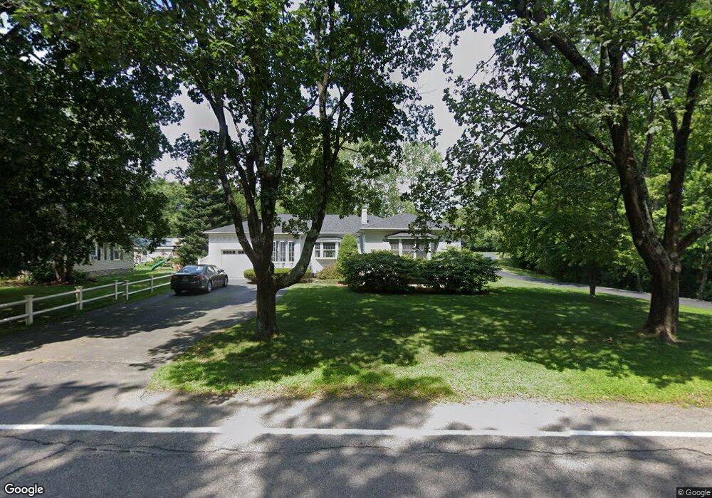
120 Wrentham Rd Bellingham, MA 02019
Estimated Value: $490,000 - $661,000
2
Beds
3
Baths
2,712
Sq Ft
$214/Sq Ft
Est. Value
About This Home
This home is located at 120 Wrentham Rd, Bellingham, MA 02019 and is currently estimated at $581,084, approximately $214 per square foot. 120 Wrentham Rd is a home located in Norfolk County with nearby schools including Joseph F. DiPietro Elementary, Bellingham High School, and Rise Prep Mayoral Academy Middle School.
Ownership History
Date
Name
Owned For
Owner Type
Purchase Details
Closed on
Aug 13, 2007
Sold by
Crosby Gary J
Bought by
Crosby Gary J and Crosby Pamela R
Current Estimated Value
Home Financials for this Owner
Home Financials are based on the most recent Mortgage that was taken out on this home.
Original Mortgage
$56,000
Outstanding Balance
$35,565
Interest Rate
6.72%
Mortgage Type
Purchase Money Mortgage
Estimated Equity
$545,519
Purchase Details
Closed on
Jul 10, 1998
Sold by
Dicristoforo Mark
Bought by
Crosby Gary J
Purchase Details
Closed on
Sep 28, 1990
Sold by
Lavallee Adrien D
Bought by
Dicristoforo Mark
Create a Home Valuation Report for This Property
The Home Valuation Report is an in-depth analysis detailing your home's value as well as a comparison with similar homes in the area
Home Values in the Area
Average Home Value in this Area
Purchase History
| Date | Buyer | Sale Price | Title Company |
|---|---|---|---|
| Crosby Gary J | -- | -- | |
| Crosby Gary J | $121,000 | -- | |
| Dicristoforo Mark | $120,000 | -- |
Source: Public Records
Mortgage History
| Date | Status | Borrower | Loan Amount |
|---|---|---|---|
| Open | Dicristoforo Mark | $10,283 | |
| Open | Crosby Gary J | $56,000 | |
| Previous Owner | Dicristoforo Mark | $124,000 | |
| Previous Owner | Dicristoforo Mark | $15,000 |
Source: Public Records
Tax History Compared to Growth
Tax History
| Year | Tax Paid | Tax Assessment Tax Assessment Total Assessment is a certain percentage of the fair market value that is determined by local assessors to be the total taxable value of land and additions on the property. | Land | Improvement |
|---|---|---|---|---|
| 2025 | $7,240 | $576,400 | $148,500 | $427,900 |
| 2024 | $6,934 | $539,200 | $135,600 | $403,600 |
| 2023 | $6,686 | $512,300 | $129,100 | $383,200 |
| 2022 | $6,622 | $470,300 | $110,400 | $359,900 |
| 2021 | $6,361 | $441,400 | $110,400 | $331,000 |
| 2020 | $5,987 | $421,000 | $110,400 | $310,600 |
| 2019 | $5,873 | $413,300 | $110,400 | $302,900 |
| 2018 | $5,698 | $395,400 | $107,800 | $287,600 |
| 2017 | $5,528 | $385,500 | $107,800 | $277,700 |
| 2016 | $5,119 | $358,200 | $109,900 | $248,300 |
| 2015 | $4,966 | $348,500 | $106,500 | $242,000 |
| 2014 | $5,263 | $359,000 | $112,100 | $246,900 |
Source: Public Records
Map
Nearby Homes
- 110 Wrentham Rd
- 130 Wrentham Rd
- 140 Wrentham Rd
- 100 Wrentham Rd
- 150 Wrentham Rd
- 90 Wrentham Rd
- 170 Wrentham Rd
- 86 Wrentham Rd
- 80 Wrentham Rd
- 101 Pine Grove Ave
- 70 Wrentham Rd
- 81 Pine Grove Ave
- 61 Pine Grove Ave
- 111 Pine Grove Ave
- 91 Pine Grove Ave
- 91 Pine Grove Ave Unit 2
- 91 Pine Grove Ave Unit 1
- 41 Pine Grove Ave
- 121 Pine Grove Ave
- 51 Wrentham Rd