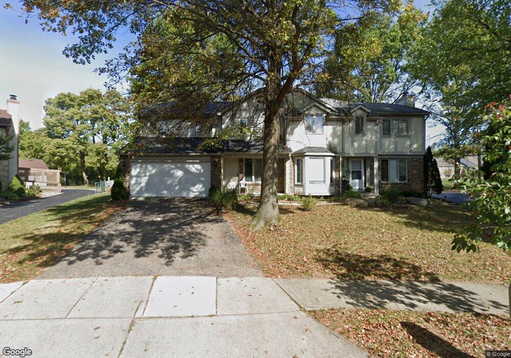
1200-1202 Colston Dr Unit 202 Westerville, OH 43081
Estimated Value: $484,000 - $538,079
6
Beds
4
Baths
3,597
Sq Ft
$142/Sq Ft
Est. Value
About This Home
This home is located at 1200-1202 Colston Dr Unit 202, Westerville, OH 43081 and is currently estimated at $512,520, approximately $142 per square foot. 1200-1202 Colston Dr Unit 202 is a home located in Franklin County with nearby schools including Mcvay Elementary School, Walnut Springs Middle School, and Westerville-North High School.
Ownership History
Date
Name
Owned For
Owner Type
Purchase Details
Closed on
Jan 16, 2004
Sold by
Wunderlich Scott D and Wunderlich Jacqueline M
Bought by
Kaileh Ayoub
Current Estimated Value
Home Financials for this Owner
Home Financials are based on the most recent Mortgage that was taken out on this home.
Original Mortgage
$243,000
Outstanding Balance
$119,283
Interest Rate
6.62%
Mortgage Type
Purchase Money Mortgage
Estimated Equity
$393,237
Purchase Details
Closed on
Mar 10, 1998
Sold by
Stone Ronald and Stone Barbara
Bought by
Wunderlich Scott D and Wunderlich Jacqueline M
Purchase Details
Closed on
Mar 3, 1998
Sold by
Guiser William J
Bought by
Stone Ronald and Stone Barbara
Purchase Details
Closed on
Apr 1, 1985
Create a Home Valuation Report for This Property
The Home Valuation Report is an in-depth analysis detailing your home's value as well as a comparison with similar homes in the area
Home Values in the Area
Average Home Value in this Area
Purchase History
| Date | Buyer | Sale Price | Title Company |
|---|---|---|---|
| Kaileh Ayoub | $260,000 | Hostetler Title | |
| Wunderlich Scott D | $225,000 | -- | |
| Stone Ronald | $210,000 | -- | |
| -- | $141,000 | -- |
Source: Public Records
Mortgage History
| Date | Status | Borrower | Loan Amount |
|---|---|---|---|
| Open | Kaileh Ayoub | $243,000 |
Source: Public Records
Tax History Compared to Growth
Tax History
| Year | Tax Paid | Tax Assessment Tax Assessment Total Assessment is a certain percentage of the fair market value that is determined by local assessors to be the total taxable value of land and additions on the property. | Land | Improvement |
|---|---|---|---|---|
| 2024 | $7,842 | $136,370 | $23,630 | $112,740 |
| 2023 | $7,678 | $136,370 | $23,630 | $112,740 |
| 2022 | $7,725 | $104,760 | $18,170 | $86,590 |
| 2021 | $7,790 | $104,760 | $18,170 | $86,590 |
| 2020 | $7,768 | $104,760 | $18,170 | $86,590 |
| 2019 | $6,866 | $87,330 | $15,160 | $72,170 |
| 2018 | $7,005 | $87,330 | $15,160 | $72,170 |
| 2017 | $7,133 | $87,330 | $15,160 | $72,170 |
| 2016 | $7,509 | $88,340 | $14,350 | $73,990 |
| 2015 | $7,276 | $88,340 | $14,350 | $73,990 |
| 2014 | $7,281 | $88,340 | $14,350 | $73,990 |
| 2013 | $3,463 | $84,140 | $13,685 | $70,455 |
Source: Public Records
Map
Nearby Homes
- 806 Watten Ln
- 6506 Purplefinch Ct
- 5769 Burntwood Way
- 4432 Scissortail Loop
- 6352 Hibiscus Ct
- 737 Autumn Branch Rd
- 750 Autumn Branch Rd
- 6360 Thrasher Loop
- 4765 Smoketalk Ln Unit 1
- 640 Brook Run Dr
- 4758 Crazy Horse Ln Unit 2
- 994 Autumn Lake Ct
- 4755 Crazy Horse Ln Unit 6
- 4786 Crazy Horse Ln Unit 2
- 800 S Spring Rd
- 1209 Chatham Ridge Rd
- 4816 Crazy Horse Ln Unit 4
- 1003 Autumn Meadows Dr
- 1146 Forest Rise Dr
- 1015 Swanton Ct
- 1200 Colston Dr Unit 202
- 1194 Colston Dr Unit 196
- 1206 Colston Dr Unit 208
- 1187 Colston Dr Unit 189
- 1214 Colston Dr Unit 216
- 1195 Colston Dr
- 1226 Colston Dr Unit 228
- 1201 Colston Dr
- 1213 Colston Dr
- 1207 Colston Dr
- 1234 Colston Dr Unit 236
- 1225 Colston Dr
- 1219 Norway Ln
- 1220 Denmark Place
- 1218 Norway Ln
- 1233 Colston Dr
- 1242 Colston Dr Unit 244
- 1217 Denmark Place
- 1244 Colston Dr