Estimated Value: $226,000 - $228,349
3
Beds
2
Baths
1,152
Sq Ft
$197/Sq Ft
Est. Value
About This Home
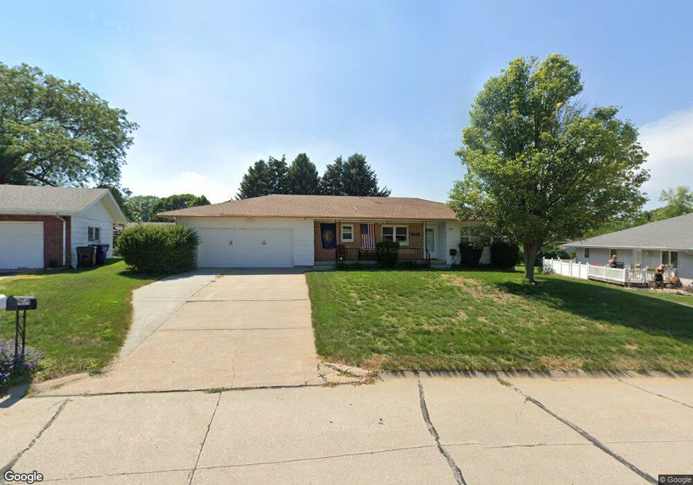
This home is located at 1200 Crescent Dr, Wayne, NE 68787 and is currently estimated at $226,837, approximately $196 per square foot. 1200 Crescent Dr is a home located in Wayne County with nearby schools including Wayne Elementary School, Wayne High School, and St. Mary Elementary School.
Ownership History
Date
Name
Owned For
Owner Type
Purchase Details
Closed on
Jul 11, 2013
Sold by
Phelps George F
Bought by
Phelps George F and George F Phelps Revocable Living Trust
Current Estimated Value
Purchase Details
Closed on
Jul 8, 2009
Sold by
Phelps Jennifer Suzanne
Bought by
Phelps George Frederick
Purchase Details
Closed on
Jul 2, 2008
Sold by
Mccubbin Garry
Bought by
Phelps George F
Purchase Details
Closed on
Jun 29, 2005
Sold by
Majeski Robert L and Majeski Cheryl C
Bought by
Luft Cory Thomas and Luft Angelina Elizabeth
Create a Home Valuation Report for This Property
The Home Valuation Report is an in-depth analysis detailing your home's value as well as a comparison with similar homes in the area
Home Values in the Area
Average Home Value in this Area
Purchase History
| Date | Buyer | Sale Price | Title Company |
|---|---|---|---|
| Phelps George F | -- | None Available | |
| Phelps George Frederick | -- | -- | |
| Phelps George F | $94,950 | -- | |
| Luft Cory Thomas | -- | None Available |
Source: Public Records
Tax History
| Year | Tax Paid | Tax Assessment Tax Assessment Total Assessment is a certain percentage of the fair market value that is determined by local assessors to be the total taxable value of land and additions on the property. | Land | Improvement |
|---|---|---|---|---|
| 2025 | $2,153 | $185,080 | $19,165 | $165,915 |
| 2024 | $2,153 | $169,435 | $19,165 | $150,270 |
| 2023 | $2,548 | $149,790 | $11,210 | $138,580 |
| 2022 | $2,322 | $133,095 | $11,210 | $121,885 |
| 2021 | $2,253 | $123,565 | $11,210 | $112,355 |
| 2020 | $2,210 | $123,565 | $11,210 | $112,355 |
| 2019 | $2,180 | $123,565 | $11,210 | $112,355 |
| 2018 | $1,142 | $123,565 | $11,210 | $112,355 |
| 2017 | $1,993 | $112,450 | $11,210 | $101,240 |
| 2016 | $0 | $0 | $0 | $0 |
| 2015 | $883 | $113,100 | $11,860 | $101,240 |
| 2014 | -- | $96,910 | $11,860 | $85,050 |
| 2013 | -- | $96,910 | $11,860 | $85,050 |
Source: Public Records
Map
Nearby Homes
- 1120 Crescent Dr
- 1204 Crescent Dr
- 1125 Lawndale Dr
- 1203 Lawndale Dr
- 1119 Lawndale Dr
- 1116 Crescent Dr
- 1123 Crescent Dr
- 1208 Crescent Dr
- 1203 Crescent Dr
- 1115 Lawndale Dr
- 1211 Lawndale Dr
- 527 Westwood Rd
- 510 Crescent Dr
- 1114 Crescent Dr
- 601 Westwood Rd
- 1111 Lawndale Dr
- 1217 Lawndale Dr
- 1200 Lawndale Dr
- 1122 Lawndale Dr
- 1200 Sherman St
Your Personal Tour Guide
Ask me questions while you tour the home.