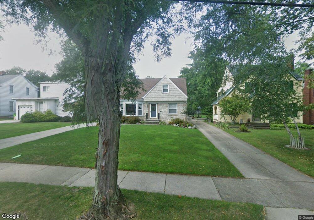
1200 Dorsh Rd Cleveland, OH 44121
Estimated Value: $200,000 - $294,000
4
Beds
1
Bath
1,690
Sq Ft
$138/Sq Ft
Est. Value
About This Home
This home is located at 1200 Dorsh Rd, Cleveland, OH 44121 and is currently estimated at $233,326, approximately $138 per square foot. 1200 Dorsh Rd is a home located in Cuyahoga County with nearby schools including Greenview Upper Elementary School, Sunview Elementary School, and Memorial Junior High School.
Ownership History
Date
Name
Owned For
Owner Type
Purchase Details
Closed on
Jan 15, 2018
Sold by
Arendt Timothy R and Arendt Debra J
Bought by
Arendt Taylor F and Spurbeck Benjamin
Current Estimated Value
Purchase Details
Closed on
Jun 7, 2005
Sold by
Arendt Timothy R and Arendt Debra J
Bought by
Arendt Debra J
Purchase Details
Closed on
Apr 2, 1993
Sold by
Arendt Timothy R
Bought by
Arendt Timothy R
Purchase Details
Closed on
Jan 28, 1987
Sold by
Arendt Genevieve
Bought by
Arendt Timothy R
Purchase Details
Closed on
Apr 4, 1986
Sold by
Arendt Fred C and Arendt Genevieve
Bought by
Arendt Genevieve
Purchase Details
Closed on
Jan 1, 1975
Bought by
Arendt Fred C and Arendt Genevieve
Create a Home Valuation Report for This Property
The Home Valuation Report is an in-depth analysis detailing your home's value as well as a comparison with similar homes in the area
Home Values in the Area
Average Home Value in this Area
Purchase History
| Date | Buyer | Sale Price | Title Company |
|---|---|---|---|
| Arendt Taylor F | -- | None Available | |
| Arendt Thomthy R | -- | None Available | |
| Arendt Debra J | -- | -- | |
| Arendt Timothy R | -- | -- | |
| Arendt Timothy R | $70,000 | -- | |
| Arendt Genevieve | -- | -- | |
| Arendt Fred C | -- | -- |
Source: Public Records
Tax History Compared to Growth
Tax History
| Year | Tax Paid | Tax Assessment Tax Assessment Total Assessment is a certain percentage of the fair market value that is determined by local assessors to be the total taxable value of land and additions on the property. | Land | Improvement |
|---|---|---|---|---|
| 2024 | $4,628 | $60,095 | $11,480 | $48,615 |
| 2023 | $4,325 | $45,820 | $8,720 | $37,100 |
| 2022 | $4,348 | $45,815 | $8,715 | $37,100 |
| 2021 | $4,314 | $45,820 | $8,720 | $37,100 |
| 2020 | $4,263 | $39,520 | $7,530 | $31,990 |
| 2019 | $3,893 | $112,900 | $21,500 | $91,400 |
| 2018 | $3,875 | $39,520 | $7,530 | $31,990 |
| 2017 | $4,373 | $41,300 | $7,140 | $34,160 |
| 2016 | $4,345 | $41,300 | $7,140 | $34,160 |
| 2015 | $4,165 | $41,300 | $7,140 | $34,160 |
| 2014 | $4,165 | $40,780 | $7,140 | $33,640 |
Source: Public Records
Map
Nearby Homes
- 1271 Dorsh Rd
- 4650 Liberty Rd
- 4781 Dorshwood Rd
- 4769 Edenwood Rd
- 4866 Fairlawn Rd
- 4591 Wilburn Dr
- 4800 Farnhurst Rd
- 4561 Wilburn Dr
- 4742 Anderson Rd
- 981 Hanley Rd
- 4695 Mayfield Rd Unit A
- 4685 Mayfield Rd Unit F
- 4532 Anderson Rd
- 1379 Cranover Rd
- 1512 Parkside Cir
- 4410 Ardmore Rd
- 1333 Clearview Rd
- 1503 Oakmount Rd
- 4880 Anderson Rd
- 4616 Mcfarland Rd