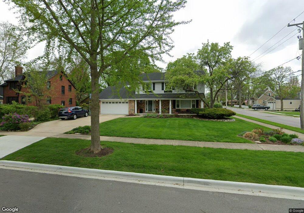
1200 E North Path Wheaton, IL 60187
Hawthorne NeighborhoodEstimated Value: $662,000 - $740,000
4
Beds
3
Baths
2,216
Sq Ft
$314/Sq Ft
Est. Value
About This Home
This home is located at 1200 E North Path, Wheaton, IL 60187 and is currently estimated at $696,917, approximately $314 per square foot. 1200 E North Path is a home located in DuPage County with nearby schools including Longfellow Elementary School, Franklin Middle School, and Wheaton North High School.
Ownership History
Date
Name
Owned For
Owner Type
Purchase Details
Closed on
Jul 23, 2014
Sold by
St George Timothy M and St George Masami K
Bought by
St George Living Trust
Current Estimated Value
Purchase Details
Closed on
Oct 30, 1998
Sold by
Maher John Michael and Maher Beatrice Nelson
Bought by
Stgeorge Timothy M and Stgeorge Masami K
Home Financials for this Owner
Home Financials are based on the most recent Mortgage that was taken out on this home.
Original Mortgage
$212,500
Outstanding Balance
$47,241
Interest Rate
6.8%
Estimated Equity
$649,676
Create a Home Valuation Report for This Property
The Home Valuation Report is an in-depth analysis detailing your home's value as well as a comparison with similar homes in the area
Home Values in the Area
Average Home Value in this Area
Purchase History
| Date | Buyer | Sale Price | Title Company |
|---|---|---|---|
| St George Living Trust | -- | None Available | |
| Stgeorge Timothy M | $250,000 | First American Title |
Source: Public Records
Mortgage History
| Date | Status | Borrower | Loan Amount |
|---|---|---|---|
| Open | Stgeorge Timothy M | $212,500 |
Source: Public Records
Tax History
| Year | Tax Paid | Tax Assessment Tax Assessment Total Assessment is a certain percentage of the fair market value that is determined by local assessors to be the total taxable value of land and additions on the property. | Land | Improvement |
|---|---|---|---|---|
| 2024 | $11,785 | $190,848 | $34,537 | $156,311 |
| 2023 | $11,331 | $175,670 | $31,790 | $143,880 |
| 2022 | $11,082 | $166,020 | $30,040 | $135,980 |
| 2021 | $11,047 | $162,080 | $29,330 | $132,750 |
| 2020 | $11,013 | $160,570 | $29,060 | $131,510 |
| 2019 | $10,762 | $156,330 | $28,290 | $128,040 |
| 2018 | $11,401 | $163,410 | $27,750 | $135,660 |
| 2017 | $11,236 | $157,390 | $26,730 | $130,660 |
| 2016 | $11,090 | $151,100 | $25,660 | $125,440 |
| 2015 | $11,011 | $144,150 | $24,480 | $119,670 |
| 2014 | $10,563 | $136,270 | $26,430 | $109,840 |
| 2013 | $10,291 | $136,680 | $26,510 | $110,170 |
Source: Public Records
Map
Nearby Homes
- 820 Cherry St
- 720 E Harrison Ave
- 817 E Forest Ave
- 123 S Blanchard St
- 404 Lawrence Ave
- 412 Lawrence Ave
- 110 Travers Ave
- 328 Lorraine St
- 1607 Stoddard Ave
- 185 N Ott Ave
- 502 S Summit St
- 312 E Lincoln Ave
- 488 Newton Ave
- 1603 Ashton Ct
- 510 S President St
- 388 Hill Ave
- 421 E Willow Ave
- 722 Countryside Dr
- 353 E Liberty Dr
- 404 Melrose Ave Unit 103
- 1200 North Path
- 1208 North Path
- 705 Stoddard Ave
- 1111 E Jefferson Ave
- 1111 E Jefferson Ave
- 1111 E Jefferson Ave
- 1111 E Jefferson Ave
- 714 Stoddard Ave
- 802 Stoddard Ave
- 1216 North Path
- 1216 E North Path
- 704 Stoddard Ave
- 807 Stoddard Ave
- 714 N Blanchard St
- 1043 E Jefferson Ave
- 704 N Blanchard St
- 806 N Blanchard St
- 1127 E North Path
- 615 Stoddard Ave
- 815 Stoddard Ave
Your Personal Tour Guide
Ask me questions while you tour the home.