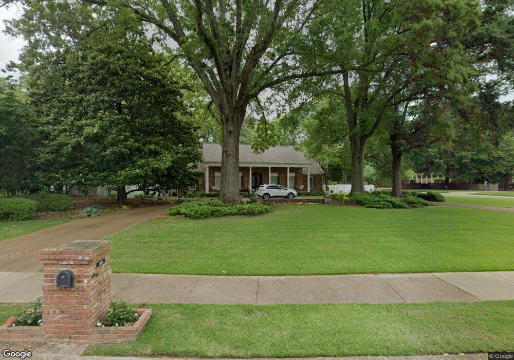
1200 Fairmeadow Rd Memphis, TN 38117
Colonial Acres NeighborhoodEstimated Value: $585,000 - $741,000
5
Beds
5
Baths
4,994
Sq Ft
$130/Sq Ft
Est. Value
About This Home
This home is located at 1200 Fairmeadow Rd, Memphis, TN 38117 and is currently estimated at $649,256, approximately $130 per square foot. 1200 Fairmeadow Rd is a home located in Shelby County with nearby schools including Sherwood Elementary School, Colonial Middle, and Overton High.
Ownership History
Date
Name
Owned For
Owner Type
Purchase Details
Closed on
Nov 1, 2019
Sold by
Sharp Dale W and Sharp Kimberly E
Bought by
Jordan William D and Jordan Theresa S
Current Estimated Value
Home Financials for this Owner
Home Financials are based on the most recent Mortgage that was taken out on this home.
Original Mortgage
$440,000
Outstanding Balance
$387,087
Interest Rate
3.6%
Mortgage Type
New Conventional
Estimated Equity
$262,169
Purchase Details
Closed on
Dec 13, 2001
Sold by
Eubanks Eunice K
Bought by
Sharp Dale W and Sharp Kimberly E
Home Financials for this Owner
Home Financials are based on the most recent Mortgage that was taken out on this home.
Original Mortgage
$300,000
Interest Rate
6.49%
Create a Home Valuation Report for This Property
The Home Valuation Report is an in-depth analysis detailing your home's value as well as a comparison with similar homes in the area
Home Values in the Area
Average Home Value in this Area
Purchase History
| Date | Buyer | Sale Price | Title Company |
|---|---|---|---|
| Jordan William D | $550,000 | Close Trak Closing & Ttl Svc | |
| Sharp Dale W | $415,000 | -- |
Source: Public Records
Mortgage History
| Date | Status | Borrower | Loan Amount |
|---|---|---|---|
| Open | Jordan William D | $440,000 | |
| Previous Owner | Sharp Dale W | $300,000 | |
| Closed | Sharp Dale W | $73,500 |
Source: Public Records
Tax History
| Year | Tax Paid | Tax Assessment Tax Assessment Total Assessment is a certain percentage of the fair market value that is determined by local assessors to be the total taxable value of land and additions on the property. | Land | Improvement |
|---|---|---|---|---|
| 2025 | $4,458 | $136,475 | $25,975 | $110,500 |
| 2024 | $4,458 | $131,500 | $22,925 | $108,575 |
| 2023 | $8,011 | $131,500 | $22,925 | $108,575 |
| 2022 | $8,011 | $131,500 | $22,925 | $108,575 |
| 2021 | $8,104 | $131,500 | $22,925 | $108,575 |
| 2020 | $7,565 | $104,400 | $22,925 | $81,475 |
| 2019 | $3,337 | $104,400 | $22,925 | $81,475 |
| 2018 | $3,337 | $104,400 | $22,925 | $81,475 |
| 2017 | $3,415 | $104,400 | $22,925 | $81,475 |
| 2016 | $4,086 | $93,500 | $0 | $0 |
| 2014 | $4,086 | $93,500 | $0 | $0 |
Source: Public Records
Map
Nearby Homes
- 4474 Cherrydale Rd
- 1207 W Perkins Rd
- 1269 W Perkins Rd
- 1181 S Perkins Rd
- 1235 Cherry Rd
- 4417 Fair Meadow Rd
- 4620 Amboy Rd
- 4506 Verne Rd
- 1168 S Perkins Rd
- 1044 Kings Park Rd
- 1218 Merrycrest Dr
- 4635 Monaco Rd
- 4401 Quince Rd
- 4594 Sea Isle Rd
- 4493 Quince Rd
- 1261 Marcia Rd
- 1407 Flamingo Rd
- 1254 Marcia Rd
- 4490 Garnett Rd
- 4613 Crossover Ln
- 1184 Fairmeadow Rd
- 4530 Kings Brook Rd
- 1226 Fair Meadow Rd
- 1226 Fairmeadow Rd
- 4531 Kingsbrook Rd
- 4507 Dee Rd
- 1205 Fairmeadow Rd
- 4517 Dee Rd
- 4525 Dee Rd
- 1165 Fairmeadow Rd
- 1185 Fairmeadow Rd
- 1221 Fairmeadow Rd
- 4533 Dee Rd
- 4541 Dee Rd
- 1159 Fairmeadow Rd
- 4495 Tall Trees Dr
- 4549 Dee Rd
- 1231 Kings Brook Cove S
- 1142 Fairmeadow Rd
- 1193 Kings Brook Cove
Your Personal Tour Guide
Ask me questions while you tour the home.