1200 W Airport Rd Payson, AZ 85541
Estimated payment $11,176/month
Highlights
- Horses Allowed On Property
- 55.95 Acre Lot
- Hilltop Location
- Panoramic View
- Heavily Wooded Lot
- Corner Lot
About This Lot
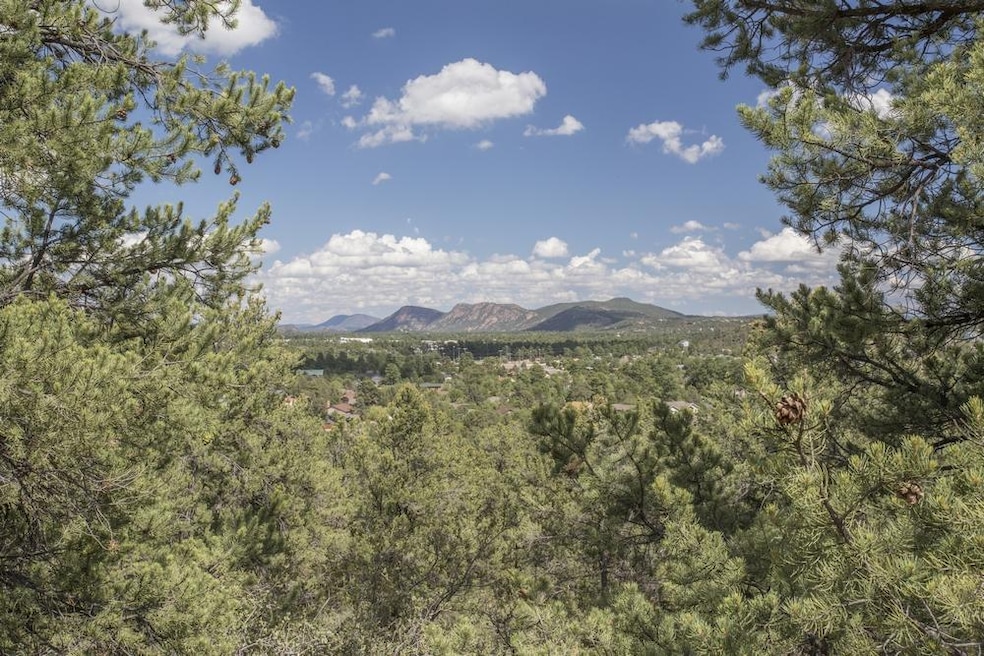
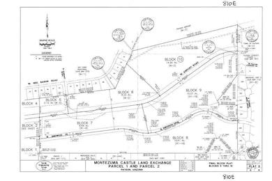
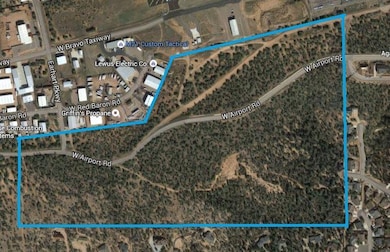
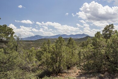
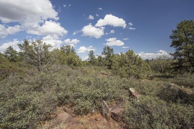
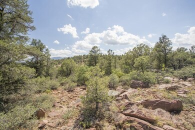
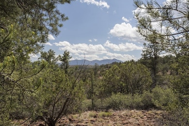
From this 56 acres of forested property, there are unparalleled views This hilltop mesa includes 12 acres, in two Industrial blocks, near Payson's Airport. Payson is a cool mountain town, an hour Northeast of Scottsdale at 5000 feet elevation. In addition to the Industrial Zoned Property, the offering includes amazing views from three residential parcels separated from the airport properties, by the collector street, Airport Road, providing a pre-platted, pre-zoned, development ready, investment opportunity. It is a rare opportunity to find property of this nature in a community as beautiful and prime for development as Payson is at this time. The property consists of Block 5 and Block 6 zoned for M-2 for industrial usage; Block 7, Block 8, and Block 9 are zoned residential. The residential lots offer views of the Mazatzal Mountains and overlook Payson. The residential lots are bordered by nice, clean neighborhoods. The M-2 industrial land is on the north side of Airport Road. The Blocks each have a Town of Payson approved plat of lots that may be developed. It's anticipated the developer would build the platted streets at the time of obtaining construction permits. This is an incredible piece of property platted for future use.
Listing Agent
Berkshire Hathaway HomeServices Advantage Realty - PAYSON License #BR012322000 Listed on: 06/17/2021

Property Details
Property Type
- Land
Est. Annual Taxes
- $7,870
Lot Details
- 55.95 Acre Lot
- West Facing Home
- Corner Lot
- Level Lot
- Hilltop Location
- Heavily Wooded Lot
- Pine Trees
- Property is zoned M-2 & R-1
Property Views
- Panoramic
- Mountain
Utilities
- Internet Available
- Phone Available
- Cable TV Available
Additional Features
- Horses Allowed On Property
- Mobile Home Allowed
Community Details
- No Home Owners Association
Listing and Financial Details
- Tax Lot 302-39-006F-I
- Assessor Parcel Number 302-39-006F
Map
Home Values in the Area
Average Home Value in this Area
Property History
| Date | Event | Price | List to Sale | Price per Sq Ft |
|---|---|---|---|---|
| 02/04/2023 02/04/23 | Price Changed | $2,000,000 | -9.1% | -- |
| 05/10/2022 05/10/22 | For Sale | $2,200,000 | -- | -- |
Source: Central Arizona Association of REALTORS®
MLS Number: 84948
Disclaimer: Certain information contained herein is derived from information provided by parties other than Homes.com. All information provided is deemed reliable, but is not guaranteed to be accurate and should be independently verified.
![]() IDX information is provided exclusively for personal, non-commercial use, and may not be used for any purpose other than to identify prospective properties consumers may be interested in purchasing. Information is deemed reliable but not guaranteed.
IDX information is provided exclusively for personal, non-commercial use, and may not be used for any purpose other than to identify prospective properties consumers may be interested in purchasing. Information is deemed reliable but not guaranteed.
- 1200 W Airport Rd Unit 96F-I
- 1000 W Falcon Lookout Ln
- 1003 W Falcon Lookout Ln
- 1003 W Falcon Lookout Ln Unit 11
- 1050 W Airport Rd
- 1050 W Airport Rd Unit 10
- 819 N Blue Spruce Cir
- 817 N Blue Spruce Cir Unit 284
- 802 N Oak Point
- 800 N Oak Point
- 908 W Sherwood Dr
- 610 N Wilderness Trail
- 1000 N Falconcrest Dr
- 830 W Sherwood Dr
- 408 N Rim Ranch Point
- 603 N Blue Spruce Rd
- 1012 N Monarch Dr
- 912 W Wilderness Trail
- 1101 N Falconcrest Dr Unit 14
- 1101 N Falconcrest Dr