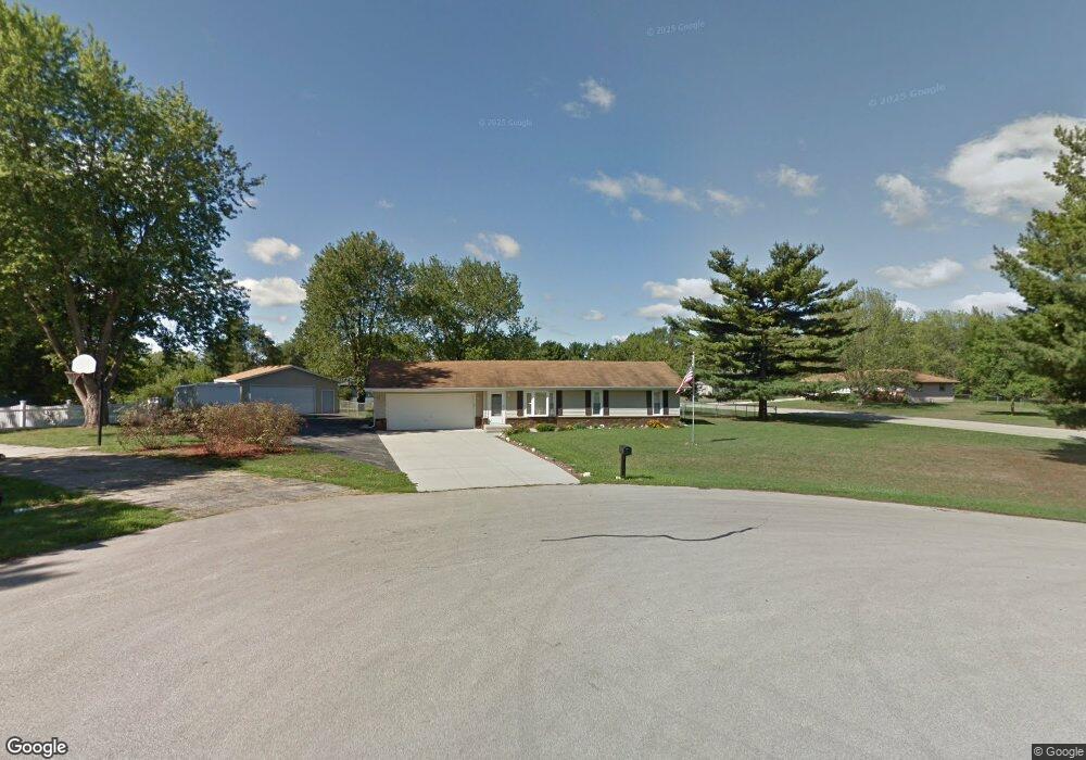
12007 Wagon Ln Roscoe, IL 61073
Estimated Value: $227,169 - $258,000
3
Beds
2
Baths
1,040
Sq Ft
$233/Sq Ft
Est. Value
About This Home
This home is located at 12007 Wagon Ln, Roscoe, IL 61073 and is currently estimated at $242,042, approximately $232 per square foot. 12007 Wagon Ln is a home located in Winnebago County with nearby schools including Ledgewood Elementary School, Kinnikinnick School, and Stone Creek School.
Ownership History
Date
Name
Owned For
Owner Type
Purchase Details
Closed on
Oct 14, 2025
Sold by
Davenport Leonard D
Bought by
Bergeron Nathan
Current Estimated Value
Home Financials for this Owner
Home Financials are based on the most recent Mortgage that was taken out on this home.
Original Mortgage
$8,400
Outstanding Balance
$8,400
Interest Rate
1.3%
Mortgage Type
New Conventional
Estimated Equity
$233,642
Purchase Details
Closed on
Apr 1, 2017
Sold by
Addams Douglas H and Addams Tonya S
Bought by
Davenport Leonard D
Home Financials for this Owner
Home Financials are based on the most recent Mortgage that was taken out on this home.
Original Mortgage
$118,798
Interest Rate
4.03%
Purchase Details
Closed on
Apr 18, 2008
Bought by
Davenport Leonard
Create a Home Valuation Report for This Property
The Home Valuation Report is an in-depth analysis detailing your home's value as well as a comparison with similar homes in the area
Home Values in the Area
Average Home Value in this Area
Purchase History
| Date | Buyer | Sale Price | Title Company |
|---|---|---|---|
| Bergeron Nathan | $240,000 | None Listed On Document | |
| Davenport Leonard D | -- | Mtc | |
| Davenport Leonard | $130,000 | -- |
Source: Public Records
Mortgage History
| Date | Status | Borrower | Loan Amount |
|---|---|---|---|
| Open | Bergeron Nathan | $8,400 | |
| Open | Bergeron Nathan | $235,653 | |
| Previous Owner | Davenport Leonard D | $118,798 | |
| Previous Owner | Davenport Leonard D | $93,500 | |
| Closed | Davenport Leonard D | $117,520 |
Source: Public Records
Tax History
| Year | Tax Paid | Tax Assessment Tax Assessment Total Assessment is a certain percentage of the fair market value that is determined by local assessors to be the total taxable value of land and additions on the property. | Land | Improvement |
|---|---|---|---|---|
| 2024 | $4,443 | $59,872 | $12,654 | $47,218 |
| 2023 | $4,103 | $53,731 | $11,356 | $42,375 |
| 2022 | $3,891 | $49,119 | $10,381 | $38,738 |
| 2021 | $3,700 | $46,143 | $9,752 | $36,391 |
| 2020 | $3,621 | $44,467 | $9,398 | $35,069 |
| 2019 | $3,512 | $42,475 | $8,977 | $33,498 |
| 2018 | $3,289 | $40,814 | $8,626 | $32,188 |
| 2017 | $3,385 | $39,366 | $8,320 | $31,046 |
| 2016 | $3,242 | $38,735 | $8,187 | $30,548 |
| 2015 | $3,098 | $37,629 | $7,953 | $29,676 |
| 2014 | $2,854 | $37,153 | $7,852 | $29,301 |
Source: Public Records
Map
Nearby Homes
- 4338 Honey Locust Ln
- 11818 Balsa Ln
- 4361 Pfister Ln
- 4593 Woodcrest Ln
- 9.41 Acres Bluestem Rd
- 11578 Edgemere Terrace
- 11392 Edgemere Terrace
- 11216 Lemon Grass Ln
- 10458 Main St
- 11740 River Hills Pkwy
- 11870 River Hills Pkwy Unit 29
- 10853 Lemon Grass Ln
- 1245 Aldrin Rd
- 10662 Chicory Ridge Way
- 5683 Oak Village Dr Unit 5683
- 4564 E Rockton Rd
- 549 Bayfield Rd
- 410 Pine White #102-B Rd
- 614 Bayfield Rd
- 410 Pine White Rd
- 12031 Wagon Ln
- 11975 Wagon Ln
- 12008 Wagon Ln
- 4246 Straw Ln
- 12030 Wagon Ln
- 4238 Straw Ln
- 12053 Wagon Ln
- 11990 Wagon Ln
- 4262 Straw Ln
- 12075 Wagon Ln
- 12048 Wagon Ln
- 11943 Wagon Ln
- 4288 Straw Ln
- 12068 Wagon Ln
- 11966 Wagon Ln
- 12091 Wagon Ln
- 12067 Tresemer Rd
- 12105 Tresemer Rd
- 12055 Tresemer Rd
- 12088 Wagon Ln
Your Personal Tour Guide
Ask me questions while you tour the home.