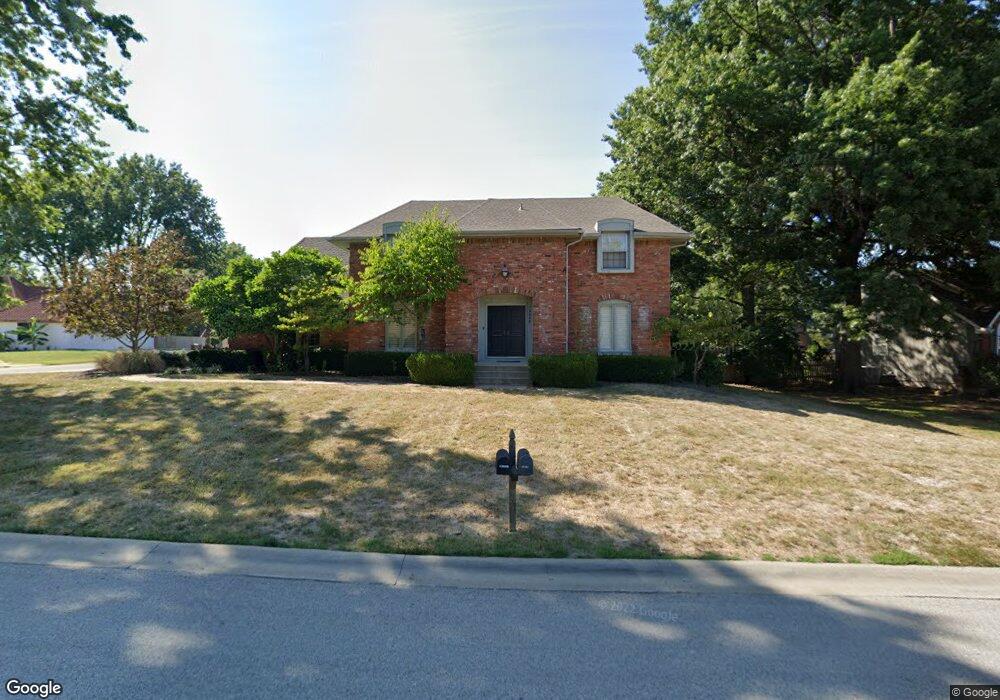
12008 Overbrook Rd Leawood, KS 66209
Estimated Value: $614,000 - $670,000
4
Beds
4
Baths
2,633
Sq Ft
$242/Sq Ft
Est. Value
About This Home
This home is located at 12008 Overbrook Rd, Leawood, KS 66209 and is currently estimated at $637,050, approximately $241 per square foot. 12008 Overbrook Rd is a home located in Johnson County with nearby schools including Leawood Elementary School, Leawood Middle School, and Blue Valley North High School.
Ownership History
Date
Name
Owned For
Owner Type
Purchase Details
Closed on
Mar 3, 2004
Sold by
Thoms Donald C and Thoms Dalene K
Bought by
Shalton Brian K and Shalton Debra L
Current Estimated Value
Home Financials for this Owner
Home Financials are based on the most recent Mortgage that was taken out on this home.
Original Mortgage
$240,000
Outstanding Balance
$112,008
Interest Rate
5.65%
Mortgage Type
Stand Alone First
Estimated Equity
$525,042
Create a Home Valuation Report for This Property
The Home Valuation Report is an in-depth analysis detailing your home's value as well as a comparison with similar homes in the area
Home Values in the Area
Average Home Value in this Area
Purchase History
| Date | Buyer | Sale Price | Title Company |
|---|---|---|---|
| Shalton Brian K | -- | All American Title Company |
Source: Public Records
Mortgage History
| Date | Status | Borrower | Loan Amount |
|---|---|---|---|
| Open | Shalton Brian K | $240,000 | |
| Closed | Shalton Brian K | $30,000 |
Source: Public Records
Tax History Compared to Growth
Tax History
| Year | Tax Paid | Tax Assessment Tax Assessment Total Assessment is a certain percentage of the fair market value that is determined by local assessors to be the total taxable value of land and additions on the property. | Land | Improvement |
|---|---|---|---|---|
| 2024 | $7,007 | $63,135 | $12,426 | $50,709 |
| 2023 | $6,959 | $61,778 | $12,426 | $49,352 |
| 2022 | $6,405 | $55,695 | $12,426 | $43,269 |
| 2021 | $5,803 | $48,162 | $11,294 | $36,868 |
| 2020 | $5,551 | $45,160 | $10,261 | $34,899 |
| 2019 | $5,409 | $43,228 | $10,261 | $32,967 |
| 2018 | $5,339 | $41,906 | $9,328 | $32,578 |
| 2017 | $5,187 | $40,043 | $7,769 | $32,274 |
| 2016 | $5,073 | $39,215 | $6,479 | $32,736 |
| 2015 | $5,017 | $38,306 | $6,479 | $31,827 |
| 2013 | -- | $37,202 | $6,479 | $30,723 |
Source: Public Records
Map
Nearby Homes
- 2200 W 121st St
- 2213 W 122nd St
- 1013 W Santa fe Trail
- 11800 Madison Ave
- 905 W 122nd Terrace
- 1985 W 123rd Place
- 11721 Manor Rd
- 12380 Summit St
- 11712 Brookwood Ave
- 1105 W Santa fe Trail
- 12208 Avila Dr
- 11530 Cambridge Rd
- 2401 W 123rd Terrace
- 11526 Cambridge Rd
- 2405 W 123rd Terrace
- 12201 Aberdeen Rd
- 11524 Cambridge Rd
- 11521 Cambridge Rd
- 11509 High Dr
- 11517 Cambridge Rd
- 12004 Overbrook Rd
- 2104 W 120th Terrace
- 12015 Overbrook Rd
- 2101 W 120th Terrace
- 12011 Overbrook Rd
- 2108 W 120th Terrace
- 12009 Overbrook Rd
- 2105 W 120th Terrace
- 2103 W 120th St
- 2000 W 120th Terrace
- 2009 W 120th Terrace
- 2102 W 121st St
- 12005 Overbrook Rd
- 2101 W 121st St
- 2107 W 120th St
- 2112 W 120th Terrace
- 2109 W 120th Terrace
- 2103 W 121st St
- 12001 Overbrook Rd
- 2113 W 120th St