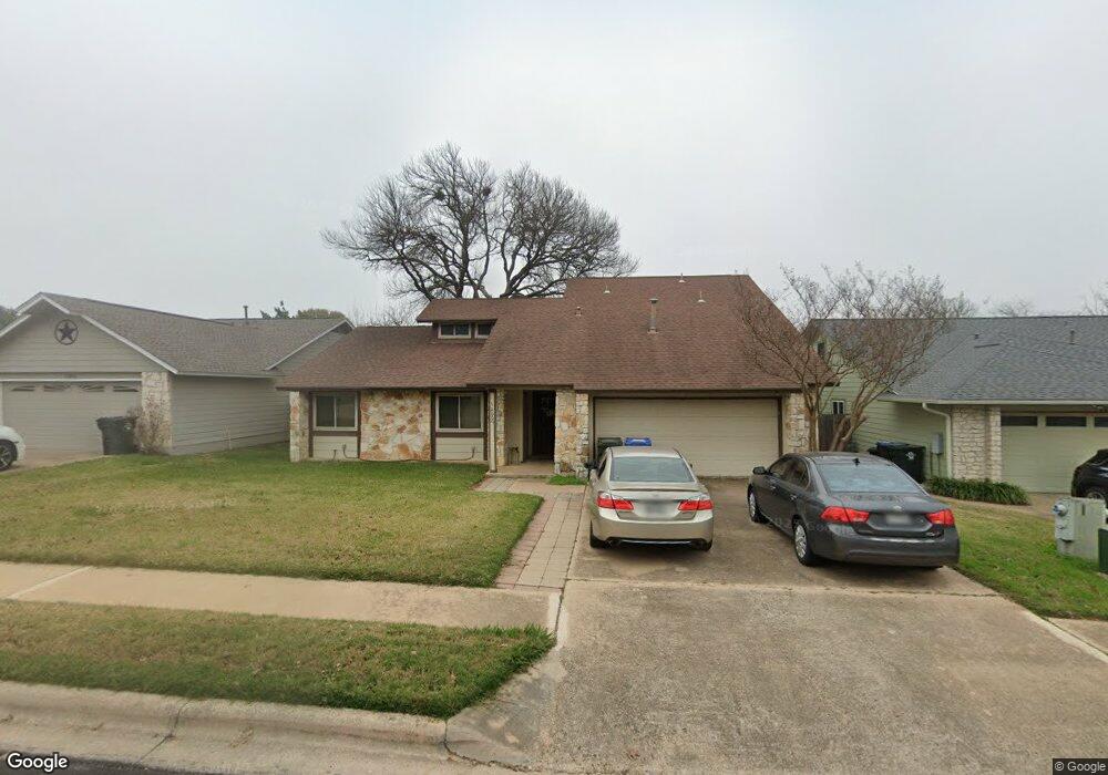
12009 Bobcat Trail Austin, TX 78750
Anderson Mill NeighborhoodEstimated Value: $455,352 - $554,000
--
Bed
2
Baths
2,081
Sq Ft
$244/Sq Ft
Est. Value
About This Home
This home is located at 12009 Bobcat Trail, Austin, TX 78750 and is currently estimated at $507,338, approximately $243 per square foot. 12009 Bobcat Trail is a home located in Williamson County with nearby schools including Purple Sage Elementary School, Noel Grisham Middle, and Westwood High School.
Ownership History
Date
Name
Owned For
Owner Type
Purchase Details
Closed on
Apr 25, 2012
Sold by
Anderson Nathan B and Anderson Caterria
Bought by
Anderson Nathan B
Current Estimated Value
Purchase Details
Closed on
Mar 17, 2006
Sold by
Weiler Donald H and Weiler Susan M
Bought by
Anderson Nathan B
Home Financials for this Owner
Home Financials are based on the most recent Mortgage that was taken out on this home.
Original Mortgage
$149,553
Outstanding Balance
$84,870
Interest Rate
6.24%
Mortgage Type
FHA
Estimated Equity
$422,468
Create a Home Valuation Report for This Property
The Home Valuation Report is an in-depth analysis detailing your home's value as well as a comparison with similar homes in the area
Home Values in the Area
Average Home Value in this Area
Purchase History
| Date | Buyer | Sale Price | Title Company |
|---|---|---|---|
| Anderson Nathan B | -- | None Available | |
| Anderson Nathan B | -- | Gracy Title Company |
Source: Public Records
Mortgage History
| Date | Status | Borrower | Loan Amount |
|---|---|---|---|
| Open | Anderson Nathan B | $149,553 |
Source: Public Records
Tax History Compared to Growth
Tax History
| Year | Tax Paid | Tax Assessment Tax Assessment Total Assessment is a certain percentage of the fair market value that is determined by local assessors to be the total taxable value of land and additions on the property. | Land | Improvement |
|---|---|---|---|---|
| 2025 | $7,492 | $441,845 | $88,500 | $353,345 |
| 2024 | $7,492 | $448,155 | $88,500 | $359,655 |
| 2023 | $6,835 | $419,502 | $0 | $0 |
| 2022 | $8,188 | $381,365 | $0 | $0 |
| 2021 | $8,517 | $346,695 | $72,000 | $307,332 |
| 2020 | $7,499 | $315,177 | $66,598 | $248,579 |
| 2019 | $7,389 | $302,069 | $60,700 | $241,369 |
| 2018 | $6,270 | $277,617 | $54,891 | $229,732 |
| 2017 | $6,299 | $252,379 | $51,300 | $222,602 |
| 2016 | $5,727 | $229,435 | $51,300 | $214,594 |
| 2015 | $4,578 | $208,577 | $42,200 | $189,418 |
| 2014 | $4,578 | $189,615 | $0 | $0 |
Source: Public Records
Map
Nearby Homes
- 11512 Powder Mill Trail
- 11611 Quarter Horse Trail
- 11506 Powder Mill Trail
- 11405 Bristle Oak Trail
- 11700 Aloe Vera Cove
- 11908 Stout Oak Trail
- 11612 Tanglebriar Trail
- 11462 Bristle Oak Trail
- 12106 Grey Fawn Path
- 11811 Buggy Whip Trail
- 12206 Saber Trail
- 1401 Mulberry Way
- 11100 Alison Parke Trail
- 11007 Opal Trail
- 1207 Meadow Lark Dr
- 3102 Red Bay Dr
- 1502 Glen Burnie Dr
- 11010 Froke Cedar Trail
- 11405 Antler Ln
- 1028 Verbena Dr
- 12011 Bobcat Trail
- 12007 Bobcat Trail
- 11509 Quarter Horse Trail
- 12013 Bobcat Trail
- 11507 Quarter Horse Trail
- 11511 Quarter Horse Trail
- 12005 Bobcat Trail
- 11505 Quarter Horse Trail
- 11513 Quarter Horse Trail
- 12006 Bobcat Trail
- 12015 Bobcat Trail
- 12004 Bobcat Trail
- 12008 Bobcat Trail
- 12003 Bobcat Trail
- 12002 Bobcat Trail
- 11515 Quarter Horse Trail
- 11503 Quarter Horse Trail
- 12010 Bobcat Trail
- 12017 Bobcat Trail
- 12012 Bobcat Trail