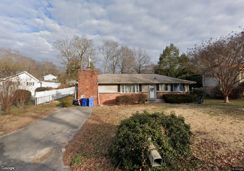
1201 Cranbrook Dr Hixson, TN 37343
Dupont NeighborhoodEstimated Value: $242,546 - $301,000
3
Beds
2
Baths
1,326
Sq Ft
$205/Sq Ft
Est. Value
About This Home
This home is located at 1201 Cranbrook Dr, Hixson, TN 37343 and is currently estimated at $271,387, approximately $204 per square foot. 1201 Cranbrook Dr is a home located in Hamilton County with nearby schools including DuPont Elementary School, St Jude School, and St. Peter's Episcopal School.
Ownership History
Date
Name
Owned For
Owner Type
Purchase Details
Closed on
Jun 11, 2009
Sold by
Mountain City Construction Company Llc
Bought by
Pruett Paul Matthew and Pruett Amelia J
Current Estimated Value
Home Financials for this Owner
Home Financials are based on the most recent Mortgage that was taken out on this home.
Original Mortgage
$114,782
Outstanding Balance
$72,209
Interest Rate
4.77%
Mortgage Type
FHA
Estimated Equity
$199,178
Purchase Details
Closed on
Jun 2, 2008
Sold by
Chaney Daryle and Chaney Denise
Bought by
The Secretary Of Housing & Urban Develop
Purchase Details
Closed on
Apr 15, 2002
Sold by
White Fred A and White Nancy B
Bought by
Chaney Daryle and Chaney Denise
Home Financials for this Owner
Home Financials are based on the most recent Mortgage that was taken out on this home.
Original Mortgage
$83,200
Interest Rate
6.8%
Mortgage Type
FHA
Create a Home Valuation Report for This Property
The Home Valuation Report is an in-depth analysis detailing your home's value as well as a comparison with similar homes in the area
Home Values in the Area
Average Home Value in this Area
Purchase History
| Date | Buyer | Sale Price | Title Company |
|---|---|---|---|
| Pruett Paul Matthew | $116,900 | None Available | |
| The Secretary Of Housing & Urban Develop | $88,658 | None Available | |
| Chaney Daryle | $83,900 | Northgate Title Escrow Inc |
Source: Public Records
Mortgage History
| Date | Status | Borrower | Loan Amount |
|---|---|---|---|
| Open | Pruett Paul Matthew | $114,782 | |
| Previous Owner | Chaney Daryle | $83,200 |
Source: Public Records
Tax History Compared to Growth
Tax History
| Year | Tax Paid | Tax Assessment Tax Assessment Total Assessment is a certain percentage of the fair market value that is determined by local assessors to be the total taxable value of land and additions on the property. | Land | Improvement |
|---|---|---|---|---|
| 2024 | $634 | $28,350 | $0 | $0 |
| 2023 | $634 | $28,350 | $0 | $0 |
| 2022 | $634 | $28,350 | $0 | $0 |
| 2021 | $634 | $28,350 | $0 | $0 |
| 2020 | $655 | $23,700 | $0 | $0 |
| 2019 | $655 | $23,700 | $0 | $0 |
| 2018 | $666 | $23,700 | $0 | $0 |
| 2017 | $655 | $23,700 | $0 | $0 |
| 2016 | $641 | $0 | $0 | $0 |
| 2015 | $1,291 | $23,175 | $0 | $0 |
| 2014 | $1,291 | $0 | $0 | $0 |
Source: Public Records
Map
Nearby Homes
- 1237 Cranbrook Dr
- 1329 Highland Way
- 955 Brynwood Dr
- 410 Bardwood Ln
- 1716 Strawberry Ln
- 4706 Eldridge Rd
- 1313 Michael Ln
- 1325 Highland Rd
- 1328 Highland Rd
- 1638 Green Hill Dr
- 4609 Plaza Hills Ln
- 961 Ashland Terrace
- 4607 Cloverdale Loop
- 810 Forest Dale Ln
- 3609 Forest Highland Dr
- 4529 Sherry Ln
- 3944 Azalean Dr
- 1004 Brynehill Ln
- 4810 Delashmitt Rd
- 1216 Clermont Dr
- 1131 Cranbrook Dr
- 1203 Cranbrook Dr
- 1127 Cranbrook Dr
- 1205 Cranbrook Dr
- 1410 Oneal Rd
- 1202 Cranbrook Dr
- 1202 Cranbrook Dr Unit 84
- 1412 Oneal Rd
- 1118 Cranbrook Dr
- 1204 Cranbrook Dr
- 1414 Oneal Rd
- 1207 Cranbrook Dr
- 1416 Oneal Rd
- 1416 Oneal Rd Unit 1
- 1125 Cranbrook Dr
- 1116 Cranbrook Dr
- 1416 O'Neal Rd
- 1203 Echo Dr
- 1418 Oneal Rd
- 1408 Oneal Rd