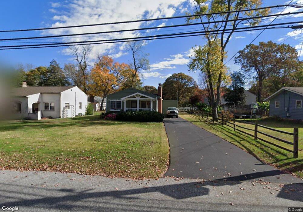
1201 Hampton Rd Annapolis, MD 21409
Cape Saint Claire NeighborhoodEstimated Value: $349,648 - $439,000
Studio
1
Bath
1,008
Sq Ft
$393/Sq Ft
Est. Value
About This Home
This home is located at 1201 Hampton Rd, Annapolis, MD 21409 and is currently estimated at $396,162, approximately $393 per square foot. 1201 Hampton Rd is a home located in Anne Arundel County with nearby schools including Cape St. Claire Elementary School, Magothy River Middle School, and Broadneck High School.
Ownership History
Date
Name
Owned For
Owner Type
Purchase Details
Closed on
Dec 23, 1977
Bought by
Murphy Francis X and Murphy Claudia J
Current Estimated Value
Home Financials for this Owner
Home Financials are based on the most recent Mortgage that was taken out on this home.
Original Mortgage
$44,000
Interest Rate
8.95%
Create a Home Valuation Report for This Property
The Home Valuation Report is an in-depth analysis detailing your home's value as well as a comparison with similar homes in the area
Home Values in the Area
Average Home Value in this Area
Purchase History
| Date | Buyer | Sale Price | Title Company |
|---|---|---|---|
| Murphy Francis X | $46,000 | -- |
Source: Public Records
Mortgage History
| Date | Status | Borrower | Loan Amount |
|---|---|---|---|
| Closed | Murphy Francis X | $44,000 |
Source: Public Records
Tax History
| Year | Tax Paid | Tax Assessment Tax Assessment Total Assessment is a certain percentage of the fair market value that is determined by local assessors to be the total taxable value of land and additions on the property. | Land | Improvement |
|---|---|---|---|---|
| 2025 | $2,781 | $331,200 | -- | -- |
| 2024 | $2,781 | $319,000 | $230,000 | $89,000 |
Source: Public Records
Map
Nearby Homes
- 1207 Hampton Rd
- 1217 Hampton Rd
- 1041 Skyview Dr
- 982 Highpoint Dr
- 1162 Saint George Dr
- 1014 St Charles Dr
- 1337 Swan Dr
- 1045 Saint Margarets Dr
- 1107 Crestview Dr
- 1148 Riverview Dr
- 1155 Bayview Vista
- 1250A Cedar Tree Ln
- 1359 Almond Dr
- 1382 Almond Dr
- 1165 Green Holly Ct
- 618 Snow Goose Ln
- 721 Fairway Dr
- 1176 Green Holly Dr
- 1576 Bay Head Rd
- 500 Wood Duck Ln
- 1199 Hampton Rd
- 1205 Hampton Rd
- 1197 Hampton Rd
- 1012 Mount Holly Dr
- 1002 Mount Holly Dr
- 1005 Mountain Top Dr
- 1195 Hampton Rd
- 1198 Hampton Rd
- 1004 Mount Holly Dr
- 1200 Hampton Rd
- 1202 Hampton Rd
- Mount Holly Dr
- 998 Dogwood Tree Dr
- 1007 Mountain Top Dr
- Lot 7 Mount Holly Drive - Taft Model
- 1209 Hampton Rd
- 1194 Hampton Rd
- 1003 Mount Holly Dr
- 1000 Mountain Top Dr
- 1206 Hampton Rd
Your Personal Tour Guide
Ask me questions while you tour the home.