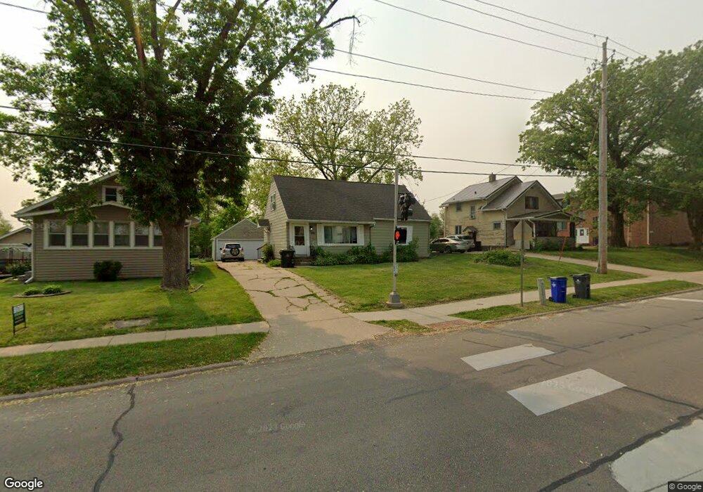
1201 Oakland Rd NE Cedar Rapids, IA 52402
Mound View NeighborhoodEstimated Value: $155,000 - $191,000
4
Beds
2
Baths
1,729
Sq Ft
$102/Sq Ft
Est. Value
About This Home
This home is located at 1201 Oakland Rd NE, Cedar Rapids, IA 52402 and is currently estimated at $175,554, approximately $101 per square foot. 1201 Oakland Rd NE is a home located in Linn County with nearby schools including Garfield Elementary School, Franklin Middle School, and George Washington High School.
Ownership History
Date
Name
Owned For
Owner Type
Purchase Details
Closed on
Jun 23, 2023
Sold by
Bevard Properties Lc
Bought by
Bevard Properties Lc
Current Estimated Value
Purchase Details
Closed on
Aug 10, 2021
Sold by
Anderson Michael and Sorenson Tami M
Bought by
C & A Bevard Properties Lc
Purchase Details
Closed on
May 6, 2014
Sold by
Heinbuch Kevin J and Rasmussen Lori S
Bought by
Bevard Properties Lc Series 27
Purchase Details
Closed on
Jul 15, 2005
Sold by
Pierson Heinbuch Karen S
Bought by
Heinbuch Kevin J
Purchase Details
Closed on
Dec 4, 2002
Sold by
Landon Debra K
Bought by
Pierson Heinbuch Karen S
Home Financials for this Owner
Home Financials are based on the most recent Mortgage that was taken out on this home.
Original Mortgage
$84,000
Interest Rate
6.38%
Create a Home Valuation Report for This Property
The Home Valuation Report is an in-depth analysis detailing your home's value as well as a comparison with similar homes in the area
Home Values in the Area
Average Home Value in this Area
Purchase History
| Date | Buyer | Sale Price | Title Company |
|---|---|---|---|
| Bevard Properties Lc | -- | None Listed On Document | |
| C & A Bevard Properties Lc | $28,981 | None Available | |
| Bevard Properties Lc Series 27 | $61,024 | None Available | |
| Heinbuch Kevin J | -- | None Available | |
| Pierson Heinbuch Karen S | $104,500 | -- |
Source: Public Records
Mortgage History
| Date | Status | Borrower | Loan Amount |
|---|---|---|---|
| Previous Owner | Pierson Heinbuch Karen S | $84,000 |
Source: Public Records
Tax History Compared to Growth
Tax History
| Year | Tax Paid | Tax Assessment Tax Assessment Total Assessment is a certain percentage of the fair market value that is determined by local assessors to be the total taxable value of land and additions on the property. | Land | Improvement |
|---|---|---|---|---|
| 2025 | $2,782 | $194,400 | $35,800 | $158,600 |
| 2024 | $3,092 | $157,200 | $32,500 | $124,700 |
| 2023 | $3,092 | $157,200 | $32,500 | $124,700 |
| 2022 | $318 | $146,600 | $26,000 | $120,600 |
| 2021 | $2,724 | $136,500 | $26,000 | $110,500 |
| 2020 | $2,724 | $123,500 | $21,100 | $102,400 |
| 2019 | $2,662 | $123,500 | $21,100 | $102,400 |
| 2018 | $2,476 | $123,500 | $21,100 | $102,400 |
| 2017 | $2,562 | $117,600 | $21,100 | $96,500 |
| 2016 | $2,500 | $117,600 | $21,100 | $96,500 |
| 2015 | $2,438 | $114,589 | $26,006 | $88,583 |
| 2014 | $2,438 | $120,125 | $26,006 | $94,119 |
| 2013 | $2,502 | $120,125 | $26,006 | $94,119 |
Source: Public Records
Map
Nearby Homes
- 1046 12th St NE
- 1311 I Ave NE
- 1204 Elmhurst Dr NE
- 1060 17th St NE
- 910 Maplewood Dr NE
- 2906 Oakland Rd NE
- 2000 Sierra Cir NE
- 2006 Sierra Cir NE
- 2011 Sierra Cir NE
- 2015 Sierra Cir NE
- 2012 Sierra Cir NE
- 2018 Sierra Cir NE
- 1839 K Ave NE
- 2019 Sierra Cir NE
- 2023 Sierra Cir NE
- 2102 Sierra Cir NE
- 2935 Wildwood Ct NE
- 2103 Sierra Cir NE
- 2110 Sierra Cir NE
- 832 Daniels St NE
- 1209 Oakland Rd NE
- 1143 Oakland Rd NE
- 1139 Oakland Rd NE
- 1129 Oakland Rd NE
- 1339 K Ave NE
- 1221 Oakland Rd NE
- 1123 Oakland Rd NE
- 1202 Oakland Rd NE
- 1140 Oakland Rd NE
- 1208 Oakland Rd NE
- 1225 Oakland Rd NE
- 1333 K Ave NE
- 1212 Oakland Rd NE
- 1119 Oakland Rd NE
- 1215 Oakland Rd NE Unit 19
- 1215 Oakland Rd NE Unit 7
- 1215 Oakland Rd NE Unit 16
- 1215 Oakland Rd NE Unit 17
- 1215 Oakland Rd NE Unit 42
- 1215 Oakland Rd NE Unit 41