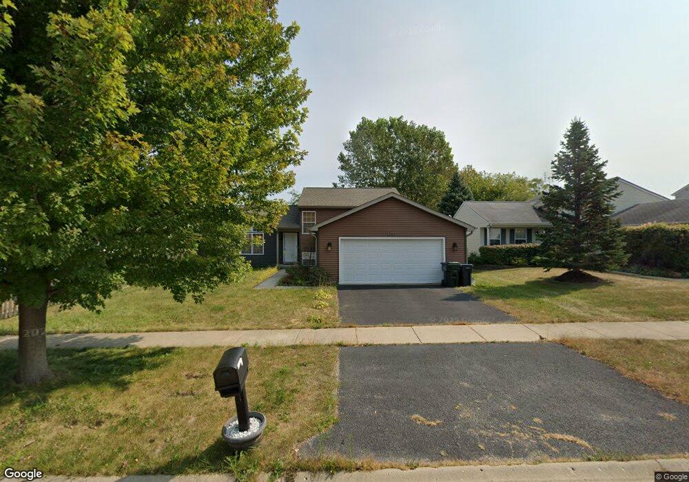
1201 Pheasant Run Zion, IL 60099
West Zion NeighborhoodEstimated Value: $247,000 - $305,000
4
Beds
2
Baths
936
Sq Ft
$297/Sq Ft
Est. Value
About This Home
This home is located at 1201 Pheasant Run, Zion, IL 60099 and is currently estimated at $278,326, approximately $297 per square foot. 1201 Pheasant Run is a home located in Lake County with nearby schools including Newport Elementary School, Beach Park Middle School, and Zion-Benton Township High School.
Ownership History
Date
Name
Owned For
Owner Type
Purchase Details
Closed on
Dec 8, 2003
Sold by
Bank Of Waukegan
Bought by
Morales Omar and Calderon Damariz
Current Estimated Value
Home Financials for this Owner
Home Financials are based on the most recent Mortgage that was taken out on this home.
Original Mortgage
$172,334
Interest Rate
5.96%
Mortgage Type
FHA
Purchase Details
Closed on
Jun 12, 2003
Sold by
Fifth Third Bank
Bought by
Bank Of Waukegan and Trust #204129
Home Financials for this Owner
Home Financials are based on the most recent Mortgage that was taken out on this home.
Original Mortgage
$127,244
Interest Rate
4.25%
Mortgage Type
Construction
Create a Home Valuation Report for This Property
The Home Valuation Report is an in-depth analysis detailing your home's value as well as a comparison with similar homes in the area
Home Values in the Area
Average Home Value in this Area
Purchase History
| Date | Buyer | Sale Price | Title Company |
|---|---|---|---|
| Morales Omar | $176,000 | Ticor | |
| Bank Of Waukegan | -- | -- |
Source: Public Records
Mortgage History
| Date | Status | Borrower | Loan Amount |
|---|---|---|---|
| Previous Owner | Morales Omar | $172,334 | |
| Previous Owner | Bank Of Waukegan | $127,244 |
Source: Public Records
Tax History
| Year | Tax Paid | Tax Assessment Tax Assessment Total Assessment is a certain percentage of the fair market value that is determined by local assessors to be the total taxable value of land and additions on the property. | Land | Improvement |
|---|---|---|---|---|
| 2024 | $7,147 | $71,714 | $9,977 | $61,737 |
| 2023 | $6,598 | $63,939 | $8,895 | $55,044 |
| 2022 | $6,598 | $56,566 | $7,300 | $49,266 |
| 2021 | $6,489 | $53,064 | $6,848 | $46,216 |
| 2020 | $6,243 | $49,910 | $6,441 | $43,469 |
| 2019 | $6,058 | $46,493 | $6,000 | $40,493 |
| 2018 | $5,414 | $41,563 | $5,420 | $36,143 |
| 2017 | $5,298 | $38,556 | $5,028 | $33,528 |
| 2016 | $4,880 | $35,000 | $4,564 | $30,436 |
| 2015 | $4,649 | $31,757 | $4,141 | $27,616 |
| 2014 | $4,256 | $30,081 | $3,908 | $26,173 |
| 2012 | $4,732 | $32,035 | $4,162 | $27,873 |
Source: Public Records
Map
Nearby Homes
- 1210 Lorelei Dr
- 1305 Reed Rd
- 3816 Tickseed Dr
- 908 Countrywood Dr
- 4108 Douglas Dr
- 4014 Ridge Rd
- 3805 Parkway Ln
- 3903 9th St
- 11778 W 12th St
- 4539 Illinois 173
- 1405 Lewis Ave
- 43411 Lynn Dale Dr
- 210 Oak Ln
- 1703 Horeb Ave
- 4109 Sarah Dr
- 1828 Horeb Ave
- 2414 Phillip Dr
- 41616 N Delany Rd
- 2410 Miriam Ave
- 42333 N Theodore Ct
- 1119 Pheasant Run
- 1203 Pheasant Run
- 1117 Pheasant Run
- 1205 Pheasant Run
- 4201 Jay Dr
- 1207 Pheasant Run
- 1115 Pheasant Run
- 4200 Quail St
- 4203 Jay Dr
- 1113 Pheasant Run
- 1209 Pheasant Run
- 4202 Quail St
- 4200 Jay Dr
- 1206 Lorelei Dr
- 4205 Jay Dr
- 1208 Lorelei Dr
- 1204 Lorelei Dr
- 4204 Quail St
- 1211 Pheasant Run
- 1110 Pheasant Run
Your Personal Tour Guide
Ask me questions while you tour the home.