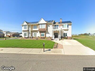
1201 Sheridan Blvd Brigantine, NJ 08203
Estimated Value: $647,000 - $967,000
--
Bed
--
Bath
2,200
Sq Ft
$352/Sq Ft
Est. Value
About This Home
This home is located at 1201 Sheridan Blvd, Brigantine, NJ 08203 and is currently estimated at $775,058, approximately $352 per square foot. 1201 Sheridan Blvd is a home located in Atlantic County with nearby schools including Brigantine Elementary School and Brigantine Community School.
Ownership History
Date
Name
Owned For
Owner Type
Purchase Details
Closed on
Sep 24, 1999
Sold by
Lange Michael J and Lange Elizabeth A
Bought by
Lange Michael J and Lange Sheila M
Current Estimated Value
Home Financials for this Owner
Home Financials are based on the most recent Mortgage that was taken out on this home.
Original Mortgage
$91,200
Interest Rate
7.81%
Mortgage Type
Purchase Money Mortgage
Create a Home Valuation Report for This Property
The Home Valuation Report is an in-depth analysis detailing your home's value as well as a comparison with similar homes in the area
Home Values in the Area
Average Home Value in this Area
Purchase History
| Date | Buyer | Sale Price | Title Company |
|---|---|---|---|
| Lange Michael J | $96,000 | Commonwealth Land Title Ins |
Source: Public Records
Mortgage History
| Date | Status | Borrower | Loan Amount |
|---|---|---|---|
| Closed | Lange Michael J | $326,400 | |
| Closed | Lange Michael J | $296,450 | |
| Closed | Lange Sheila M | $340,000 | |
| Closed | Lange Michael J | $60,000 | |
| Closed | Lange Sheila | $275,000 | |
| Closed | Lange Sheila M | $90,000 | |
| Closed | Lange Michael J | $50,000 | |
| Closed | Lange Michael J | $91,200 |
Source: Public Records
Tax History Compared to Growth
Tax History
| Year | Tax Paid | Tax Assessment Tax Assessment Total Assessment is a certain percentage of the fair market value that is determined by local assessors to be the total taxable value of land and additions on the property. | Land | Improvement |
|---|---|---|---|---|
| 2024 | $7,242 | $385,200 | $178,000 | $207,200 |
| 2023 | $6,691 | $385,200 | $178,000 | $207,200 |
| 2022 | $6,691 | $385,200 | $178,000 | $207,200 |
| 2021 | $6,572 | $385,200 | $178,000 | $207,200 |
| 2020 | $6,502 | $385,200 | $178,000 | $207,200 |
| 2019 | $6,560 | $385,200 | $178,000 | $207,200 |
| 2018 | $6,691 | $385,200 | $178,000 | $207,200 |
| 2017 | $5,140 | $291,200 | $178,000 | $113,200 |
| 2016 | $5,137 | $291,200 | $178,000 | $113,200 |
| 2015 | $5,163 | $291,200 | $178,000 | $113,200 |
| 2014 | $4,971 | $291,200 | $178,000 | $113,200 |
Source: Public Records
Map
Nearby Homes
- 1300 Duncan Place
- 29 Cummings Place
- 17 Vardon Rd
- 1311 Duncan Place
- 506 Lafayette Blvd
- 5 Collette Cir
- 18 Macdonald Place
- 16 Collette Cir
- 510 W Shore Dr
- 554 W Shore Dr
- 714 Sheridan Blvd
- 1507 Sheridan Blvd
- 444 W Shore Dr Unit 1
- 2 Franklin Place
- 1040 N Shore Dr
- 926 N Shore Dr
- 209 Bayshore Ave
- 703 Bobby Jones Rd
- 466 W Shore Dr
- 817 Lafayette Blvd
- 1201 Sheridan Blvd
- 3 Vardon Rd
- 5 Vardon Rd
- 1202 Sheridan Blvd Unit 203
- 4 Vardon Rd
- 1301 Sheridan Blvd
- 7 Vardon Rd
- 6 Vardon Rd
- 8 Vardon Rd
- 1 Cummings Place
- 1300 Sheridan Blvd
- 9 Vardon Rd
- 1303 Sheridan Blvd
- 2 Cummings Place
- 3 Cummings Place
- 11 Vardon Rd
- 10 Vardon Rd
- 1305 Sheridan Blvd
- 1302 Sheridan Blvd
- 4 Cummings Place