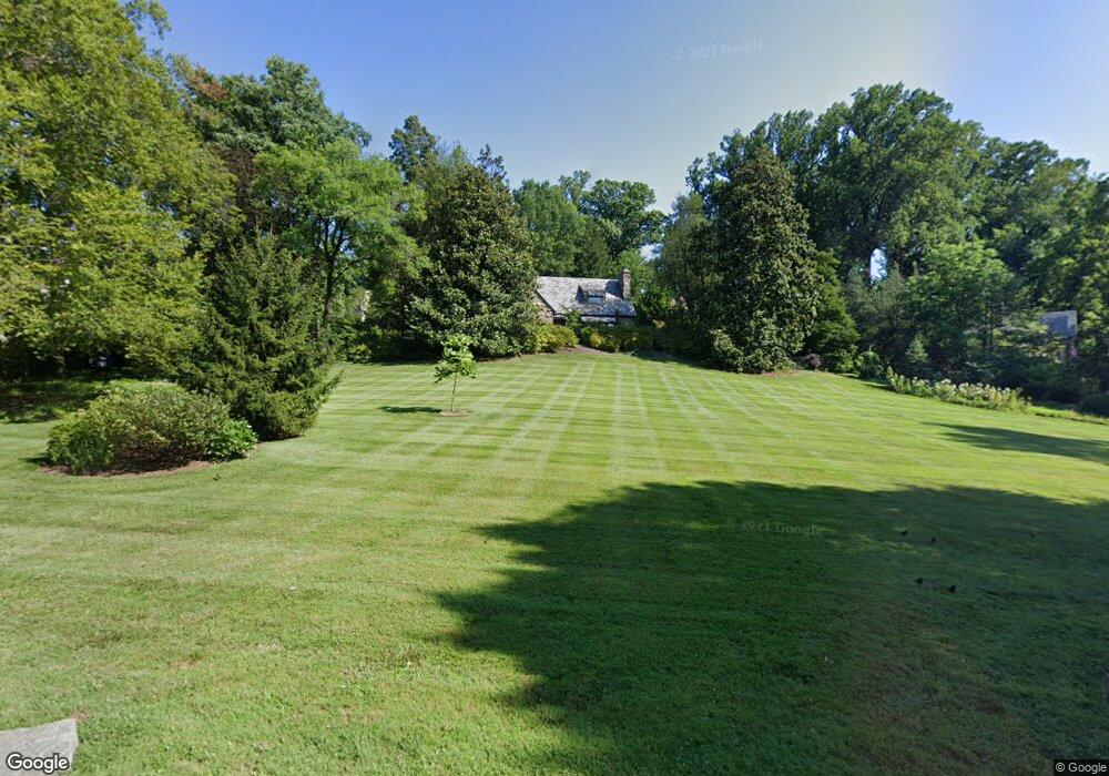
1201 Woodside Pkwy Silver Spring, MD 20910
Estimated Value: $1,109,000 - $1,289,000
--
Bed
2
Baths
2,211
Sq Ft
$547/Sq Ft
Est. Value
About This Home
This home is located at 1201 Woodside Pkwy, Silver Spring, MD 20910 and is currently estimated at $1,208,374, approximately $546 per square foot. 1201 Woodside Pkwy is a home located in Montgomery County with nearby schools including Woodlin Elementary School, Sligo Middle School, and Albert Einstein High School.
Ownership History
Date
Name
Owned For
Owner Type
Purchase Details
Closed on
Dec 31, 2024
Sold by
Davis Robert Aubry and Brannan Patricia A
Bought by
Robert Aubry Davis Revocable Trust and Patricia A Brannan Revocable Trust
Current Estimated Value
Purchase Details
Closed on
May 25, 1994
Sold by
Weiss S M
Bought by
Davis Robert A
Home Financials for this Owner
Home Financials are based on the most recent Mortgage that was taken out on this home.
Original Mortgage
$340,000
Interest Rate
8.22%
Create a Home Valuation Report for This Property
The Home Valuation Report is an in-depth analysis detailing your home's value as well as a comparison with similar homes in the area
Home Values in the Area
Average Home Value in this Area
Purchase History
| Date | Buyer | Sale Price | Title Company |
|---|---|---|---|
| Robert Aubry Davis Revocable Trust | -- | None Listed On Document | |
| Davis Robert A | $440,000 | -- |
Source: Public Records
Mortgage History
| Date | Status | Borrower | Loan Amount |
|---|---|---|---|
| Previous Owner | Davis Robert A | $340,000 |
Source: Public Records
Tax History Compared to Growth
Tax History
| Year | Tax Paid | Tax Assessment Tax Assessment Total Assessment is a certain percentage of the fair market value that is determined by local assessors to be the total taxable value of land and additions on the property. | Land | Improvement |
|---|---|---|---|---|
| 2025 | $12,886 | $1,099,133 | -- | -- |
| 2024 | $12,886 | $1,044,000 | $443,500 | $600,500 |
| 2023 | $5,601 | $960,367 | $0 | $0 |
| 2022 | $9,756 | $876,733 | $0 | $0 |
| 2021 | $8,719 | $793,100 | $443,500 | $349,600 |
| 2020 | $8,719 | $793,100 | $443,500 | $349,600 |
| 2019 | $8,678 | $793,100 | $443,500 | $349,600 |
| 2018 | $9,224 | $843,900 | $443,500 | $400,400 |
| 2017 | $9,215 | $829,000 | $0 | $0 |
| 2016 | -- | $814,100 | $0 | $0 |
| 2015 | $8,329 | $799,200 | $0 | $0 |
| 2014 | $8,329 | $799,200 | $0 | $0 |
Source: Public Records
Map
Nearby Homes
- 1010 Highland Dr
- 1300 Highland Dr
- 1305 Woodside Pkwy
- 9109 Fairview Rd
- 1205 Burton St
- 1318 Midwood Place
- 8832 Woodland Dr
- 9406 Pin Oak Dr
- 9001 Ottawa Place
- 1514 Red Oak Dr
- 8920 Courts Way
- 1412 Crestridge Dr
- 1407 Crestridge Dr
- 70 Ellsworth Heights St
- 1409 Crestridge Dr
- 8613 Cedar St
- 0 Roeder Rd
- 302 Ellsworth Dr
- 9505 Columbia Blvd
- 620 Woodside Pkwy
- 9104 Alton Pkwy
- 1212 Pinecrest Cir
- 1211 Woodside Pkwy
- 1214 Pinecrest Cir
- 9108 Alton Pkwy
- 1216 Pinecrest Cir
- 1202 Pinecrest Cir
- 1217 Woodside Pkwy
- 1118 Woodside Pkwy
- 1218 Pinecrest Cir
- 1119 Woodside Pkwy
- 1200 Woodside Pkwy
- 9112 Alton Pkwy
- 1211 Pinecrest Cir
- 1108 Highland Dr
- 9021 Alton Pkwy
- 1200 Pinecrest Cir
- 1206 Woodside Pkwy
- 1220 Pinecrest Cir
- 1221 Woodside Pkwy