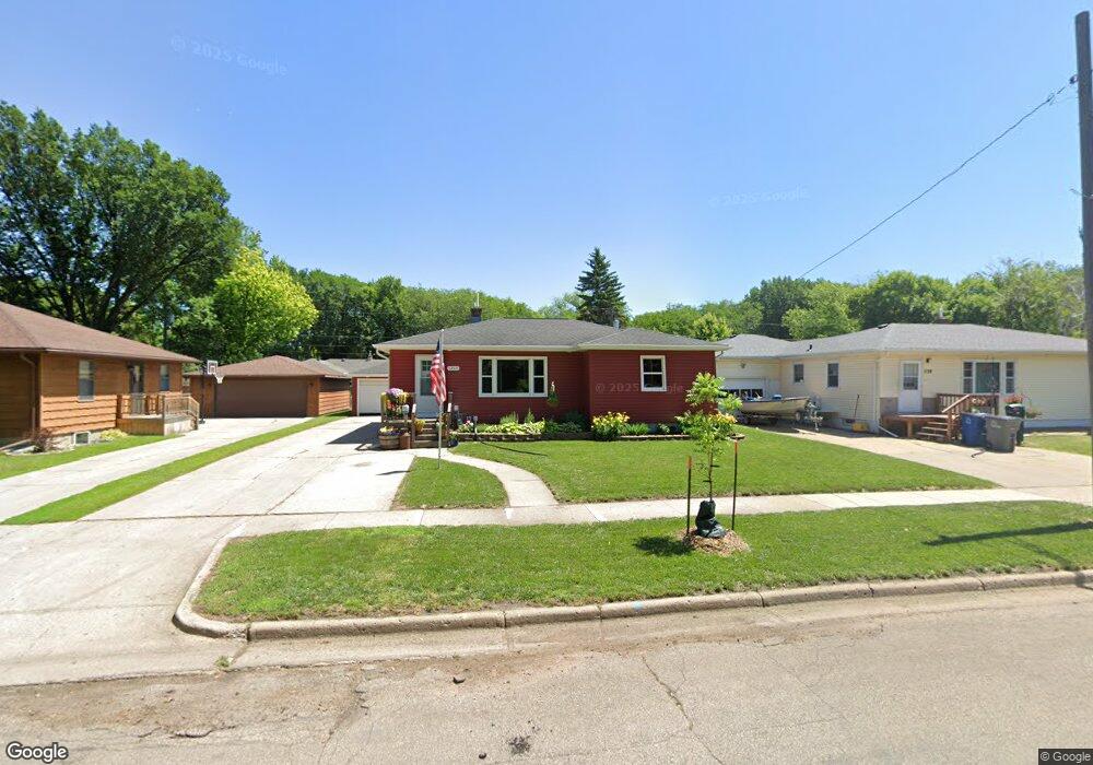
1202 10th St N Moorhead, MN 56560
Estimated Value: $204,000 - $245,000
3
Beds
2
Baths
1,124
Sq Ft
$201/Sq Ft
Est. Value
About This Home
This home is located at 1202 10th St N, Moorhead, MN 56560 and is currently estimated at $225,972, approximately $201 per square foot. 1202 10th St N is a home located in Clay County with nearby schools including R. Asp Elementary School, Horizon Middle School, and Moorhead High School.
Ownership History
Date
Name
Owned For
Owner Type
Purchase Details
Closed on
Feb 26, 2010
Sold by
Winter Larry S
Bought by
Middlestead Scott A and Middlestead Lynne M
Current Estimated Value
Home Financials for this Owner
Home Financials are based on the most recent Mortgage that was taken out on this home.
Original Mortgage
$133,394
Outstanding Balance
$89,595
Interest Rate
5.25%
Mortgage Type
FHA
Estimated Equity
$136,377
Create a Home Valuation Report for This Property
The Home Valuation Report is an in-depth analysis detailing your home's value as well as a comparison with similar homes in the area
Home Values in the Area
Average Home Value in this Area
Purchase History
| Date | Buyer | Sale Price | Title Company |
|---|---|---|---|
| Middlestead Scott A | $135,900 | None Available |
Source: Public Records
Mortgage History
| Date | Status | Borrower | Loan Amount |
|---|---|---|---|
| Open | Middlestead Scott A | $133,394 |
Source: Public Records
Tax History Compared to Growth
Tax History
| Year | Tax Paid | Tax Assessment Tax Assessment Total Assessment is a certain percentage of the fair market value that is determined by local assessors to be the total taxable value of land and additions on the property. | Land | Improvement |
|---|---|---|---|---|
| 2025 | $2,708 | $203,700 | $34,900 | $168,800 |
| 2024 | $2,708 | $196,200 | $34,900 | $161,300 |
| 2023 | $2,654 | $188,300 | $34,900 | $153,400 |
| 2022 | $2,440 | $182,100 | $34,900 | $147,200 |
| 2021 | $2,516 | $166,200 | $32,000 | $134,200 |
| 2020 | $2,432 | $169,300 | $32,000 | $137,300 |
| 2019 | $2,172 | $168,000 | $32,000 | $136,000 |
| 2018 | $2,032 | $163,800 | $32,000 | $131,800 |
| 2017 | $1,898 | $155,100 | $32,000 | $123,100 |
| 2016 | $1,644 | $150,400 | $32,000 | $118,400 |
| 2015 | $1,436 | $126,500 | $24,300 | $102,200 |
| 2014 | $1,442 | $126,500 | $24,300 | $102,200 |
Source: Public Records
Map
Nearby Homes
- 1206 10th St N
- 1128 10th St N
- 1214 10th St N
- 1124 10th St N
- 1203 10 1/2 St N
- 1207 10 1/2 St N
- 1125 10 1/2 St N
- 1211 10 1/2 St N
- 1211 10 1 2 St N
- 1121 10 1/2 St N
- 1222 10th St N
- 1118 10th St N
- 1121 10 1 2 St N
- 1123 10th St N
- 1203 10th St N
- 1219 10 1/2 St N
- 1119 10th St N
- 1117 10 1/2 St N
- 1207 10th St N
- 1224 10th St N