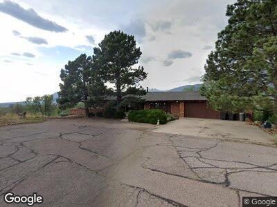
1202 E High Point Ln Colorado Springs, CO 80904
The Mesa NeighborhoodEstimated Value: $865,000 - $1,077,000
4
Beds
5
Baths
2,990
Sq Ft
$313/Sq Ft
Est. Value
About This Home
This home is located at 1202 E High Point Ln, Colorado Springs, CO 80904 and is currently estimated at $936,306, approximately $313 per square foot. 1202 E High Point Ln is a home located in El Paso County with nearby schools including Bristol Elementary, School of the Arts and STEM, Holmes Middle School, and Coronado High School.
Ownership History
Date
Name
Owned For
Owner Type
Purchase Details
Closed on
Jun 15, 2016
Sold by
Buresh Leonard L and Buresh Genevieve R
Bought by
Benson Linda M
Current Estimated Value
Purchase Details
Closed on
Dec 28, 2009
Sold by
Buresh Leonard L and Buresh Genevieve R
Bought by
Buresh Leonard L and Buresh Genevieve R
Purchase Details
Closed on
Jun 10, 1980
Bought by
Benson Linda M
Purchase Details
Closed on
Feb 26, 1980
Bought by
Benson Linda M
Purchase Details
Closed on
Sep 11, 1974
Bought by
Benson Linda M
Purchase Details
Closed on
Aug 21, 1974
Bought by
Benson Linda M
Purchase Details
Closed on
Jul 29, 1965
Bought by
Benson Linda M
Create a Home Valuation Report for This Property
The Home Valuation Report is an in-depth analysis detailing your home's value as well as a comparison with similar homes in the area
Home Values in the Area
Average Home Value in this Area
Purchase History
| Date | Buyer | Sale Price | Title Company |
|---|---|---|---|
| Benson Linda M | $419,000 | Empire Title Co Ltd | |
| Buresh Leonard L | -- | None Available | |
| Benson Linda M | -- | -- | |
| Benson Linda M | -- | -- | |
| Benson Linda M | -- | -- | |
| Benson Linda M | -- | -- | |
| Benson Linda M | -- | -- |
Source: Public Records
Mortgage History
| Date | Status | Borrower | Loan Amount |
|---|---|---|---|
| Previous Owner | The Buresh Family Living Trust | $100,000 | |
| Previous Owner | Buresh Leonard L | $100,000 |
Source: Public Records
Tax History Compared to Growth
Tax History
| Year | Tax Paid | Tax Assessment Tax Assessment Total Assessment is a certain percentage of the fair market value that is determined by local assessors to be the total taxable value of land and additions on the property. | Land | Improvement |
|---|---|---|---|---|
| 2024 | $2,879 | $58,690 | $8,440 | $50,250 |
| 2023 | $2,879 | $58,690 | $8,440 | $50,250 |
| 2022 | $2,983 | $53,310 | $7,980 | $45,330 |
| 2021 | $3,236 | $54,840 | $8,210 | $46,630 |
| 2020 | $3,178 | $46,830 | $6,820 | $40,010 |
| 2019 | $3,161 | $46,830 | $6,820 | $40,010 |
| 2018 | $3,990 | $54,380 | $5,100 | $49,280 |
| 2017 | $3,779 | $54,380 | $5,100 | $49,280 |
| 2016 | $2,668 | $53,990 | $5,370 | $48,620 |
| 2015 | $2,658 | $53,990 | $5,370 | $48,620 |
| 2014 | $2,501 | $49,530 | $5,370 | $44,160 |
Source: Public Records
Map
Nearby Homes
- 1185 Marlstone Place
- 520 W San Miguel St
- 527 W Columbia St
- 945 Marlstone Place
- 1426 N Chestnut St
- 976 Uintah Bluffs Place
- 1455 La Mesa St
- 1528 N Chestnut St
- 1407 Manitou Blvd
- 549 W Dale St Unit 569
- 565 W Dale St
- 735 N Walnut St
- 610 N Tower St
- 720 N Walnut St
- 738 Harrison Place
- 1345 Talley Cir
- 1355 Talley Cir
- 1645 Mesa Rd
- 1728 Armstrong Ave
- 1731 Mesa Rd
- 1202 E High Point Ln
- 1206 E High Point Ln
- 1121 Terrace Rd
- 1111 Terrace Rd
- 1127 Terrace Rd
- 1115 Terrace Rd
- 1210 E High Point Ln
- 1133 Terrace Rd
- 1209 E High Point Ln
- 1214 E High Point Ln
- 1139 Terrace Rd
- 1210 N Chestnut St
- 1213 E High Point Ln
- 1132 Terrace Rd
- 1212 N Chestnut St
- 1126 Terrace Rd
- 1145 Terrace Rd
- 1201 W High Point Ln
- 1218 E High Point Ln
- 1216 N Chestnut St