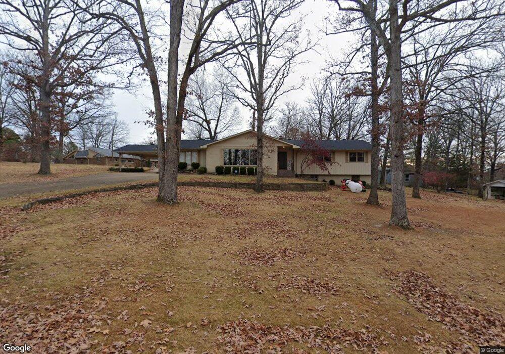
1202 Lurlyn Dr Poplar Bluff, MO 63901
Estimated Value: $261,000 - $446,000
--
Bed
--
Bath
4,119
Sq Ft
$79/Sq Ft
Est. Value
About This Home
This home is located at 1202 Lurlyn Dr, Poplar Bluff, MO 63901 and is currently estimated at $324,442, approximately $78 per square foot. 1202 Lurlyn Dr is a home with nearby schools including Poplar Bluff Fifth & Sixth Grade Center, O'Neal Elementary School, and Poplar Bluff Junior High School.
Ownership History
Date
Name
Owned For
Owner Type
Purchase Details
Closed on
Jun 18, 2013
Sold by
Bidewell James M and The Martha M Bidewell Trust
Bought by
Morton Patrick and Morton Mallory
Current Estimated Value
Home Financials for this Owner
Home Financials are based on the most recent Mortgage that was taken out on this home.
Original Mortgage
$66,168
Interest Rate
3.43%
Mortgage Type
Purchase Money Mortgage
Purchase Details
Closed on
Aug 16, 2010
Sold by
Bidewell Martha and Bidewell Benjamin
Bought by
Bidewell Martha M and Martha M Bidewell Trust
Create a Home Valuation Report for This Property
The Home Valuation Report is an in-depth analysis detailing your home's value as well as a comparison with similar homes in the area
Home Values in the Area
Average Home Value in this Area
Purchase History
| Date | Buyer | Sale Price | Title Company |
|---|---|---|---|
| Morton Patrick | -- | None Available | |
| Bidewell Martha M | -- | -- |
Source: Public Records
Mortgage History
| Date | Status | Borrower | Loan Amount |
|---|---|---|---|
| Closed | Morton Patrick | $66,168 |
Source: Public Records
Tax History Compared to Growth
Tax History
| Year | Tax Paid | Tax Assessment Tax Assessment Total Assessment is a certain percentage of the fair market value that is determined by local assessors to be the total taxable value of land and additions on the property. | Land | Improvement |
|---|---|---|---|---|
| 2024 | $18 | $38,210 | $0 | $0 |
| 2023 | $1,846 | $38,210 | $0 | $0 |
| 2022 | $1,787 | $37,050 | $0 | $0 |
| 2021 | $1,787 | $37,050 | $0 | $0 |
| 2020 | $1,676 | $34,260 | $0 | $0 |
| 2019 | $1,674 | $34,260 | $0 | $0 |
| 2018 | $1,674 | $34,260 | $0 | $0 |
| 2017 | -- | $34,260 | $0 | $0 |
| 2016 | -- | $34,260 | $0 | $0 |
| 2015 | -- | $34,260 | $0 | $0 |
| 2014 | -- | $32,150 | $0 | $0 |
| 2012 | $1,348 | $31,650 | $0 | $0 |
Source: Public Records
Map
Nearby Homes
- 2105 Jackson Rd
- 2035 King Rd
- 2005 W Spring
- 2006 Holloway Dr
- 2015 Snider Rd
- 618 Old St
- 2022 Snider Rd
- 2462 Roxie Rd
- 1423 Woodland Rd
- 1824 Sunset Dr
- 1715 Big Bend Rd
- 501 N 16th St
- 1401 Grove St
- 14715 Highway Pp
- 1402 Spring St
- 0 Highway Pp
- 2011 Woodland Rd
- 1303 Gardner St
- 1214 W Harper St
- 1107 Hickory St
- 1200 Lurlyn Rd
- 1300 Lurlyn Dr
- 1300 Lurlyn Dr
- 2106 Jackson Rd
- 2107 Jackson Rd
- 1203 Lurlyn Dr
- 1201 Lurlyn Rd
- 2104 Jackson Rd
- 1302 Lurlyn Dr
- 1302 Lurlyn Dr
- 1301 Lurlyn Rd
- 1303 Lurlyn Rd
- 2102 Jackson Rd
- 2103 Jackson Rd
- 1310 Lurlyn Dr
- 2104 Birkhead Rd
- 1305 Lurlyn Rd
- 2102 Birkhead Rd
- 2051 King Rd
- 2101 Jackson Rd