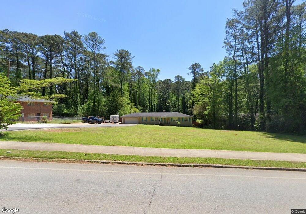
1202 Rowland Rd Unit 2 Stone Mountain, GA 30083
Estimated Value: $258,000 - $292,000
3
Beds
2
Baths
1,692
Sq Ft
$163/Sq Ft
Est. Value
About This Home
This home is located at 1202 Rowland Rd Unit 2, Stone Mountain, GA 30083 and is currently estimated at $275,142, approximately $162 per square foot. 1202 Rowland Rd Unit 2 is a home located in DeKalb County with nearby schools including Allgood Elementary School, Freedom Middle School, and Clarkston High School.
Ownership History
Date
Name
Owned For
Owner Type
Purchase Details
Closed on
Jun 4, 2019
Sold by
Smith Ronald Alan
Bought by
Brown Alethia
Current Estimated Value
Home Financials for this Owner
Home Financials are based on the most recent Mortgage that was taken out on this home.
Original Mortgage
$155,000
Outstanding Balance
$98,393
Interest Rate
4.1%
Mortgage Type
New Conventional
Estimated Equity
$176,749
Purchase Details
Closed on
Dec 12, 2000
Sold by
Moss Thomas W
Bought by
Smith Ronald A
Create a Home Valuation Report for This Property
The Home Valuation Report is an in-depth analysis detailing your home's value as well as a comparison with similar homes in the area
Home Values in the Area
Average Home Value in this Area
Purchase History
| Date | Buyer | Sale Price | Title Company |
|---|---|---|---|
| Brown Alethia | $160,000 | -- | |
| Smith Ronald A | $110,000 | -- |
Source: Public Records
Mortgage History
| Date | Status | Borrower | Loan Amount |
|---|---|---|---|
| Open | Brown Alethia | $155,000 |
Source: Public Records
Tax History Compared to Growth
Tax History
| Year | Tax Paid | Tax Assessment Tax Assessment Total Assessment is a certain percentage of the fair market value that is determined by local assessors to be the total taxable value of land and additions on the property. | Land | Improvement |
|---|---|---|---|---|
| 2025 | $2,640 | $99,320 | $21,600 | $77,720 |
| 2024 | $2,664 | $99,040 | $21,600 | $77,440 |
| 2023 | $2,664 | $96,680 | $21,600 | $75,080 |
| 2022 | $2,003 | $73,920 | $11,040 | $62,880 |
| 2021 | $1,693 | $60,480 | $11,040 | $49,440 |
| 2020 | $1,500 | $51,960 | $11,040 | $40,920 |
| 2019 | $1,660 | $29,680 | $10,982 | $18,698 |
| 2018 | $1,318 | $29,679 | $10,981 | $18,698 |
| 2017 | $1,666 | $29,680 | $10,982 | $18,698 |
| 2016 | $969 | $13,840 | $11,072 | $2,768 |
| 2014 | $984 | $13,840 | $11,040 | $2,800 |
Source: Public Records
Map
Nearby Homes
- 997 Carlisle Rd Unit 1
- 4094 Carlisle Place
- 4058 Chemawa Dr
- 4048 Carlinswood Way
- 4036 Carlinswood Way
- 4218 Durham Cir
- 1019 Privy Ln Unit 74
- 1195 Indian Creek Place
- 1051 Rowland Rd
- 905 S Indian Creek Dr
- 747 John Alden Rd
- 4011 Redan Rd Unit 6
- 4011 Redan Rd Unit 8
- 1010 Allgood Rd
- 4157 Autumn Hill Dr
- 1115 Old Coach Rd
- 798 Durham Trail
- 4147 Scofield Place
- 792 Carlisle Club Dr Unit 2
- 4255 Autumn Woods Ct Unit 2
- 1208 Rowland Rd
- 1192 Rowland Rd
- 4119 Durham Cir
- 1182 Rowland Rd Unit 2
- 1011 Carlisle Rd
- 4127 Durham Cir
- 1215 Rowland Rd
- 1014 Carlisle Rd Unit 1
- 1003 Carlisle Rd
- 4135 Durham Cir
- 1164 Rowland Rd
- 1227 Rowland Rd
- 4126 Durham Cir
- 1006 Carlisle Rd
- 1175 Rowland Rd Unit 4
- 1154 Rowland Rd
- 4143 Durham Cir
- 4140 Durham Cir
- 1167 Rowland Rd Unit 4
- 998 Carlisle Rd Unit 1