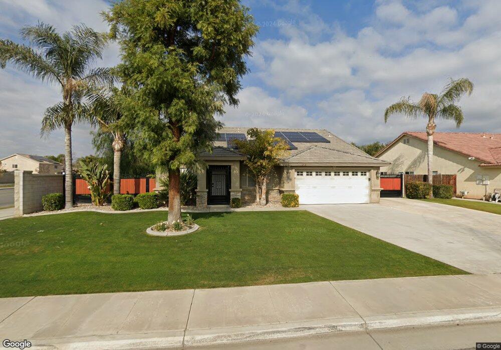
12020 Cedar Bluff Ave Unit 2 Bakersfield, CA 93312
Estimated Value: $440,296 - $469,000
4
Beds
2
Baths
2,041
Sq Ft
$221/Sq Ft
Est. Value
About This Home
This home is located at 12020 Cedar Bluff Ave Unit 2, Bakersfield, CA 93312 and is currently estimated at $450,074, approximately $220 per square foot. 12020 Cedar Bluff Ave Unit 2 is a home located in Kern County with nearby schools including Norris Elementary School, Norris Middle School, and Frontier High School.
Ownership History
Date
Name
Owned For
Owner Type
Purchase Details
Closed on
Aug 11, 2014
Sold by
Hayes Raymond A and Hayes Raymond A
Bought by
Hayes Raymond A
Current Estimated Value
Home Financials for this Owner
Home Financials are based on the most recent Mortgage that was taken out on this home.
Original Mortgage
$204,800
Outstanding Balance
$156,218
Interest Rate
4.12%
Mortgage Type
New Conventional
Estimated Equity
$293,856
Purchase Details
Closed on
Aug 18, 2003
Sold by
Bakersfield Avalon Llc
Bought by
Hayes Raymond A
Home Financials for this Owner
Home Financials are based on the most recent Mortgage that was taken out on this home.
Original Mortgage
$153,232
Interest Rate
5.82%
Mortgage Type
Purchase Money Mortgage
Create a Home Valuation Report for This Property
The Home Valuation Report is an in-depth analysis detailing your home's value as well as a comparison with similar homes in the area
Home Values in the Area
Average Home Value in this Area
Purchase History
| Date | Buyer | Sale Price | Title Company |
|---|---|---|---|
| Hayes Raymond A | -- | Stewart Title Guaranty | |
| Hayes Raymond A | $192,000 | Ticor Title |
Source: Public Records
Mortgage History
| Date | Status | Borrower | Loan Amount |
|---|---|---|---|
| Open | Hayes Raymond A | $204,800 | |
| Previous Owner | Hayes Raymond A | $153,232 | |
| Closed | Hayes Raymond A | $28,731 |
Source: Public Records
Tax History
| Year | Tax Paid | Tax Assessment Tax Assessment Total Assessment is a certain percentage of the fair market value that is determined by local assessors to be the total taxable value of land and additions on the property. | Land | Improvement |
|---|---|---|---|---|
| 2025 | $4,621 | $272,249 | $72,499 | $199,750 |
| 2024 | $4,529 | $266,912 | $71,078 | $195,834 |
| 2023 | $4,529 | $261,680 | $69,685 | $191,995 |
| 2022 | $4,457 | $256,550 | $68,319 | $188,231 |
| 2021 | $4,639 | $251,521 | $66,980 | $184,541 |
| 2020 | $4,516 | $248,943 | $66,294 | $182,649 |
| 2019 | $4,462 | $248,943 | $66,294 | $182,649 |
| 2018 | $4,348 | $239,278 | $63,721 | $175,557 |
| 2017 | $4,327 | $234,587 | $62,472 | $172,115 |
| 2016 | $4,114 | $229,989 | $61,248 | $168,741 |
| 2015 | $4,064 | $226,535 | $60,328 | $166,207 |
| 2014 | $3,978 | $222,099 | $59,147 | $162,952 |
Source: Public Records
Map
Nearby Homes
- 12016 Cedar Bluff Ave Unit 2
- 12109 Timberpointe Dr
- 12203 Timberpointe Dr
- 12307 Great Country Dr
- 11504 Mercatello Ave
- 12311 Verdelho Ave
- 11815 Darlington Ave
- 12509 Willowdale Dr
- 11415 Mercatello Ave
- 11603 Bocelli Ave
- 11502 Summit Point Ct
- 11404 Mantova Ave
- 12602 Mezzadro Ave
- 11302 Mantova Ave
- 11311 Mezzadro Ave Unit 3
- 12515 Valentano Ave
- 12414 Lavina Ave
- 12325 Lavina Ave
- 12012 Cedar Bluff Ave Unit 2
- 12027 Montague Ave
- 12021 Cedar Bluff Ave
- 12019 Montague Ave Unit 3
- 12017 Cedar Bluff Ave
- 6900 Gallery Dr
- 12100 Timberpointe Dr
- 12013 Cedar Bluff Ave
- 12015 Montague Ave Unit 3
- 12104 Timberpointe Dr
- 12103 Midtowne Dr
- 12004 Cedar Bluff Ave
- 6904 Gallery Dr
- 12026 Montague Ave
- 12009 Cedar Bluff Ave
- 12101 Timberpointe Dr
- 12011 Montague Ave
- 6908 Gallery Dr
- 12000 Cedar Bluff Ave
Your Personal Tour Guide
Ask me questions while you tour the home.