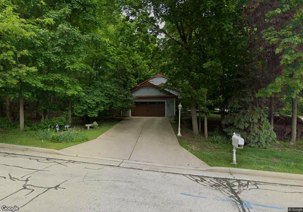
12020 W Morgan Oak Dr Milwaukee, WI 53228
Estimated Value: $514,804 - $605,000
3
Beds
3
Baths
2,493
Sq Ft
$223/Sq Ft
Est. Value
About This Home
This home is located at 12020 W Morgan Oak Dr, Milwaukee, WI 53228 and is currently estimated at $556,201, approximately $223 per square foot. 12020 W Morgan Oak Dr is a home located in Milwaukee County with nearby schools including Edgerton Elementary School, Whitnall Middle School, and Whitnall High School.
Ownership History
Date
Name
Owned For
Owner Type
Purchase Details
Closed on
Jun 23, 1999
Sold by
Kane Dennis L and Kane Janet L
Bought by
Kojis Richard A and Kojis Jaclyn L
Current Estimated Value
Home Financials for this Owner
Home Financials are based on the most recent Mortgage that was taken out on this home.
Original Mortgage
$199,000
Outstanding Balance
$48,483
Interest Rate
6.12%
Mortgage Type
Purchase Money Mortgage
Estimated Equity
$507,718
Create a Home Valuation Report for This Property
The Home Valuation Report is an in-depth analysis detailing your home's value as well as a comparison with similar homes in the area
Home Values in the Area
Average Home Value in this Area
Purchase History
| Date | Buyer | Sale Price | Title Company |
|---|---|---|---|
| Kojis Richard A | $279,000 | -- |
Source: Public Records
Mortgage History
| Date | Status | Borrower | Loan Amount |
|---|---|---|---|
| Open | Kojis Richard A | $199,000 |
Source: Public Records
Tax History Compared to Growth
Tax History
| Year | Tax Paid | Tax Assessment Tax Assessment Total Assessment is a certain percentage of the fair market value that is determined by local assessors to be the total taxable value of land and additions on the property. | Land | Improvement |
|---|---|---|---|---|
| 2024 | $8,254 | $468,400 | $130,600 | $337,800 |
| 2023 | $8,254 | $468,400 | $130,600 | $337,800 |
| 2022 | $8,074 | $299,200 | $100,400 | $198,800 |
| 2021 | $8,037 | $299,200 | $100,400 | $198,800 |
| 2020 | $8,186 | $299,200 | $100,400 | $198,800 |
| 2019 | $7,930 | $299,200 | $100,400 | $198,800 |
| 2018 | $8,382 | $299,200 | $100,400 | $198,800 |
| 2017 | $7,520 | $299,200 | $100,400 | $198,800 |
| 2016 | $7,528 | $299,200 | $100,400 | $198,800 |
| 2015 | $7,426 | $299,200 | $100,400 | $198,800 |
| 2014 | $7,589 | $299,200 | $100,400 | $198,800 |
| 2013 | $7,626 | $299,200 | $100,400 | $198,800 |
Source: Public Records
Map
Nearby Homes
- 11924 W Ohio Ave
- 12520 W Crawford Dr
- 3239 S 121st St
- 12720 W Verona Dr
- 12374 W Waterford Ave Unit 4
- 3470 S 129th St
- 3129 S 122nd St Unit 18
- 4052 S 124th St
- 4120 S 124th St
- 2938 S Waukesha Rd
- 2902 S 124th St
- 3817 S Oakbrook Dr Unit 3817
- 13196 W National Ave
- 11444 W Montana Ave
- 4013 S 106th St
- 4540 S 116th St
- 2544 S Seymour Place
- 4475 S 108th St
- 4657 S 114th St
- 14068 W Tiffany Place
- 3571 S 120th St
- 12040 W Morgan Oak Dr
- 12023 W Morgan Oak Dr
- 3552 S 121st Ct
- 3561 S 120th St
- 12073 W Morgan Oak Dr
- 3590 S 120th St
- 3600 S 120th St
- 3570 S 120th St
- 3630 S 120th St
- 3541 S 120th St
- 3560 S 120th St
- 12030 W Black Oak Dr
- 12060 W Black Oak Dr
- 12122 W Morgan Oak Dr
- 3650 S 120th St
- 12123 W Morgan Oak Dr
- 12100 W Black Oak Dr
- 3531 S 120th St
- 3533 S 121st Ct