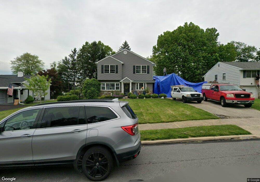
1203 Greenhill Rd Flourtown, PA 19031
Estimated Value: $554,000 - $667,657
3
Beds
3
Baths
1,863
Sq Ft
$327/Sq Ft
Est. Value
About This Home
This home is located at 1203 Greenhill Rd, Flourtown, PA 19031 and is currently estimated at $608,664, approximately $326 per square foot. 1203 Greenhill Rd is a home located in Montgomery County with nearby schools including Erdenheim Elementary School, Enfield Elementary School, and Springfield Township Middle School.
Ownership History
Date
Name
Owned For
Owner Type
Purchase Details
Closed on
May 28, 2010
Sold by
Dfander Judith D
Bought by
Carruthers Kathryn A and Carruthers Casey N
Current Estimated Value
Home Financials for this Owner
Home Financials are based on the most recent Mortgage that was taken out on this home.
Original Mortgage
$272,250
Outstanding Balance
$183,711
Interest Rate
5.11%
Estimated Equity
$424,953
Create a Home Valuation Report for This Property
The Home Valuation Report is an in-depth analysis detailing your home's value as well as a comparison with similar homes in the area
Home Values in the Area
Average Home Value in this Area
Purchase History
| Date | Buyer | Sale Price | Title Company |
|---|---|---|---|
| Carruthers Kathryn A | $302,500 | None Available |
Source: Public Records
Mortgage History
| Date | Status | Borrower | Loan Amount |
|---|---|---|---|
| Open | Carruthers Kathryn A | $272,250 |
Source: Public Records
Tax History Compared to Growth
Tax History
| Year | Tax Paid | Tax Assessment Tax Assessment Total Assessment is a certain percentage of the fair market value that is determined by local assessors to be the total taxable value of land and additions on the property. | Land | Improvement |
|---|---|---|---|---|
| 2025 | $7,643 | $162,250 | -- | -- |
| 2024 | $7,643 | $162,250 | -- | -- |
| 2023 | $7,376 | $162,250 | $0 | $0 |
| 2022 | $7,165 | $162,250 | $0 | $0 |
| 2021 | $6,978 | $162,250 | $0 | $0 |
| 2020 | $6,815 | $162,250 | $0 | $0 |
| 2019 | $6,710 | $162,250 | $0 | $0 |
| 2018 | $6,710 | $144,080 | $49,410 | $94,670 |
| 2017 | $5,688 | $144,080 | $49,410 | $94,670 |
| 2016 | $5,631 | $144,080 | $49,410 | $94,670 |
| 2015 | $5,354 | $144,080 | $49,410 | $94,670 |
| 2014 | $5,354 | $144,080 | $49,410 | $94,670 |
Source: Public Records
Map
Nearby Homes
- 401 Pennybrook Ct Unit 1 REDFORD END
- 405 Pennybrook Ct Unit 3 REDFORD INTERIOR
- 001 Pennybrook Ct Unit REDFORD INTERIOR
- 407 Pennybrook Ct Unit 4 REDFORD END
- 403 Pennybrook Ct Unit 2 REDFORD INTERIOR
- Redford Plan at The Towns at Pennybrook
- 406 Pennybrook Ct Unit 14 REDFORD INTERIOR
- 404 Pennybrook Ct Unit 15 REDFORD INTERIOR
- 1005 Harston Ln
- 303 Glenway Rd
- 418 Glenway Rd
- 32 Jones Ave
- 21 Jones Ave
- 21 Franklin Ave
- 402 Longfield Rd
- 9 Comly Ct
- 2106 Carolton Way
- 28 Grove Ave
- 500 E Mill Rd
- 6313 Sunnybrook Rd
- 1201 Greenhill Rd
- 1205 Greenhill Rd
- 1204 Wedgewood Rd
- 1206 Wedgewood Rd
- 1109 Greenhill Rd
- 1207 Greenhill Rd
- 1202 Wedgewood Rd
- 1200 Greenhill Rd
- 1208 Wedgewood Rd
- 1202 Greenhill Rd
- 1204 Greenhill Rd
- 1107 Greenhill Rd
- 1200 Wedgewood Rd
- 1209 Greenhill Rd
- 1210 Wedgewood Rd
- 1106 Greenhill Rd
- 307 Suffolk Rd
- 306 Preston Rd
- 1106 Wedgewood Rd
- 1205 Wedgewood Rd