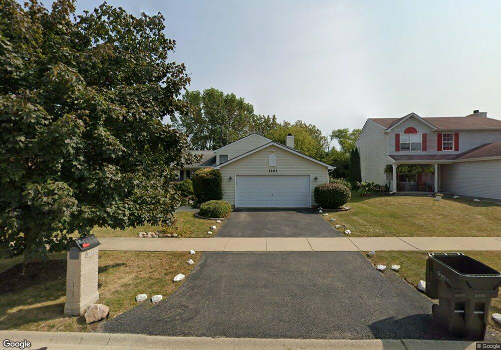
1203 Pheasant Run Zion, IL 60099
West Zion NeighborhoodEstimated Value: $289,000 - $307,000
3
Beds
2
Baths
1,104
Sq Ft
$271/Sq Ft
Est. Value
About This Home
This home is located at 1203 Pheasant Run, Zion, IL 60099 and is currently estimated at $299,662, approximately $271 per square foot. 1203 Pheasant Run is a home located in Lake County with nearby schools including Newport Elementary School, Beach Park Middle School, and Zion-Benton Township High School.
Ownership History
Date
Name
Owned For
Owner Type
Purchase Details
Closed on
Dec 8, 1999
Sold by
Bank Of Waukegan
Bought by
Hayes Elora B
Current Estimated Value
Home Financials for this Owner
Home Financials are based on the most recent Mortgage that was taken out on this home.
Original Mortgage
$133,998
Outstanding Balance
$41,441
Interest Rate
7.7%
Mortgage Type
FHA
Estimated Equity
$258,221
Create a Home Valuation Report for This Property
The Home Valuation Report is an in-depth analysis detailing your home's value as well as a comparison with similar homes in the area
Home Values in the Area
Average Home Value in this Area
Purchase History
| Date | Buyer | Sale Price | Title Company |
|---|---|---|---|
| Hayes Elora B | $152,500 | -- |
Source: Public Records
Mortgage History
| Date | Status | Borrower | Loan Amount |
|---|---|---|---|
| Open | Hayes Elora B | $133,998 |
Source: Public Records
Tax History Compared to Growth
Tax History
| Year | Tax Paid | Tax Assessment Tax Assessment Total Assessment is a certain percentage of the fair market value that is determined by local assessors to be the total taxable value of land and additions on the property. | Land | Improvement |
|---|---|---|---|---|
| 2024 | $8,247 | $90,350 | $9,951 | $80,399 |
| 2023 | $7,531 | $80,554 | $8,872 | $71,682 |
| 2022 | $7,531 | $68,721 | $7,281 | $61,440 |
| 2021 | $7,371 | $64,466 | $6,830 | $57,636 |
| 2020 | $7,057 | $60,634 | $6,424 | $54,210 |
| 2019 | $6,813 | $56,482 | $5,984 | $50,498 |
| 2018 | $6,143 | $51,511 | $5,405 | $46,106 |
| 2017 | $5,986 | $47,784 | $5,014 | $42,770 |
| 2016 | $5,449 | $43,377 | $4,552 | $38,825 |
| 2015 | $5,119 | $39,358 | $4,130 | $35,228 |
| 2014 | $4,661 | $37,103 | $3,899 | $33,204 |
| 2012 | $5,343 | $39,513 | $4,152 | $35,361 |
Source: Public Records
Map
Nearby Homes
- 1210 Lorelei Dr
- 1305 Reed Rd
- 4004 Gregory Dr
- 4108 Douglas Dr
- 4014 Ridge Rd
- 3903 9th St
- 1524 Anderson Trail
- 1712 Dusk Dr
- 11778 W 12th St
- 4539 Illinois 173
- 4533 Illinois 173
- 1907 Dawn Ln
- 1521 Southport Ct
- 1405 Lewis Ave
- 42908 N Lewis Ave
- 210 Oak Ln
- 12434 W Van Ct
- 1814 Jethro Ave
- 4109 Sarah Dr
- 43100 N Lewis Ave
- 1201 Pheasant Run
- 1205 Pheasant Run
- 1119 Pheasant Run
- 1207 Pheasant Run
- 4200 Quail St
- 1117 Pheasant Run
- 4201 Jay Dr
- 1209 Pheasant Run
- 4202 Quail St
- 1115 Pheasant Run
- 4203 Jay Dr
- 1208 Lorelei Dr
- 1211 Pheasant Run
- 1206 Lorelei Dr
- 4201 Quail St
- 1204 Lorelei Dr
- 4204 Quail St
- 1113 Pheasant Run
- 4205 Jay Dr
- 4200 Jay Dr