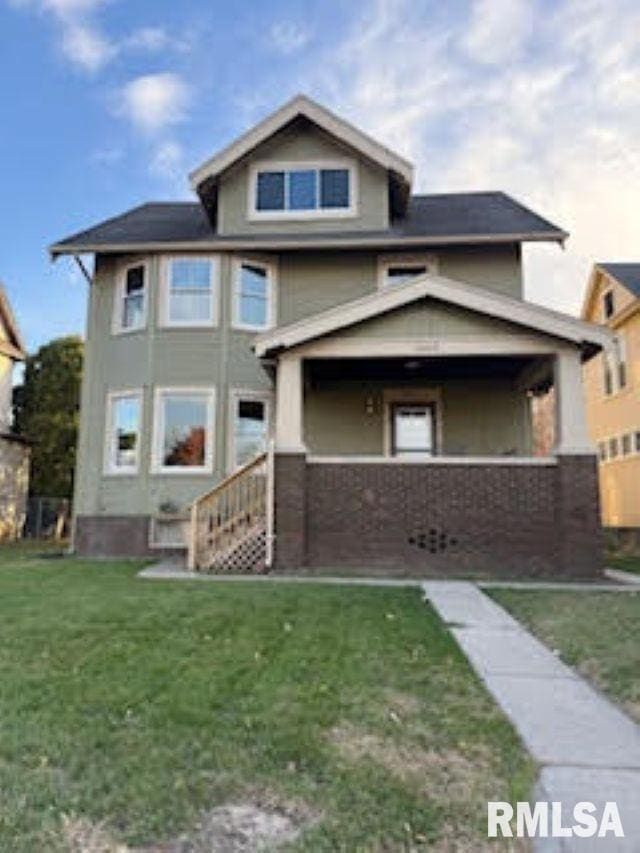
1203 W Locust St Davenport, IA 52804
Central Davenport NeighborhoodEstimated payment $1,781/month
Highlights
- Deck
- Porch
- Laundry Room
- 2 Car Detached Garage
- Oversized Parking
- Guest Parking
About This Home
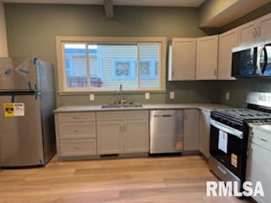
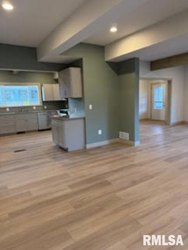
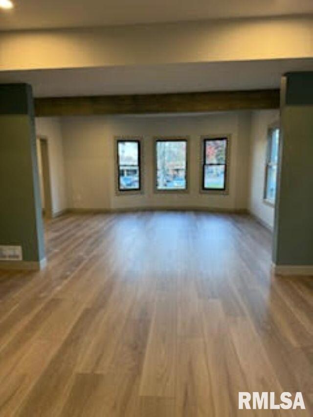
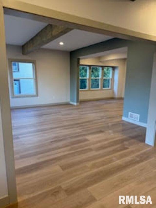
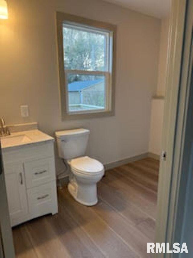
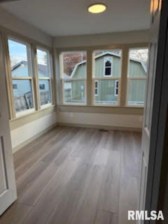
**Coming Soon** **Professional Photos to come** Beauty meets charm in this 2 story home that has been completely gutted on the main level and upper level. Everything you love about the space of a older home with modern updates! The over sized 2 car insulated garage has an overhead loft space to store all you goodies! The backyard is fully fenced and has a deck off the back of the house. As you enter the main level you are greeted to a beautiful open foyer and the living is hosted with huge windows to allow all the natural light in. The pella windows will be there for life! The informal dining room has a 4 season room off of it filled with windows to surely keep you warm during those winter months! There is a half bath and laundry room off the back door. The kitchen has lots of cabinets for storage and even a cute little coffee nook! The whole main level has luxury vinyl plank flooring. As you go upstairs you are greeted with 4 bedrooms and a full bath that has been completely reconstructed. Go up one more level and you are greeted with a 5th bedroom or flex space. There is over 700sq ft on the 3rd level! there are several large walk in closets. There is a full basement (900sq ft) that is not finished but could be finished. This home is located in an very convenient location to gas, shopping, dining, bus route. Roof 2010, garage roof 2020, windows some 2017, some 2025 furnace 2025, ac 2025, water heater 2025, new elec 2025 You can scheduled your showing now!
Listing Agent
eXp Realty Brokerage Phone: 309-721-5271 License #475.168849/S66950000 Listed on: 11/18/2025

Home Details
Home Type
- Single Family
Est. Annual Taxes
- $2,708
Year Built
- Built in 1910
Lot Details
- Lot Dimensions are 48x155
- Fenced
- Level Lot
Parking
- 2 Car Detached Garage
- Oversized Parking
- Garage Door Opener
- Guest Parking
Home Design
- Block Foundation
- Frame Construction
- Shingle Roof
- Wood Siding
Interior Spaces
- 1,940 Sq Ft Home
- Ceiling Fan
- Replacement Windows
- Dining Room
- Unfinished Basement
- Basement Fills Entire Space Under The House
- Storage In Attic
- Laundry Room
Kitchen
- Range
- Microwave
- Dishwasher
Bedrooms and Bathrooms
- 5 Bedrooms
Outdoor Features
- Deck
- Porch
Schools
- Davenport High School
Utilities
- Forced Air Heating and Cooling System
- Heating System Uses Natural Gas
- Gas Water Heater
Community Details
- Rosedale Subdivision
Listing and Financial Details
- Assessor Parcel Number G0001-08
Map
Home Values in the Area
Average Home Value in this Area
Tax History
| Year | Tax Paid | Tax Assessment Tax Assessment Total Assessment is a certain percentage of the fair market value that is determined by local assessors to be the total taxable value of land and additions on the property. | Land | Improvement |
|---|---|---|---|---|
| 2025 | $2,708 | $85,220 | $21,820 | $63,400 |
| 2024 | $2,634 | $170,150 | $21,820 | $148,330 |
| 2023 | $2,800 | $170,150 | $21,820 | $148,330 |
| 2022 | $2,798 | $143,330 | $13,570 | $129,760 |
| 2021 | $2,798 | $142,750 | $13,570 | $129,180 |
| 2020 | $2,542 | $129,150 | $13,570 | $115,580 |
| 2019 | $2,456 | $121,220 | $13,570 | $107,650 |
| 2018 | $2,398 | $121,220 | $13,570 | $107,650 |
| 2017 | $656 | $121,220 | $13,570 | $107,650 |
| 2016 | $2,346 | $119,200 | $0 | $0 |
| 2015 | $2,346 | $114,470 | $0 | $0 |
| 2014 | $2,276 | $114,470 | $0 | $0 |
| 2013 | $2,230 | $0 | $0 | $0 |
| 2012 | -- | $126,780 | $12,110 | $114,670 |
Purchase History
| Date | Type | Sale Price | Title Company |
|---|---|---|---|
| Warranty Deed | $151,000 | None Available |
Mortgage History
| Date | Status | Loan Amount | Loan Type |
|---|---|---|---|
| Open | $154,246 | VA |
Source: RMLS Alliance
MLS Number: QC4269486
APN: G0001-08
Disclaimer: Certain information contained herein is derived from information provided by parties other than Homes.com. All information provided is deemed reliable, but is not guaranteed to be accurate and should be independently verified.
![]() IDX information is provided exclusively for personal, non-commercial use, and may not be used for any purpose other than to identify prospective properties consumers may be interested in purchasing. Information is deemed reliable but not guaranteed.
IDX information is provided exclusively for personal, non-commercial use, and may not be used for any purpose other than to identify prospective properties consumers may be interested in purchasing. Information is deemed reliable but not guaranteed.
- 1921 Lillie Ave
- 2026 N Marquette St
- 1118 W 15th St
- 2038 N Myrtle St
- 1925 Vine St
- 1514 N Marquette St
- 1034 W 14th St
- 930 W 14th St
- 2015 Washington St
- 2133 Warren St
- 922 W Lombard St
- 822 W 14th St
- 1319 Warren St
- 2325 N Marquette St
- 2230 Warren St
- 1321 W 13th St
- 1525 W High St
- 1335 W 13th St
- 1207 N Marquette St
- 1517 W Lombard St
- 1937 Washington St
- 2133 Warren St
- 1420 N Harrison St
- 1318 N Main St Unit 2
- 405 W Columbia Ave Unit 6
- 702 W 7th St
- 2206 Pacific St
- 2648 N Ripley St Unit 5
- 328 W Columbia Ave
- 627 N Division St
- 627 N Division St
- 601 W 2nd St
- 2927 Fair Ave Unit Upper
- 2608 Leclaire St
- 401 N Brady St
- 324 Brady St
- 229 W 3rd St
- 3575 Marquette St
- 128 W 3rd St
- 321 E 7th St