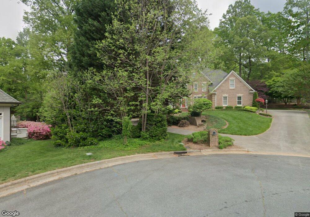
1204 Brennington Place Rd Winston Salem, NC 27104
New Sherwood Forest NeighborhoodEstimated Value: $885,000 - $1,029,000
4
Beds
5
Baths
4,721
Sq Ft
$205/Sq Ft
Est. Value
About This Home
This home is located at 1204 Brennington Place Rd, Winston Salem, NC 27104 and is currently estimated at $970,068, approximately $205 per square foot. 1204 Brennington Place Rd is a home located in Forsyth County with nearby schools including Sherwood Forest Elementary School, Thomas Jefferson Middle School, and Mount Tabor High School.
Ownership History
Date
Name
Owned For
Owner Type
Purchase Details
Closed on
Oct 28, 2004
Sold by
Hutcheson Joel Collier and Hutcheson Emma Elizabeth
Bought by
Potts Stephen B and Potts Melinda C
Current Estimated Value
Home Financials for this Owner
Home Financials are based on the most recent Mortgage that was taken out on this home.
Original Mortgage
$452,800
Outstanding Balance
$210,615
Interest Rate
4.87%
Mortgage Type
Purchase Money Mortgage
Estimated Equity
$759,453
Purchase Details
Closed on
Nov 19, 2002
Sold by
Best James W and Best Carol S
Bought by
Hutcheson Joel Collier and Hutcheson Emma Elizabeth
Home Financials for this Owner
Home Financials are based on the most recent Mortgage that was taken out on this home.
Original Mortgage
$80,250
Interest Rate
5.95%
Mortgage Type
Credit Line Revolving
Create a Home Valuation Report for This Property
The Home Valuation Report is an in-depth analysis detailing your home's value as well as a comparison with similar homes in the area
Home Values in the Area
Average Home Value in this Area
Purchase History
| Date | Buyer | Sale Price | Title Company |
|---|---|---|---|
| Potts Stephen B | $566,000 | -- | |
| Hutcheson Joel Collier | $535,000 | -- |
Source: Public Records
Mortgage History
| Date | Status | Borrower | Loan Amount |
|---|---|---|---|
| Open | Potts Stephen B | $452,800 | |
| Previous Owner | Hutcheson Joel Collier | $80,250 | |
| Previous Owner | Hutcheson Joel Collier | $428,000 | |
| Closed | Potts Stephen B | $56,600 |
Source: Public Records
Tax History Compared to Growth
Tax History
| Year | Tax Paid | Tax Assessment Tax Assessment Total Assessment is a certain percentage of the fair market value that is determined by local assessors to be the total taxable value of land and additions on the property. | Land | Improvement |
|---|---|---|---|---|
| 2025 | $9,825 | $1,039,900 | $110,500 | $929,400 |
| 2024 | $9,377 | $700,400 | $97,500 | $602,900 |
| 2023 | $9,377 | $700,400 | $97,500 | $602,900 |
| 2022 | $9,202 | $700,400 | $97,500 | $602,900 |
| 2021 | $9,037 | $700,400 | $97,500 | $602,900 |
| 2020 | $8,138 | $589,300 | $97,500 | $491,800 |
| 2019 | $8,197 | $589,300 | $97,500 | $491,800 |
| 2018 | $7,784 | $589,300 | $97,500 | $491,800 |
| 2016 | $7,629 | $579,698 | $97,500 | $482,198 |
| 2015 | $7,544 | $579,698 | $97,500 | $482,198 |
| 2014 | $7,321 | $579,698 | $97,500 | $482,198 |
Source: Public Records
Map
Nearby Homes
- 3814 Pinewood Lake Dr
- 1201 Cliffspring Ct
- 813 Chancy Ln
- 3563 Milhaven Rd
- 328 Hambrick Ct
- 940 N Peace Haven Rd
- 811 Gibb St
- 665 Alpine Rd
- 773 Gibb St
- 924 Ashley Glen Dr
- 217 Cedar Trail
- 581 Clyde Dr
- 2433 Albemarle Ct
- 205 Cedar Trail
- 0 N Peace Haven Rd
- 626 Willowbrook Ln
- 559 Alpine Rd
- 5005 Marble Arch Rd
- 543 Barrett Rd
- 1147 Strathmore Cir
- 1117 Glousman Rd
- 1305 Hunterswood Dr
- 1121 Glousman Rd
- 1113 Glousman Rd
- 1106 Wetherburn Ct
- 1109 Glousman Rd
- 110 Hillstone Ct
- 120 Hillstone Ct
- 1308 Hunterswood Dr
- 1108 Wetherburn Ct
- 1105 Glousman Rd
- 1104 Wetherburn Ct
- 1116 Glousman Rd
- 1112 Glousman Rd
- 1120 Glousman Rd
- 1053 Cross Gate Rd
- 1101 Glousman Rd
- 125 Hillstone Ct
- 1108 Glousman Rd
- 1304 Hunterswood Dr