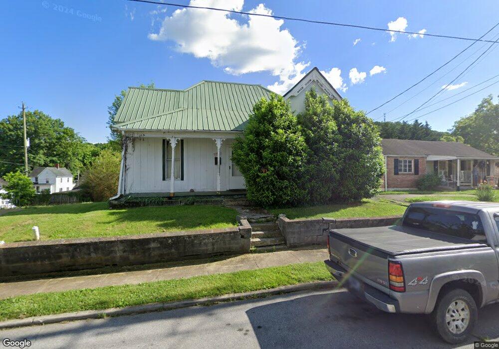
1204 Broad St Bristol, TN 37620
Estimated Value: $118,000 - $156,241
3
Beds
1
Bath
1,158
Sq Ft
$120/Sq Ft
Est. Value
About This Home
This home is located at 1204 Broad St, Bristol, TN 37620 and is currently estimated at $138,810, approximately $119 per square foot. 1204 Broad St is a home located in Sullivan County with nearby schools including Anderson Elementary School, Vance Middle School, and Tennessee High School.
Ownership History
Date
Name
Owned For
Owner Type
Purchase Details
Closed on
Aug 13, 2014
Current Estimated Value
Purchase Details
Closed on
Dec 8, 2010
Sold by
Federal Home Loan Mortgage Corporation
Bought by
Cornelius John
Purchase Details
Closed on
Jun 24, 2010
Sold by
Mitchell Johnnie E Mary
Bought by
Sub Serrano Rubin S
Purchase Details
Closed on
Sep 29, 2006
Sold by
Manning Patrick R
Bought by
Mitchell Johnnie E
Home Financials for this Owner
Home Financials are based on the most recent Mortgage that was taken out on this home.
Original Mortgage
$12,960
Interest Rate
6.36%
Purchase Details
Closed on
Apr 6, 2005
Sold by
Richards Dayton E and Richards Ethel
Bought by
Manning Patrick R
Create a Home Valuation Report for This Property
The Home Valuation Report is an in-depth analysis detailing your home's value as well as a comparison with similar homes in the area
Home Values in the Area
Average Home Value in this Area
Purchase History
| Date | Buyer | Sale Price | Title Company |
|---|---|---|---|
| -- | $18,300 | -- | |
| Street Leon Kemery | $18,250 | -- | |
| Cornelius John | $16,000 | -- | |
| Sub Serrano Rubin S | $56,857 | -- | |
| Mitchell Johnnie E | $64,800 | -- | |
| Manning Patrick R | $40,000 | -- |
Source: Public Records
Mortgage History
| Date | Status | Borrower | Loan Amount |
|---|---|---|---|
| Previous Owner | Manning Patrick R | $12,960 | |
| Previous Owner | Manning Patrick R | $51,840 |
Source: Public Records
Tax History Compared to Growth
Tax History
| Year | Tax Paid | Tax Assessment Tax Assessment Total Assessment is a certain percentage of the fair market value that is determined by local assessors to be the total taxable value of land and additions on the property. | Land | Improvement |
|---|---|---|---|---|
| 2024 | -- | $17,175 | $1,325 | $15,850 |
| 2023 | $754 | $17,175 | $1,325 | $15,850 |
| 2022 | $754 | $17,175 | $1,325 | $15,850 |
| 2021 | $754 | $17,175 | $1,325 | $15,850 |
| 2020 | $424 | $17,175 | $1,325 | $15,850 |
| 2019 | $781 | $16,500 | $1,325 | $15,175 |
| 2018 | $778 | $16,500 | $1,325 | $15,175 |
| 2017 | $778 | $16,500 | $1,325 | $15,175 |
| 2016 | $650 | $13,475 | $1,325 | $12,150 |
| 2014 | $614 | $13,472 | $0 | $0 |
Source: Public Records
Map
Nearby Homes
- 1210 Broad St
- 1212 Broad St
- 1205 Anderson St
- 0 12th St
- 12 12th St
- 1201 Anderson St
- 1214 Broad St
- 1209 Anderson St
- 1130 Broad St
- 1215 Anderson St
- 1211 Broad St Unit 3
- 1205 Broad St
- 1203 Broad St
- 1137 Anderson St
- 1218 Broad St
- 1129 Broad St
- 1129 Broad St Unit 2
- 1129 Broad St Unit 1
- 1124 Broad St
- 1200 Anderson St